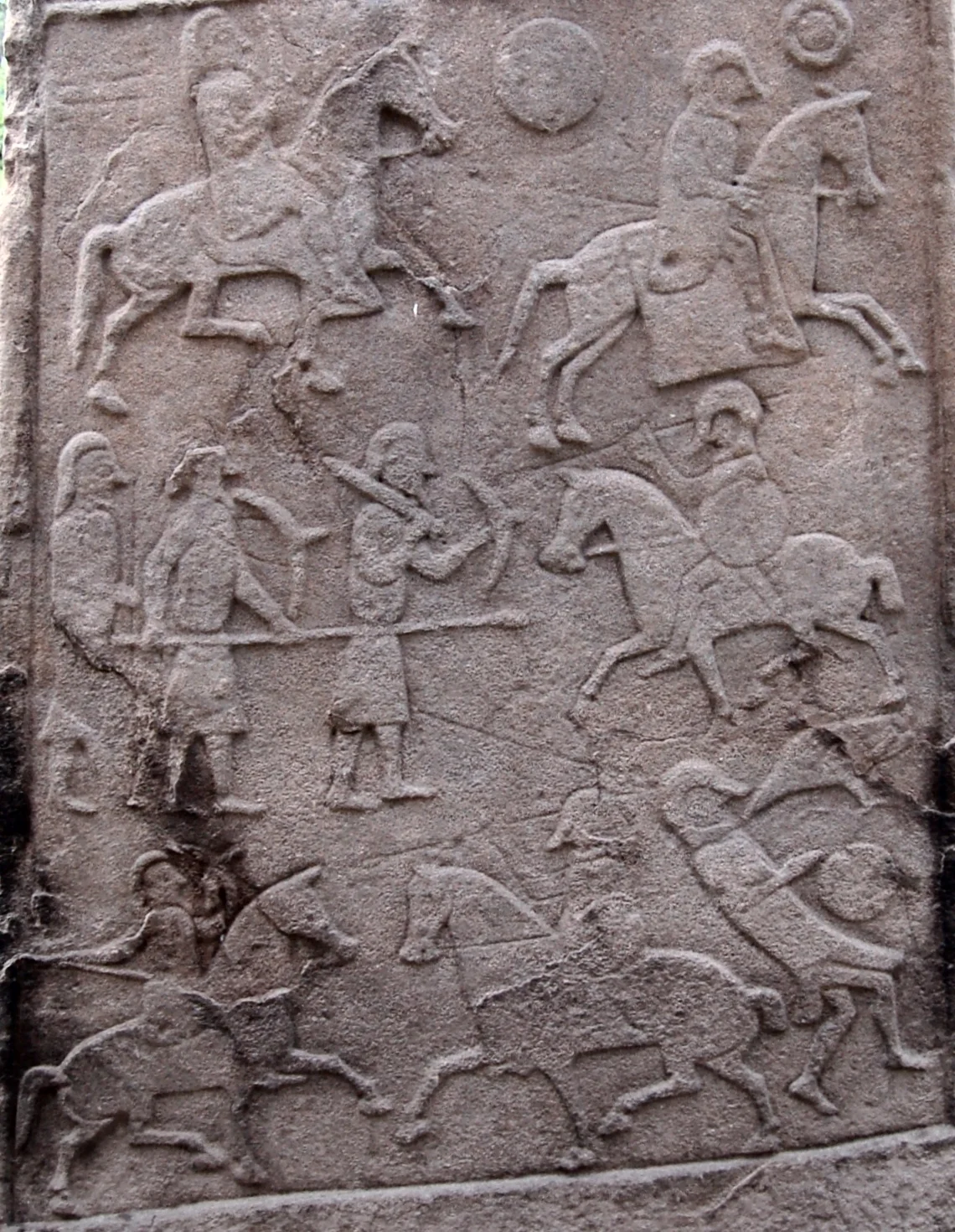

Battle of Dun Nechtain
On the 20th of May 685, Bridei mac Bili of the Picts watched a Northumbrian army of horsemen ride into a narrow valley. The Picts had been in feigned retreat for some time, allowing themselves to be chased and chased, drawing the invaders deeper into country they did not know. The Welsh chroniclers later called the place Linn Garan - the lake of the cranes. The English called it Nechtansmere. By the end of the day, the Northumbrian king Ecgfrith was dead, and the greater part of his army with him. The northern half of Britain had just been redrawn. Almost everything else we say about that day comes with question marks attached, including where it actually happened.
The Edge of Empire
By the late 7th century the Northumbrian kingdom had grown into the dominant power of northern Britain. The Annals of Tigernach record their capture of Eidyn - Edinburgh - in 638. By the reign of Oswald the Picts north of the Forth had been subjugated. Ecgfrith inherited that hegemony in 670 and immediately faced rebellion. He crushed the first revolt of the Northern Picts at the Battle of Two Rivers, deposing their king Drest mac Donuel, who was replaced by Bridei mac Bili. By 679 things were unravelling. The Mercians had killed Ecgfrith's brother Aelfwine in battle. Picts were raiding southward - sieges at Dunnottar in 680 and Dundurn in 682 likely Bridei's work - and in 681 Bridei was even recorded as having "destroyed" the Orkneys. The northern frontier of Ecgfrith's kingdom was disappearing in front of him.
Against All Advice
In 684 Ecgfrith made a brutal pre-emptive strike. He sent an army to Brega in Ireland to break up a Gaelic-Briton alliance. The force decimated the local population and burned churches. The Venerable Bede, who lived through these years and wrote about them in the next generation, treats the Brega raid with open scorn. The following spring Ecgfrith decided to deal with the Picts the same way. His own advisers urged him not to. He went anyway. Bede tells us the battle took place 'in straits of inaccessible mountains' - which is one reason historians now doubt the traditional Angus location. The Picts knew their ground. The Northumbrians did not. A feigned retreat drew them between hills until there was no way out.
A Lake Called Crane
The 9th-century Welsh chronicler Nennius records the engagement as Gueith Linn Garan - the Battle of Crane Lake - and the 12th-century Symeon of Durham gives the Old English Nechtansmere, 'Nechtan's lake.' Both agree on a lake. The traditional site is at Dunnichen in Angus, identified in the early 19th century by the antiquarian George Chalmers, who found 'Dun Nechtan' recorded in early charters of Arbroath Abbey. Old maps show a small drained lake at Dunnichen Moss, east of the village. The carved battle scene on the Aberlemno kirkyard stone three miles north has often been cited as evidence - though the stone is probably mid-8th or even 9th century. In 2006 the historian Alex Woolf made the case for a different site entirely: Dunachton, on the shores of Loch Insh in Badenoch, where the inaccessible mountains Bede describes actually exist. The argument has not been settled.
The Border Holds
Whatever the exact patch of ground, the result was decisive. Bede records that the Picts recovered the lands the Northumbrians and the Dal Riatan Scots had held. Northumbrians who could not flee were killed or enslaved. The Northumbrian diocese set up at Abercorn for the conversion of the Picts was abandoned. Its bishop, Trumwine, fled to Whitby with his monks. The Roman Catholic mission to the north stalled for generations. Ecgfrith's death effectively ended any chance that the Anglo-Saxon kingdoms would absorb what would become Scotland. The line of difference - cultural, linguistic, religious - that runs across the island today was set, in some real sense, on that May afternoon by a lake in the north. It is the kind of battle whose consequences can still be measured.
From the Air
The traditional Dunnichen site lies at 56.63°N, 2.80°W, about 4 nm east of Forfar in Angus, with Dunnichen Moss east of the village. The alternative site at Dunachton lies further north on Loch Insh in the Cairngorms. From 2,000-4,000 ft AGL over Dunnichen, look for the low Dunnichen Hill (about 700 ft) covered in birch wood and surrounded by farmland. The carved Aberlemno Stone is 3 nm to the north. Nearest airports: Dundee (EGPN) 14 nm south; Leuchars (EGQL) 20 nm south-southeast; Aberdeen (EGPD) 40 nm northeast. Forfar and Glamis Castle are nearby landmarks.
Nearby Stories
- Lochnagar 5 km away
- Lindores Abbey 9 km away
- St Andrews Cathedral Priory 13 km away
- Blairgowrie and Rattray 15 km away
- Crathes Castle 17 km away
- River Dee Ferryboat Disaster 21 km away
- Girdle Ness Lighthouse 50 km away
- Eyemouth Disaster 59 km away