
Yellowcraig
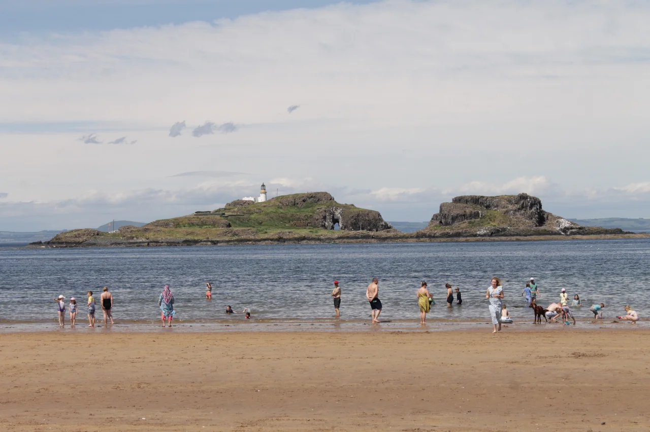
Looking north-west from the sand at Yellowcraig, you see a small humped island with a lighthouse on top. That is Fidra. Robert Louis Stevenson, who summered around here as a child, drew it from memory when he sketched the map that became Treasure Island. The shape on Long John Silver's chart and the shape of Fidra rising out of the Firth of Forth are the same island. Stand at Yellowcraig on a clear day and you are standing in front of one of the most famous treasure maps in fiction.
Broad Sands
Yellowcraig has two names. The Ordnance Survey calls it Broad Sands Beach, and the locals call it Yellowcraig after the band of yellow lichen on the rocks at the eastern end of the bay. The beach faces directly across the Firth of Forth to Fife, with Edinburgh's skyline just visible to the west on clear days. Behind the dunes a strip of Scots-pine forest provides shelter from the North Sea wind. The whole area sits within the Firth of Forth Site of Special Scientific Interest, sandwiched between the Archerfield links to the west and North Berwick West Links to the east. The Bass Rock looms three miles to the east. Fidra sits half a mile to the north-west, low and dark.
On the John Muir Way
Yellowcraig is a waypoint on the John Muir Way, the 134-kilometre coast-to-coast footpath named for the conservationist who was born in Dunbar, just down the East Lothian coast in 1838. Muir emigrated to America as a boy, fell in love with the Sierra Nevada, and helped persuade the United States to set aside Yosemite and Sequoia as national parks. The path that bears his name connects his birthplace at Dunbar to Helensburgh on the Clyde, threading through Yellowcraig as it follows the south shore of the Forth. Local school groups arrive at the car park, walk the beach, and learn his story. The path is part of the wider North Sea Trail, a network of routes linking seven countries around the North Sea basin.
Treasure Island, Drawn from a Window
Stevenson's family had Edinburgh roots and East Lothian summer habits. He often stayed at Scoughall Farm a few miles east, where Fidra dominates the seaward view. Years later, in 1881, he was holidaying with his stepson Lloyd Osbourne in Braemar when he sketched a map for the boy's amusement. The shape of the island, the bay, the headlands he drew were Fidra. The map produced a story; the story became a novel; the novel became Treasure Island. Today the island is an RSPB reserve and a working lighthouse station. Puffins burrow there in summer, and the Scottish Seabird Centre at North Berwick beams live camera footage from its colonies. The Treasure Island themed adventure playground at the Yellowcraig car park makes the literary connection explicit for younger visitors, complete with a Pirates Cove sign.
Birds and Tides
The wider beach is unfussy: a car park 270 metres back from the sand, wheelchair-accessible boardwalk to a viewing platform, picnic and barbecue area, basic facilities. The East Lothian Countryside Ranger Service manages the dunes and the woodland, controlling invasive species and protecting nesting little terns in summer. Eider ducks bob in the shallows. Curlews probe the wet sand at low tide. Cormorants line up on the rocks below the dunes with wings spread to dry. The tide drops a long way out here, leaving wet sand that mirrors the sky. Walk it at dawn and you will have it largely to yourself. Walk it on a summer Sunday and half of Edinburgh has the same idea.
From the Air
Yellowcraig: 56.063 N, 2.774 W on the East Lothian coast, between Dirleton and North Berwick. Best viewed at 1,500 ft AGL on a south-east heading, with Fidra and its lighthouse to the north-west and the Bass Rock to the east. The yellow-lichened rocks and broad sandbar are visible against the dark blue Firth. Nearest airport is Edinburgh (EGPH) 23 nm west; East Fortune Airfield (no ICAO) lies four nm south. Watch for haar (North Sea fog) which can hide the coast in summer mornings and may form a sharp boundary between sun ashore and cloud offshore.
Nearby Stories
- Leith 0.8 km away
- Crail 1.4 km away
- Falkland Palace 2.8 km away
- Peebles 8 km away
- Mellerstain House 9.9 km away
- Eyemouth Disaster 11 km away
- Battle of Homildon Hill 19 km away
- River Dee Ferryboat Disaster 99 km away