Abu Simbel (village)
Here is a village that exists because a temple was moved. Before the 1960s, the population of Abu Simbel numbered a few dozen Nubian families who lived along the Nile in the shadow of Ramses II's colossi. Then the Aswan High Dam rose, the water climbed, the temple was sawed apart and reassembled on higher ground, and Egypt built a new village to go with it. Today about 2,600 people live at Abu Simbel, most of them on the edge of Lake Nasser in houses that were not there two generations ago. The village exists for one reason: to receive the buses and planes that bring visitors to the relocated temple, forty kilometers from the Sudanese border.
The Name Before the Name
The Arabic name Abu Simbel, or Abu Sunbul in Modern Standard Arabic, descends from the older place-name Ipsambul. During the New Kingdom, when Ramses II was commissioning the temple around 1265 BCE, the region where the colossi now stand may have been called Meha. Twenty kilometers to the southwest, just across what is now the Sudanese border, was a small Nubian village called Ibshek, slightly north of the Nile cataracts. Ibshek is now underwater, drowned by Lake Nubia, the Sudanese name for the same reservoir Egyptians call Lake Nasser. Names outlast places, but sometimes only by a little.
On the Disputed Line
Abu Simbel sits in a strange corner of the map. The Sudanese border is just twenty kilometers southwest, but it does not run along the 22nd parallel of latitude the way maps often suggest. Here the boundary deviates into the Wadi Halfa Salient, a territory disputed between Egypt and Sudan since 1902. Egypt claims all land up to the 22nd parallel; Sudan claims the salient. The nearest real city, Wadi Halfa, lies 65 kilometers southwest on the far side of the dispute, also relocated to higher ground in the 1960s for the same reason Abu Simbel was. Both towns are children of the dam. The road from Aswan runs 240 kilometers west of Lake Nasser through the Libyan Desert, carrying tour buses and the irrigation projects that are slowly trying to make the surrounding desert fertile.
The Climate of an Outpost
This is one of the hottest places in Egypt. Summer highs average above 40 degrees Celsius and summer nights rarely cool below 20. Winter days settle around 25 with nights that can drop below 10 if the desert wind is strong. Precipitation is so rare that no rainy season can meaningfully be defined, though in August 2024 the Intertropical Convergence Zone drifted far enough north to bring a rare threat of rain. Because the village sits on the edge of Lake Nasser, it can feel ten degrees cooler than Aswan when the wind comes across the water, and Nubian lodge owners tell winter guests to pack scarves. The light is always direct and the shadows are always sharp.
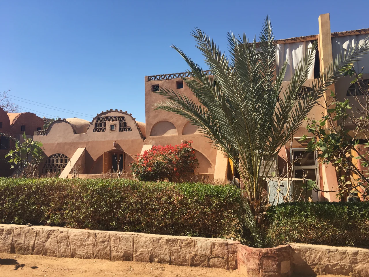
The Village They Built
When the Aswan High Dam was completed in the 1960s, all of Lower Nubia flooded behind it. Most Nubian families were resettled to the areas around Aswan and Kom Ombo, far from their ancestral villages. Abu Simbel was the exception. Because UNESCO's international campaign saved the temples between 1960 and 1980, cutting them into blocks and reassembling them sixty meters higher, a new village was built here to house the tourism industry the saved temples would generate. The village has a hotel, an airport, restaurants along the main road, and a Nubian lodge called Eskaleh run by a local family that arranges sunrise boat tours. Nearly the entire population now depends on tourism for income, because the surrounding desert offers almost no agricultural land.
Visible from the Air
What a pilot sees from cruise altitude is the blue sliver of Lake Nasser against the endless tan of the Libyan and Nubian Deserts, and, at 22.34 north, a small cluster of roofs on the west bank with an airstrip running parallel to the shore. The temple itself is difficult to spot from above because its facade faces east into a dug-out cliff, but the artificial hill constructed to cover the rear of the Great Temple gives the monument a distinct profile. Below that hill live the descendants of families who watched the old Abu Simbel drown and who built this new one on the higher ground. The village is small, but the view from the ridge at sunrise is what tourists fly across the world to see, and what the people here have quietly made their livelihood.
From the Air
Located at 22.34 N, 31.63 E on the west bank of Lake Nasser, about 240 km southwest of Aswan and 40 km from the Sudanese border. Nearest airport: Abu Simbel Airport (ICAO HEBL), 2 km from the village, with a single 2,000-meter runway suitable for domestic Dakota and regional jet traffic. From cruise altitude the blue expanse of Lake Nasser is an unmissable navigation landmark; the village sits on the reservoir's southwestern shore.
Nearby Stories
- Wadi Halfa Salient 8.8 km away
- Kulb 124 km away
- Temple of Dendur 126 km away
- Kulubnarti 154 km away
- Bi'r Tawīl 183 km away
- Bir Tawil 190 km away
- Aswan Dam 204 km away
- Kharga Oasis 289 km away