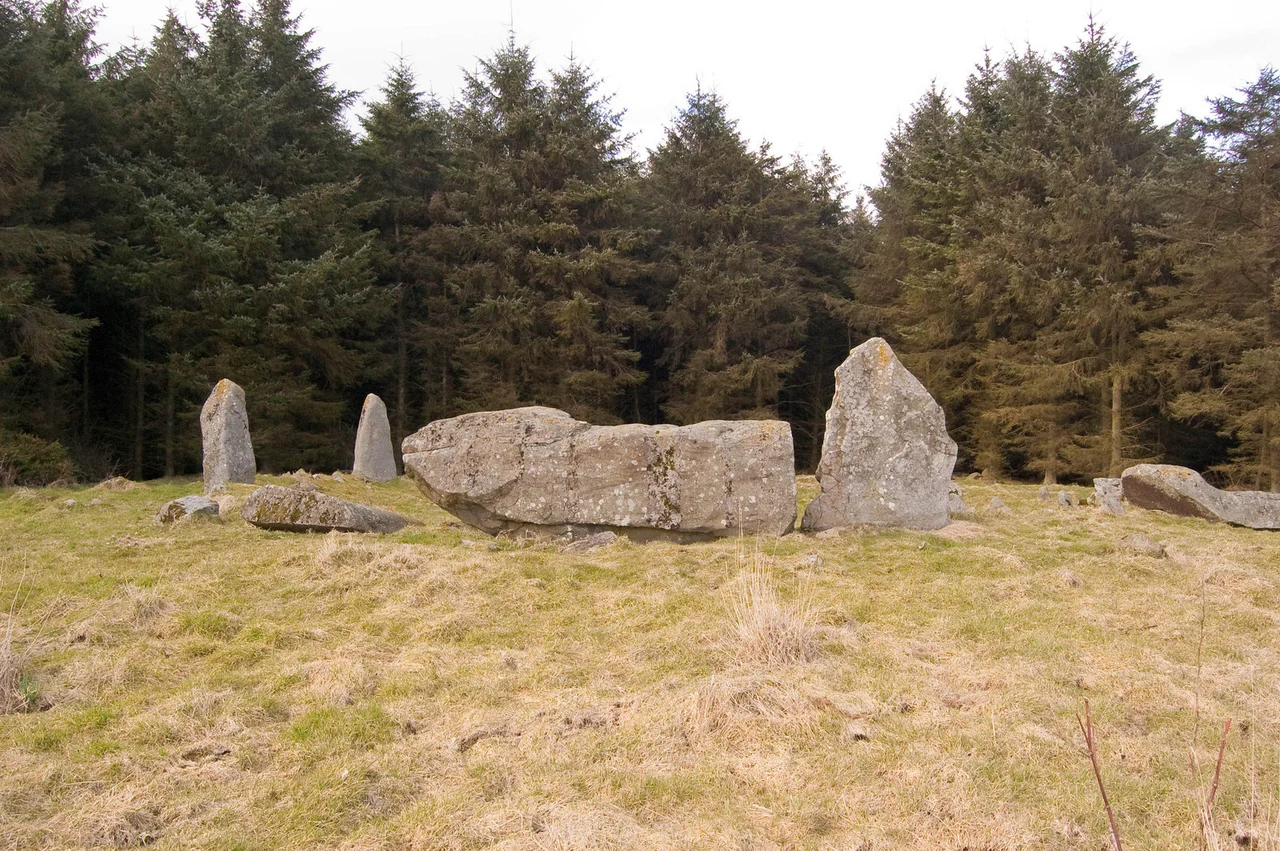

Aikey Brae Stone Circle
It weighs about twenty-one and a half tonnes. It lies on its long side, oriented just so, between two flanking uprights with the long axis pointed between south and south-west - and it has done so since the Bronze Age. The recumbent stone at Aikey Brae is one of the largest in Aberdeenshire, and the ring it anchors is one of more than seventy recumbent stone circles found nowhere on Earth except a small patch of lowland Aberdeenshire and the south-west of Ireland. Whatever its builders intended, they built it for the long term. Nearly four millennia later, it is still doing whatever it was meant to do.
Crowns of Stone
Recumbent stone circles are a Scottish invention. The defining feature is the recumbent itself - the largest stone in the ring, laid horizontally on its long side rather than driven upright like the others. Its long axis points always between south and south-west. The two stones flanking the recumbent, the flankers, are usually the tallest uprights in the circle, framing the laid stone like the posts of a gate. Inside the ring there was generally a low ring cairn, though most have eroded away. They were built in the early Bronze Age, possibly developing from the Clava cairns over in Inverness-shire. The closest cousins anywhere else on Earth are the axial stone circles of south-west Ireland, across the Irish Sea. Nobody knows exactly what they were for. Cremated remains have been found inside some. The recumbent stones almost all face the southern horizon, where the moon swings low in its long cycles.
The Site on Parkhouse Hill
Aikey Brae crowns the summit of Parkhouse Hill, near the village of Old Deer in the Buchan country east of the Aberdeenshire town of Maud. The circle is between fifteen and sixteen and a half metres across. Five stones still stand, including the great recumbent; five more lie fallen. The site was surrounded by conifer plantation for decades, the dark trees pressing in until they were felled in October and November 2019 and the circle could once again be seen from a distance. The view that opens from the brow is the view its Bronze Age builders chose: out over rolling farmland, with the line of the southern horizon laid clean for the moonrise.
Red Stones, White Stones
When Chris Ball and Richard Bradley excavated Aikey Brae in 2001, they uncovered something the surface had hidden. The ring bank around the circle was edged with kerbstones, and the kerbstones alternated by colour: red and white, red and white, like teeth in a circling mouth. Forty-three pieces of worked stone came out of the ground, with quartz flakes and flint scrapers among them. Radiocarbon dates were anomalous and suggested the Late Bronze Age, later than most of the other recumbent circles. Where some Aberdeenshire circles, like Tomnaverie, show signs of having been built up piecemeal over centuries, Aikey Brae looks like it was put together as a single coherent project. Somebody made a decision, gathered the stones, alternated red and white in the kerb, set the great twenty-one-tonne recumbent in place, and stepped back.
Astronomers Without a Calendar
In the 1980s the archaeo-astronomers Clive Ruggles and Aubrey Burl came north and measured Aikey Brae with the rest of the Aberdeenshire recumbents. The pattern they had been chasing held: the recumbent stones all looked out toward the segment of horizon where the moon rides at the southern extreme of its eighteen-and-a-half-year cycle. The flankers framed the rising and setting points of the major lunar standstill. Whether this was ritual, calendar, theatre, or memorial nobody can say with certainty, and the builders did not leave us a manual. But the precision of the alignment is not in doubt. Aikey Brae was made a scheduled monument in 1925, one of the earliest protections of its kind. The stones still face south, the moon still swings low, and the great recumbent still lies waiting for whatever it was meant to receive.
From the Air
Aikey Brae sits on Parkhouse Hill at 57.51 degrees north, 2.07 degrees west, about a mile west of Old Deer and three miles south of Maud. From the air the circle is a small clearing of fallen and standing stones on a rounded hilltop, with the surrounding ground recently cleared of forestry. The nearest commercial airport is Aberdeen Dyce, ICAO EGPD, about twenty-five nautical miles south-south-west. Best viewed at 800-1500 feet AGL in low-angle morning or evening light, which casts the stones' shadows across the ring bank. The Buchan plain that opens to the south was the audience the builders chose.
Nearby Stories
- Mither Tap Hillfort 4.3 km away
- Banff and Macduff Lifeboat Station 11 km away
- SS St Petersburg 12 km away
- River Don, Aberdeenshire 17 km away
- HMS Exmouth (H02) 53 km away
- Piper Alpha 120 km away
- German submarine U-1274 190 km away
- HMS Nottingham (1913) 231 km away