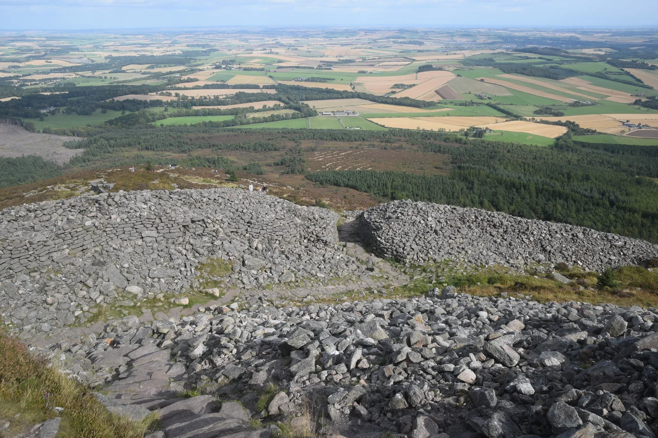

Mither Tap Hillfort
From the granite summit of the Mither Tap, the whole of the Aberdeenshire lowland opens out beneath you in a single sweep, and somewhere down on that plain, in the autumn of AD 83, the Roman governor Agricola is supposed to have fought the battle Tacitus called Mons Graupius. We do not know exactly where the battle was, only that it was somewhere up here in north-east Scotland, and one of the leading candidates is the slope that drops away from Mither Tap toward the modern village of Inverurie. What is more certain is that a thousand-odd years of Pictish people thought this granite tor was important enough to wrap it in a double ring of stone walls and turn it into a fortified town. They were probably right.
The Outcrop and Its Walls
Mither Tap is a prominent granite outcrop on the eastern end of the Bennachie ridge, the kind of weather-beaten knuckle of rock that draws the eye for miles around. The Pictish builders saw what they had and built accordingly. An inner rampart hugs the granite outcrop at the summit and encloses a small citadel area shaped largely by the rock itself. A second, outer rampart runs lower down the slope and encloses a much larger area, big enough for a small permanent settlement. Most of the outer rampart's stonework has collapsed downslope over the centuries, but its line can still be traced clearly around the hill. The terraced platforms cut into the hillside between the ramparts suggest that people lived here, with circular and rectangular foundations that may have supported roundhouses or other buildings.
The Well That Held Water
In the lower citadel, the nineteenth-century Scottish antiquarian Christian Maclagan, one of the first women to be admitted to the Society of Antiquaries of Scotland, recorded a well that still held water in her day. The well was filled in during the twentieth century, but recent excavations have uncovered it again: a rectangular, stone-lined structure with steps keyed into the surrounding rampart's stonework, showing that the well was an integrated part of the original fort design rather than an afterthought. A clay lining suggests waterproofing. A fort on a granite summit with no water supply would be useless in a siege. The Picts had thought of this.
The Kingdom of Ce
The fort shows clear evidence of occupation between the fourth and eighth centuries AD, the heart of the Pictish period, and scholars have argued for a long time that it served as a major centre within the Pictish territory of Ce. The Picts wrote little down themselves, and what we know about their kingdoms comes mostly from later Irish and Anglo-Saxon chronicles, but the name Bennachie itself may be a survival. Some scholars derive it from Benne Ce, meaning mountain of Ce, which would make this the eponymous peak of the lost kingdom. Others prefer a Gaelic etymology, Beinn na Ciche, meaning hill of the breast, referring to the summit's distinctive shape. Both readings could be right; the names of mountains often layer up like that.
Crucibles and a Gaming Piece
Recent archaeological excavations have changed how we think about Mither Tap. The trench on the southeast side of the fort recovered iron fragments, an intact crucible, and slag, all evidence of metalworking inside the walls. Trench 4, in the upper citadel, produced animal bone fragments, teeth, charcoal, and a gaming piece, suggesting people lived and played here, not just defended the place when threatened. Pockets of heat-affected soil on the southern slope of the central tor show that fires were used repeatedly in this part of the fort. A flat-stone surface in the inner citadel may be a constructed pathway. The picture that emerges is less of a refuge in emergencies and more of a regular high-status settlement, perhaps the seat of a Pictish king or his officials.
The View North to Mons Graupius
Stand on the summit and the question of where Tacitus's battle was fought looks slightly different. From up here, the slope to the north and east opens onto exactly the kind of broad ground where two ancient armies could deploy. Calgacus, the Caledonian leader Tacitus has speaking the famous line about Roman conquest creating a desert and calling it peace, may have stood somewhere within sight of where you are standing. Or maybe not; rival candidate sites for Mons Graupius range across the north-east of Scotland. The archaeology of Mither Tap does not directly support the connection, but the geography is suggestive. What is certain is that for somewhere between four and five centuries after the Romans went home, this granite knuckle was the heart of something. A regional power centre. A Pictish capital, possibly. A place worth carving the path up to from the lowland below, which is what visitors still do today, scrambling up the last steep granite to the same view the Picts saw.
From the Air
Mither Tap stands at 57.29 degrees north, 2.53 degrees west on the eastern end of the Bennachie ridge in Aberdeenshire, about 18 nautical miles west-northwest of Aberdeen. The summit rises to 518 metres (1,699 feet), with the distinctive granite outcrop and surrounding hillfort ramparts visible from cruising altitude in clear weather. Nearest major airport is Aberdeen (EGPD) approximately 18 nautical miles east. Bennachie is a major navigational landmark for the upper Don valley, with the village of Alford about 5 miles southwest and Inverurie about 5 miles east. The Grampian Transport Museum sits just south.
Nearby Stories
- Glendronach Distillery 0.8 km away
- The Macallan Distillery 2.6 km away
- Aikey Brae Stone Circle 4.4 km away
- Brig o' Balgownie 4.4 km away
- Corgarff Castle 7.3 km away
- Fettercairn Distillery 12 km away
- Blairgowrie and Rattray 42 km away
- Eyemouth Disaster 117 km away