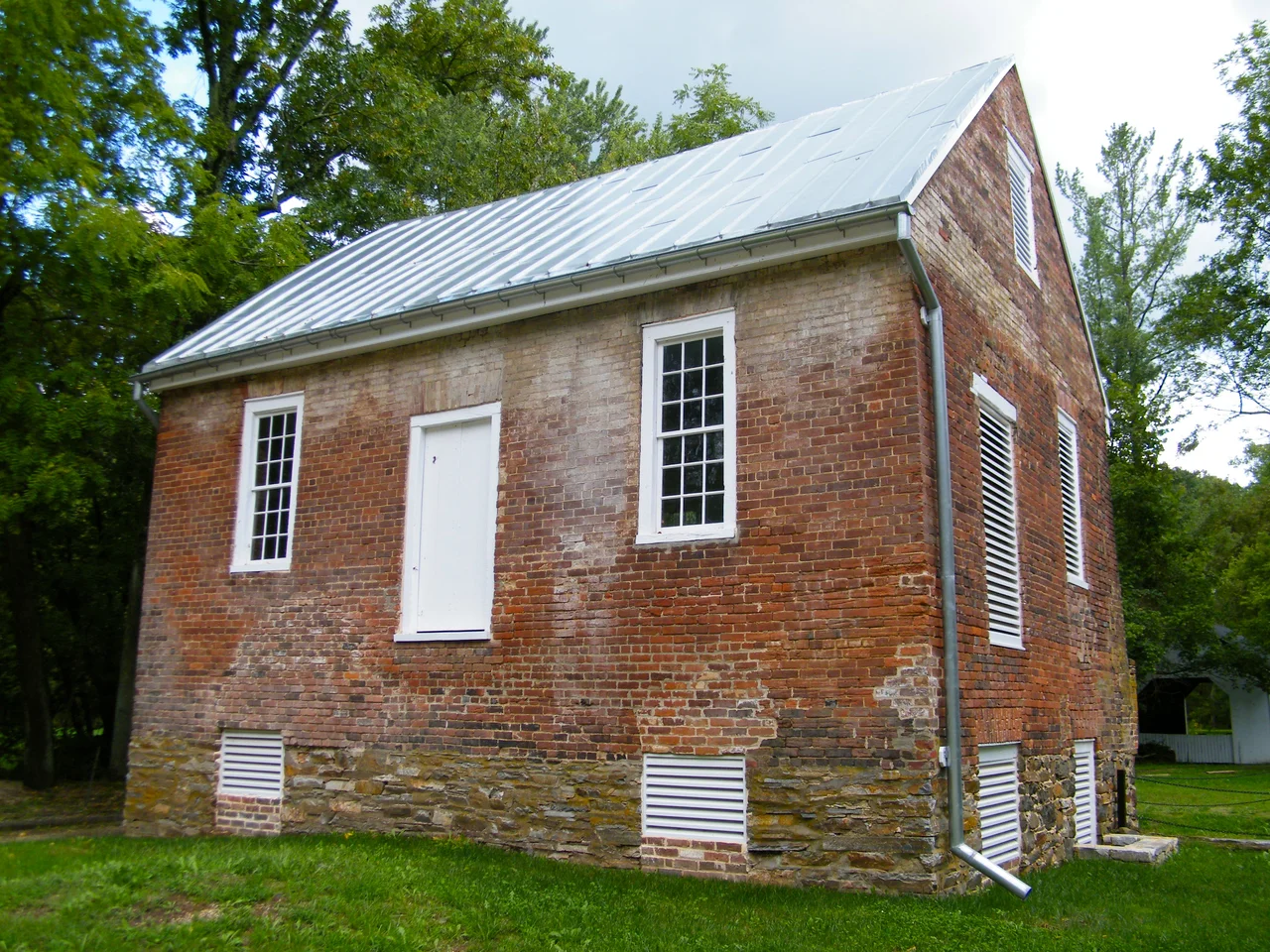

Aldie Mill Historic District
The same family ran the Aldie Mill for six generations. John Moore bought it from Charles Mercer in 1835, and Moore descendants kept the waterwheels turning until 1971 - 136 unbroken years of one family grinding the wheat and corn of the Loudoun Piedmont. The mill itself is older than that. Built between 1807 and 1809 on the Little River by an indentured worker named William Cooke, it sits at the edge of the Aldie village that grew up around it. Cooke worked four years to build the mill in exchange for a half share of the operation. He sold his half back to Mercer in 1816. The Moores took it over almost twenty years later. They were still there when the cars started coming.
Charles Mercer's Manor
Charles Fenton Mercer was a Virginia lawyer, state legislator, U.S. congressman, brigadier general in the War of 1812, and tireless promoter of the colonization of free Black Americans to Africa as a co-founder of the American Colonization Society. He obtained the right to dam the Little River and build a mill in 1804 - the year his father James Mercer's older tub mill, dating back to about 1764, had been outgrown. Charles Mercer built a Federal-style house for himself across the Little River Turnpike from the new mill, called the complex Aldie Manor after the Aldie Castle in Scotland from which he claimed ancestry, and watched the village that grew up around the mill take the same name in 1810. The mill complex eventually included a granary, a miller's house, a store, a distillery, a blacksmith shop, a sawmill, a cooperage, and a wheelwright's shop. William Cooke had built all of it under an indenture contract that traded four years of building for a half-share in the finished operation. Mercer bought Cooke's share back in 1816 for $11,250.
Oliver Evans's Patent
The original mill machinery Cooke installed was a Federal-era engineering marvel: a complete automatic grain-milling system patented by Oliver Evans in 1790 and reckoned to be one of the first true automated production lines in America. Evans's system used continuous belts, screw augers, and bucket elevators to move grain from delivery wagon to finished flour barrel without human handling, dramatically reducing labor and waste. Aldie's two overshot waterwheels - arranged in series rather than parallel, one wheel feeding the next - powered the entire complex. Overshot wheels, the most efficient kind of waterwheel, dropped water onto the top of the wheel and used gravity rather than river current to turn the machinery. Most of the original Evans machinery and the wooden water wheels were replaced in the early twentieth century with iron and steel components. Some elements of the original layout, including the system of millstones and the structural beams, survive. The mill itself is two stories with two loft levels under the roof, flanked by a one-story east wing and a two-story west wing, all built of brick laid in Flemish bond.
Six Generations of Moores
Mercer sold the mill in 1835 to John Moore, who was running it within months. Moore's son took over from him. His grandson took over from him. The descent continued through six generations of Moores until 1971, when the last Moore miller closed the operation. For 136 years the mill was the steady heartbeat of Aldie - the farmers of central Loudoun County brought wheat and corn here, paid in either cash or a percentage of the grain, and took home flour and meal. During the Civil War the mill ran intermittently. Cavalry fights swept through Aldie in 1863 during the Gettysburg campaign - the Battle of Aldie on June 17, 1863, took place a few hundred yards from the mill's water wheels. The Moores kept milling whenever the fighting stopped. After the war they kept milling. When farming gave way to commuter subdivisions in the late twentieth century, they kept milling. The mill closed in 1971 not because the Moores ran out of family but because there were no longer enough local farmers bringing in grain.
A Park and a Working Demonstration
The Aldie Mill Historic District was added to the National Register of Historic Places on September 15, 1970, the year before the mill closed for commercial operation. The Northern Virginia Regional Park Authority acquired the property and now operates it as Aldie Mill Historic Park. Park staff regularly run the waterwheels for public demonstrations - twice a month on weekends from spring through fall, water flows down the millrace, the overshot wheels turn, the gears engage, the millstones grind, and visitors can take home a small bag of flour milled the same way it was milled in 1820. The Mercer House across the Turnpike has been restored as the visitor center. The Miller's House, a two-story brick structure behind the mill between the river and the millrace, remains as well. The site is part of the Journey Through Hallowed Ground National Heritage Area, which connects historic sites from Gettysburg to Charlottesville.
What You See in Aldie
From the air the Aldie Mill complex sits on the south side of U.S. Route 50 - the old Little River Turnpike - at the village's western edge, with the Little River curving past behind it and the millpond just upstream of the wheels. The brick mill building, the white Mercer House across the road, and the Miller's House behind form a tight historic cluster within the small village. Aldie itself has perhaps 250 residents today, strung along the Turnpike between Middleburg and Centreville. The Bull Run Mountains rise about five miles east; the Blue Ridge another fifteen miles farther west. Mount Zion Church, where Mosby's Rangers wiped out a Union cavalry detachment in 1864, is a mile east. The Mosby Heritage Area markers thread through the area. Aldie sits in some of the most picturesque horse country in Virginia, stone walls running across the open fields, and the mill that gave the village its name is still the visual anchor at the western end of town.
From the Air
Aldie Mill Historic District sits at 38.975 N, 77.642 W in the village of Aldie, Loudoun County, Virginia, along U.S. Route 50. Recommended viewing altitude is 1,500 to 2,500 feet AGL for a clear look at the brick mill, the millpond, the Little River, and the small historic village clustered around them. The nearest airport is Leesburg Executive (KJYO), about 11 nautical miles north. Manassas Regional (KHEF) lies 13 nm southeast. Dulles International (KIAD) is 13 nm north-northeast - check Class B airspace. The Bull Run Mountains rise about 5 nm east; the Blue Ridge another 15 nm beyond. Best light is mid-morning when the brick mill catches the sun and the waterwheel shadows are sharpest. Heavy weekend traffic on Route 50 toward Middleburg.
Nearby Stories
- Bladensburg Dueling Grounds 4.6 km away
- Monocacy Aqueduct 6.4 km away
- Howard County, Maryland 7.9 km away
- Third Battle of Winchester 8.1 km away
- Long Branch Plantation 12 km away
- Stafford County, Virginia 24 km away
- Battle of Cedar Mountain 30 km away
- St. Mary's City, Maryland 73 km away