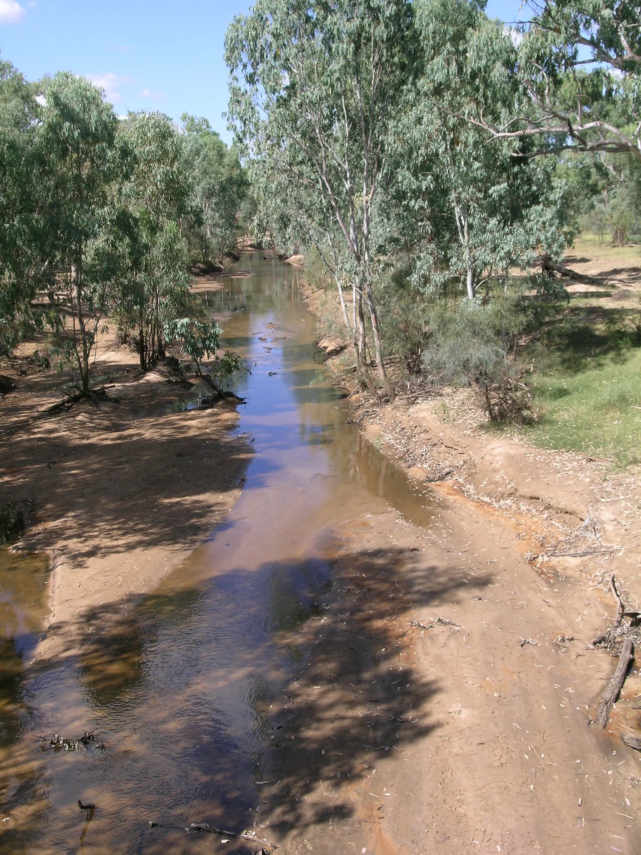

Alice River (Barcoo River tributary)
Most rivers run to the sea. The Alice does not. Rising on the western slopes of the Great Dividing Range, it turns its back on the coast and flows southwest, away from the ocean and into the immense, sun-flattened interior of Queensland. For much of the year there is no river to speak of at all - just a sandy channel and a string of waterholes waiting under a hard sky. Then the summer rains come, and the Alice fills, spreads, and joins the Barcoo on a journey that ends not at any coastline but in the dead centre of the continent.
Iningai Country
The traditional owners of this country are the Iningai people, whose lands reach west of the Great Dividing Range and whose name for themselves is also recorded as Yiningay. Their region took in the catchments of the Alice River and Cornish Creek and the country around Longreach, Barcaldine, Muttaburra, and Aramac - well-watered, well-timbered land along broad, meandering streams. For the Iningai, the Alice was not an obstacle or a survey line but a source: its waterholes held fish and drew game through the long dry, and the seasonal rhythm that left newcomers baffled was simply the way the country worked. The town of Barcaldine now sits on the river's banks. The river itself was read and named long before any of that, in a language older than the maps.
The River That Flows Inland
Here is the geography that makes the Alice strange. Its waters feed the Barcoo, and the Barcoo, joined further on by the Thomson, becomes Cooper Creek - one of the great rivers of the Lake Eyre basin, the largest internal drainage system in Australia and one of the largest on Earth. Nothing in this basin reaches the sea. When rain falls in the north, the floodwaters fan out across the floodplains, filling waterholes and carving fresh channels - the famous Channel Country - before draining slowly toward Kati Thanda-Lake Eyre, the lowest point on the continent, sixteen metres below sea level. In most years the water never even gets that far. It sinks into the earth, lingers in the waterholes, or simply evaporates into the desert air. The Barcoo, locals say, marks the edge of the outback proper; west of it lies almost nothing at all.
Named in the Year of First Contact
In 1846, the explorer Thomas Mitchell became the first European to lay eyes on the Barcoo and the Alice. He named the Alice, and his own name stuck to far more than one river: the surrounding pastoral district and the tough native grass that fed its sheep both became 'Mitchell,' as in Mitchell grass, the silvery tussock that still defines these downs. Where Mitchell saw promise, others saw opportunity. In October 1863, Donald Cameron, his son John, and the brothers James and William Crombie walked sheep all the way from the New England district of New South Wales and spread them along a forty-mile frontage of the Alice. They named the run Barcaldine, after a family farm in Scotland - a Highland name pinned, improbably, to a riverbank in the Queensland sun.
When the Dry River Wakes
A river that is usually a sandy bed becomes something else entirely when it floods. In 1891 the Alice rose in a record flood that cut traffic for a week. On 20 March 1910 it spilled across all the low-lying country and blocked the railway line outright. This is the paradox of the inland watercourse: invisible for months, then suddenly a brown inland sea, transforming the plains and stranding everything in its path before retreating again to a chain of quiet pools. To know the Alice River is to understand that 'river' out here is a verb as much as a noun - something the country does occasionally, gloriously, and on no schedule but the weather's.
From the Air
The Alice River runs through central-west Queensland; the coordinates here (24.03°S, 144.85°E) lie southwest along its course toward Isisford and its confluence with the Barcoo. From the air, the river usually reads as a sinuous, pale sandy channel fringed by darker timber, often without flowing water, threading across vast flat Mitchell-grass downs - look for the tree-lined corridor rather than open water. The town of Barcaldine sits upstream on the river, served by Barcaldine Airport (ICAO YBAR); Longreach (YLRE) lies to the northwest and Blackall (YBCK) to the south. Recommended viewing altitude 3,000-5,000 ft AGL to follow the channel's meanders. Visibility is typically excellent; after summer rains the normally dry course can appear as a startling ribbon of water spreading across the plain.
Nearby Stories
- Old Isisford District Hospital 5.4 km away
- Wellshot Station 13 km away
- Yalleroi 23 km away
- St Peter's Anglican Church, Barcaldine 34 km away
- Jindalee Operational Radar Network 36 km away
- Blackall, Queensland 49 km away
- Augustus Charles Gregory 67 km away
- Lake Dunn 126 km away