Amazonia National Park
The Tapajos River is not like its famous muddy sibling. Rising from the Precambrian crystalline shields of central Brazil, it carries almost no sediment, and its water runs clear enough that white sand beaches glow along the upper reaches. At 1,070,737 hectares, Amazonia National Park straddles this river roughly halfway between Manaus and Belem, protecting some of the least-disturbed lowland rainforest on Earth. The park has a harder job than most national parks. Illegal loggers and gold miners work the eastern edges closest to the towns of Itaituba and Trairao, and the park itself has been trimmed by successive decrees as the Brazilian state negotiated with extractive interests.
A River That Runs Between Worlds
The Tapajos does more than cut the park in half. It functions as a biogeographic barrier. Some species on the western bank never cross to the east, and some on the east never move west. Biologists have documented this pattern across Amazon rivers, where genetic isolation between banks produces close cousins that have diverged over millions of years into distinct species of birds, primates and frogs. The upper Tapajos is unusual in the Amazon basin for its areas of white-sand grassland beside the river, patches of nutrient-poor soil where a specialized flora adapted to the extreme conditions. Elsewhere the park is dense lowland rainforest, the classic multi-tiered cathedral of green with the largest emergents reaching 50 meters into the canopy.
Created in 1974, Revised Ever Since
Federal Decree 73.683 established the park on February 19, 1974, at the height of the Brazilian military government's push to open and occupy the Amazon. Its boundaries were altered in 1985, 2006 and 2011. In 2012, Law 12678 redrew the limits of the Amazonia, Campos Amazonicos and Mapinguari national parks along with several national forests and a protected area, reducing almost all of them to accommodate the Belo Monte and Teles Pires hydroelectric complexes. Amazonia lost area and ended up at its current 1,070,737 hectares. The management plan was drafted in 1988 but never made official. A consultative council was finally created in 2004, three decades after the park itself. The halting institutional history reflects the larger story of Brazilian Amazon conservation: ambitious creation, grudging enforcement, piecemeal reduction.
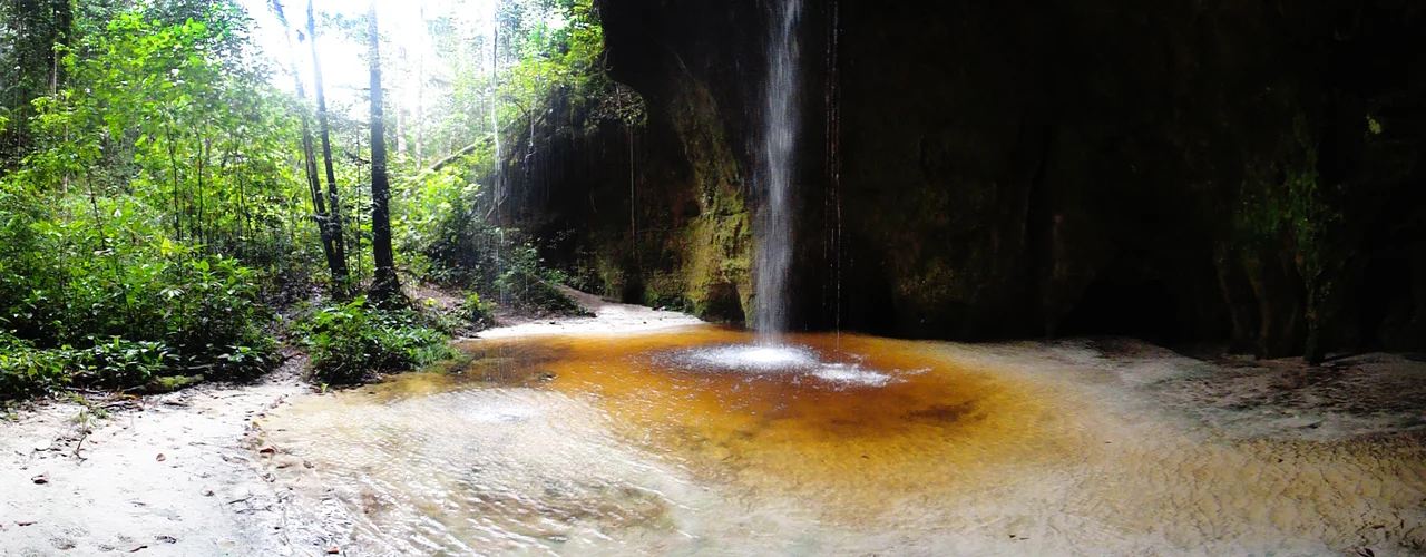
What Lives Beneath the Canopy
About 98 percent of the park is dense humid tropical forest, its uniform canopy letting enough filtered light through to sustain a rich understory of vines, lichens, mosses and orchids. Many of the mammals are nocturnal, padding unseen through the gloom, including jaguar and ocelot. Several of the park's most charismatic species are endangered: the giant otter, which hunts in noisy family groups along blackwater lakes; the Amazonian manatee, a ponderous gray vegetarian drifting through flooded forest; and the giant anteater, its huge front claws shredding termite mounds. The rivers themselves teem with fish, reptiles and aquatic invertebrates. The Pau-Rosa National Forest adjoins the park to the west, and both are proposed components of the South Amazon Ecological Corridor, a still-theoretical green seam meant to link protected areas across thousands of kilometers.
Getting There Is Most of the Adventure
Itaituba is the gateway. The first park base lies about 53 kilometers out. The Transamazonian highway runs east to west through the area, paved as far as Itaituba and then reverting to unpaved earth roads topped with gravel. Rainy season, November through April, turns sections to mud that needs repair every May and June. Many visitors arrive instead from Santarem, the city where the Tapajos meets the Amazon. Santarem has an airport and regular flights from Manaus and Belem. Once in the region, travel usually means a mix of four-wheel drive vehicles and boat, because the river remains the truest road here. The park receives few tourists compared to its size, and facilities are minimal. This is not a manicured national park experience. It is rainforest that has barely been curated.
From the Air
Located at 4.44S, 56.84W, straddling the Tapajos River in western Para state. Nearest airport is Itaituba Airport (SBIH) with paved runway, and Santarem/Maestro Wilson Fonseca (SBSN) to the north at the Tapajos-Amazon confluence. Recommended cruise altitude 33,000-37,000 feet. From the air the clear Tapajos shows as a distinctive blue-green ribbon between dense canopy, visibly different from the muddy Amazon it joins downstream. Expect heavy afternoon convection in the wet season; dry season haze from regional burning can reduce visibility July through October.
Nearby Stories
- Sawre Muybu Indigenous Territory 26 km away
- Fordlândia 94 km away
- Jamanxim National Park 119 km away
- Alto Maues Ecological Station 138 km away
- Cachoeira dos Patos Dam 168 km away
- Parintins 177 km away
- Sai Cinza Indigenous Territory 233 km away
- Amazon Tall Tower Observatory 298 km away