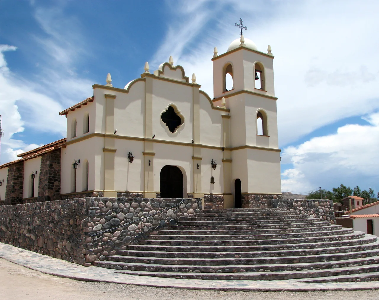

Angastaco
The name means "eagle of the carob tree" - aguila del algarrobo - in the language of the people who lived here long before the road or the vineyards came. Angastaco is a village of fewer than a thousand souls tucked into the Calchaqui Valley of Salta Province, strung along the legendary Ruta Nacional 40 at nearly two thousand meters of altitude. Green crops glow against sandy desert, condors wheel over canyons of red stone, and the wine grown in this thin, brilliant air ranks among the highest on the planet. Few travelers expect to find so much packed into so small a place.
Wine Grown Closer to the Sun
The Calchaqui Valley is the kind of place that bends the rules of viticulture. Stretching some five hundred kilometers through northwestern Argentina, it holds the highest winemaking region on Earth, with vineyards planted between roughly 2,300 and 3,100 meters above sea level. At that altitude the sun is fierce, the nights are cold, and the air is so clear it intensifies everything - color, flavor, the very light itself. The valley's signature grape is Torrontes, an aromatic white that thrives in the high desert. Angastaco sits in the heart of this circuit, and the village pours its own regional wines along with local specialties like the sweet, perfumed mistela. Every summer it celebrates the Feast of the Grape and the foot-pressing of wine, a harvest ritual older than memory.
The Gorge of Arrows
Just west of town, the earth performs something close to a miracle. The Quebrada de las Flechas - the Gorge of Arrows - is a stretch of jagged rock formations thrown up some twenty million years ago, where sharp blades of stone tilt skyward like a frozen sea of spearpoints. It runs for about twenty kilometers between Angastaco and the Calchaqui River, a landscape so otherworldly that locals compare it to the surface of the moon. The rock shifts color through the day, deepening and paling as the light moves across it. Nearby, in a natural amphitheater of multicolored hills called Los Colorados, a Salta artist set a seated stone Christ - the Christ of Humility and Patience - so that faith and red rock share the same vast stage.
A Dance Without Wingbeats
Look up over Los Colorados and you may catch the valley's most spectacular performers. Andean condors ride the canyon's updrafts in pairs, vanishing behind a ridge and reappearing somewhere unexpected, tracing long silent arcs across the red hills. They scarcely beat their wings at all - they simply read the rising and falling air with the mastery of seasoned pilots, climbing on thermals and sliding down the far side. With wingspans that can top three meters, these are among the largest flying birds on Earth, and to watch a pair work the canyon currents is to understand why the people of the Andes have always regarded the condor as sacred.
Layers of Faith and Time
Angastaco wears its history in its churches. The oldest dates from 1945, built in the local manner of brick, bamboo, and adobe and tucked into the streets of the Old Village. A newer church in colonial style went up between 1976 and 1979 and was consecrated by the bishop of Cafayate. A short way out along the road to Cachi, the Finca El Carmen guards one of the oldest churches in the whole Calchaqui Valley, dating to 1780 and lovingly restored. Long before any of these, from the mid-eighteenth century, the indigenous communities of Angastaco were tied to the Franciscan mission of the valley - a reminder that this small village has been a place of gathering, worship, and work for centuries.
Not a Place to Hurry Through
It would be easy to treat Angastaco as a waypoint, a pause on the long drive up Route 40 between Cafayate and Cachi. That would be a mistake. This is a village that rewards slowness - the green fields against the desert, the perfume of its wines, the shifting colors of the gorge, the condors overhead, the dry clear days that follow one another in unhurried succession. The valley grows vines and cereals and fruit, scents the air with paprika, anise, and cumin, and lives at a pace set by the harvest and the light. To pass through quickly is to miss almost everything that makes it worth coming at all.
From the Air
Angastaco lies at approximately 25.69°S, 66.17°W in the San Carlos Department of Salta Province, at about 1,990 meters elevation in the Calchaqui Valley along Ruta Nacional 40. The terrain is dramatic high desert: a narrow green river valley walled by multicolored sandstone, with the Quebrada de las Flechas rock formations just to the west and the high Andes beyond. From the air the contrast is striking - irrigated vineyards and crops as a thin green ribbon through tan and red rock. The nearest major airport is Martin Miguel de Guemes International Airport at Salta (ICAO SASA), roughly 180 km to the north (Salta city lies about 245 km away by road). Recommended viewing altitude is 3,500-5,000 feet AGL to clear the surrounding ridges and appreciate the canyons and valley pattern; mind the terrain, as peaks rise well above the valley floor. The climate is dry, arid, and sunny most of the year, with strong midday thermals over the desert and reliably clear skies - early morning offers the calmest air and the richest low-angle color on the rock.
Nearby Stories
- Cafayate 30 km away
- Los Cardones National Park 41 km away
- Museum of High Altitude Archaeology 85 km away
- Tafi del Valle 95 km away
- 1692 Salta Earthquake 102 km away
- Tolar Grande 117 km away
- Londres, Catamarca 192 km away
- Llullaillaco 209 km away