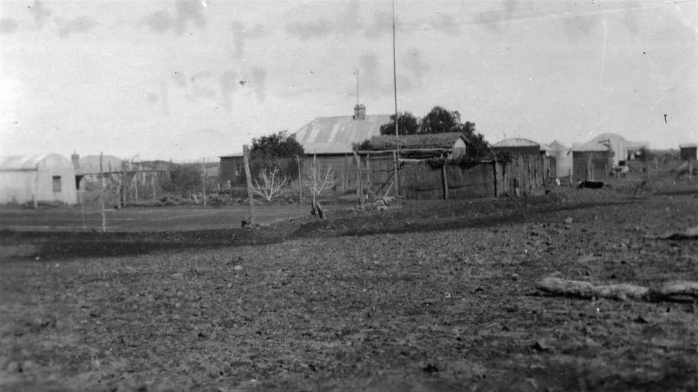

Arrabury
The dingoes settled the question. For decades Arrabury ran sheep across its plains in the far southwest of Queensland, and for decades the wild dogs of the Channel Country thinned the flocks until the arithmetic stopped working. By the late 1940s the sheep were gone, replaced by cattle - animals big enough to fend off a dingo and hardy enough for a country that alternates between bone-dry drought and floodwater stretching to the horizon. Arrabury today is one of the largest cattle holdings in the state, a place measured not in acres but in thousands of square kilometres, where the nearest neighbour is a long drive and the seasons arrive as either too little or far too much.
A Property the Size of a County
Arrabury occupies roughly 7,600 square kilometres in the Channel Country, about 106 km north of Innamincka and 186 km southeast of Birdsville. Since 1992 it has been paired with the neighbouring Cluny station, another 5,500 square kilometres, both held by the Arrabury Pastoral Company under the Daley family. Together they form a single working landscape larger than many small nations. The two properties do a specific job in the cattle business: they fatten. Animals bred in the wetter gulf country to the north are brought down to Arrabury's floodplains to put on weight on the rich feed that follows the floods, before heading on to market. It is a system that turns the Cooper's unpredictability into an asset - when the water comes, the grass comes, and the cattle thrive.
Wool, Fire, and the Melbourne Market
Arrabury was running cattle and finding buyers before 1887. In 1888 its owner, William Campbell, sold it along with his other holdings - Doonmulla, Thackabury and Kangarrah - to William Henry Lindsay, and by 1892 the station's wool was reaching the Melbourne market, more than a thousand kilometres to the south. Distance was the constant adversary. In 1903, fire tore through the store and part of the homestead, destroying hundreds of pounds of supplies that could not be quickly replaced in a place this far from anywhere. In 1917 the Arrabury Pastoral Company was formed with thirty thousand pounds of capital to consolidate the leases, its directors a small board of pastoralists betting that patience and scale could tame an unforgiving country.
The Rhythm of Drought and Flood
There is no such thing as an average year out here. The entire district was gripped by drought in 1946, cattle dying and properties forced to destock. Then the Cooper Creek broke its banks in 1949 and again in 1950, spilling across the flat country and flooding the same paddocks that had lately been dust. The land swings between these two states with little in between, and the people who work it learn to read the sky and the upstream rains rather than the calendar. Drought returned hard between 2002 and 2007, a long dry that broke the spirit of weaker operations - and then the rain arrived again, the channels filled, and the feed came back. Survival here has always meant outlasting the bad years to reach the good ones.
Where the Rivers Spread Out
Arrabury sits in the heart of the Channel Country, a region of roughly 285,000 square kilometres named for the extraordinary way its rivers behave. The land is almost perfectly flat, with so little fall that the Cooper - Australia's largest braided stream - cannot cut a single deep channel. Instead it splits into a maze of interlacing watercourses that, in a big flood, can spread up to 80 kilometres wide across the plain. This is the inland of the Lake Eyre Basin, a closed drainage where the water rarely reaches the sea or even the distant lake it is named for; most of it sinks into the floodplain or simply evaporates under the desert sun. What it leaves behind is the secret of stations like Arrabury. When the channels flood and recede, they lay down nutrient-rich silt and trigger a flush of native grasses, creating some of the finest cattle-fattening country on earth - briefly, gloriously, in the middle of one of the driest landscapes in Australia.
From the Air
Arrabury lies at 26.80°S, 140.93°E in the Channel Country of southwest Queensland, roughly 106 km north of Innamincka and 186 km southeast of Birdsville. From altitude the defining feature is the braided maze of Cooper Creek channels - a fan of pale watercourses across red and ochre plains that fills with shimmering water and green growth after rain, then fades to dust in drought. The terrain is overwhelmingly flat with few vertical landmarks; navigate by the creek systems and the occasional station track. Birdsville Airport (YBDV) is the nearest significant strip to the northwest, with Innamincka's airstrip to the south. Uncontrolled airspace; expect severe heat haze and turbulence on summer afternoons and crystal-clear conditions in winter. Best viewing May through September.
Nearby Stories
- Coongie Lakes 13 km away
- Lake Yamma Yamma 32 km away
- Sturt Stony Desert 35 km away
- Innamincka 51 km away
- Durham Downs Station 58 km away
- Haddon Corner 64 km away
- Eromanga Sea 66 km away
- Ballera gas plant 80 km away