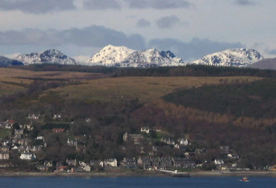

Arrochar Alps
From a train carriage on the West Highland Line, an hour or so out of Glasgow Queen Street, the Cobbler comes into view. Its summit is unmistakable: three sharp rocky pinnacles rising above the head of Loch Long, the central peak crowned by a square-cut block that looks, from certain angles, exactly like a cobbler at his last. This is Ben Arthur, the most distinctive mountain in the Arrochar Alps and one of the most photographed hills in Scotland. It is not technically a Munro — it falls short at 886.7 metres — but no one in the West of Scotland cares about that. The Cobbler is the Cobbler.
Where the Highlands Become Climbing Country
The Arrochar Alps cluster around the heads of three sea lochs: Loch Long reaching up from the Firth of Clyde, Loch Fyne running north toward Inveraray, and Loch Goil branching off Loch Long to the south. They are part of the Grampian Mountains range, but the more meaningful description is geographical: they are the closest serious mountains to Glasgow. The villages of Arrochar at the head of Loch Long and Lochgoilhead at the head of Loch Goil are the natural gateways. Most of the range lies within both the Loch Lomond and the Trossachs National Park and the Argyll Forest Park, on the eastern side of the Cowal Peninsula. The A83 trunk road threads through the heart of the range over the Rest and be Thankful pass — a name that explains itself the first time you walk it.
The Five Munros
Five mountains here cross the 914.4-metre (3,000-foot) threshold to qualify as Munros. Beinn Ìme is the highest at 1,011 metres — its name means butter mountain in Gaelic, a reference to traditional summer grazing. Beinn Bhuidhe at 948.5 metres sits further northeast above Glen Fyne, with its name meaning yellow mountain. Ben Vorlich at 942.8 metres is one of two Munros sharing that name (the other is on Loch Earn, further east). Beinn Narnain at 926.8 metres rises beside the Cobbler and is often climbed in the same outing. Ben Vane at 915.76 metres barely scrapes the 3,000-foot line. They are not the highest mountains in Scotland — that distinction belongs to Ben Nevis, sixty miles north — but their proximity to Glasgow makes them the most-walked Munros in the central belt.
The Cobbler and the Corbetts
Eight Corbetts — mountains between 2,500 and 3,000 feet — fill out the range, and the Cobbler at 886.7 metres is the most famous of them. Climbing the Cobbler involves the steep walk up from Succoth, a traverse to the central peak, and, for the truly committed, a thread-the-needle move through a slot in the rock to reach the actual summit pinnacle. Beinn an Lochain at 901.7 metres towers above the Rest and be Thankful viewpoint. Beinn Luibhean, Ben Donich, Binnein an Fhidhleir, the Brack, Beinn Bheula, and Cnoc Còinnich complete the Corbett list. Below them are six Grahams (between 2,000 and 2,500 feet) and a long list of smaller hills with names that sing in Gaelic: Cruach nam Mult, Stob na Boine Druim-fhinn, Creag Tharsuinn.
Rest and be Thankful
The A83 climbs out of Arrochar, runs along Loch Long, then turns west up Glen Croe to the pass that gives Glen Croe its character: the Rest and be Thankful, at 803 feet (245 metres) above sea level. The name is older than the road. Soldiers building the military road through here in the 18th century carved the words into a stone at the summit, and the spot has been called that ever since. Modern road engineers have given it more recent troubles: landslides have repeatedly closed the A83 here, with the Old Military Road below pressed into service as a diversion when the main route is shut. The Rest is also the trailhead for Beinn an Lochain and offers one of the most accessible views in the southern Highlands.
Mountain Rescue and the Modern Range
Because the Arrochar Alps are so accessible from Glasgow — perhaps an hour and a quarter by train to Arrochar and Tarbet station — they attract heavy weekend traffic in all weather. The mountains themselves do not care how easy they are to reach. Routes turn icy in winter, weather changes fast, and inexperienced walkers can get into trouble quickly. The Arrochar Mountain Rescue Team works these hills regularly, supported by Scotland's Charity Air Ambulance for the worst incidents. Glens with names like Hell's Glen run between the peaks, and the open country up at the watershed feels remote even when the A83 is humming a few miles below. For most Glaswegians, the Arrochar Alps are where serious hillwalking begins. For many of them, they are also where it ends — five Munros, eight Corbetts, and the Cobbler are a lifetime of weekends if you want them to be.
From the Air
The Arrochar Alps centre around approximately 56.24°N, 4.82°W, in the southern Scottish Highlands at the meeting point of Loch Long, Loch Fyne, and Loch Goil. Recommended viewing altitude 5,500-8,500 ft to clear the highest summits (Beinn Ìme at 1,011 m / 3,317 ft) with margin. Nearest airport: Glasgow International (EGPF) 30 nm southeast. The Cobbler (Ben Arthur) with its three distinctive pinnacles is the easiest visual reference. Loch Long runs north-south below the eastern peaks; Loch Fyne lies west of the range. Beware of rapidly changing mountain weather and the Rest and be Thankful pass cloud layer that often forms below summit level.
Nearby Stories
- Ardchattan Priory 4.3 km away
- Old Firm 5.5 km away
- Callander 9.1 km away
- Skelmorlie Castle 10 km away
- Loch Fyne 11 km away
- HMS Vandal 21 km away
- Fortingall 22 km away
- Rannoch Moor 23 km away