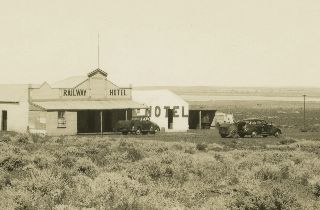

Austin, Western Australia
Most towns are built on firm ground. Austin was built on an island in a salt lake. South of Cue, in the dry heart of the Murchison, the settlement clung to a low rise surrounded by the glittering white pan of Lake Austin, which is why it was also known simply as Lake Austin, or The Island. When the lake lies dry it is a blinding sheet of crusted salt; when the rare rains come it fills and the town's island truly becomes one. Today Austin is a ghost town, abandoned and all but erased, yet still faintly visible from the Great Northern Highway as it crosses the lake.
Very Indifferent Country
The lake and the town both carry the name of Robert Austin, the surveyor who was the first European to chart this country in the 1850s. His verdict on the place was not flattering. He called the area "very indifferent," though in the same breath he added a prophecy that would prove worth more than the land itself: the geology, he wrote, indicated rich goldfields. Austin first labelled the lake the Great Inland Marsh before it was renamed in his honour. He could hardly have guessed that within forty years prospectors would be chasing his prediction across the very salt flats he had dismissed.
Gold on the Salt
Austin's prophecy paid off. Gold was found in the area in the early 1890s, and the townsite was gazetted in 1895. A ten-head stamp mill, a machine that pounded ore to powder so the gold could be drawn out, was soon thudding away at the Austin mine just outside the settlement. It was a strange place to raise a town: a cluster of buildings on a rise in the middle of a saltpan, miles from reliable fresh water, baking under the Murchison sun. But where there was gold there was a town, however unlikely the ground, and for a time Austin lived the brief, intense life of a goldfields settlement.
The Railway Crosses the Lake
Getting in and out was the constant difficulty. At first the only link was a coach that ran twice a week from Yalgoo. Then, in 1898, the goldfields railway pushing north from Mullewa toward Cue reached the town, running its rails out across the salt to the island settlement. For a remote outpost this was transformation: the line meant ore could go out and supplies could come in without days of jolting coach travel. A railway platform served the diggings nearby. The image is an arresting one, a steam train threading across a white salt lake to a town that floated, for all practical purposes, in the middle of it.
A Lake That Comes and Goes
Lake Austin is what hydrologists call ephemeral: a salt lake that is bone-dry far more often than it is wet. Stretching across the country roughly 21 kilometres south of Cue, it spends most of its existence as a crust of glaring white salt, then transforms after heavy rain into a shallow, shining sheet of water that can linger for weeks before evaporating away again. To build a permanent town on an island in such a place was to gamble on the lake staying dry, a bet that mostly held but always carried risk. The settlement shared its name not only with the lake but with a scatter of related camps and workings around the shore, the Golconda diggings and others, all chasing the same gold-bearing ground the surveyor had foreseen.
What the Salt Keeps
Goldfields towns burn bright and brief, and Austin was no exception. The easy gold thinned, the people drifted to other fields, and the island emptied. The buildings fell, the railway through the Murchison eventually closed, and the salt reclaimed the silence. Yet the place has not entirely vanished. Drive the Great Northern Highway south of Cue and the lake opens out on either side, the old townsite still discernible on its rise, the bones of a community that once chose, against every practical instinct, to live on an island in a sea of salt. When the lake fills after rain and the white pan turns to mirror, the ghosts of Austin sit framed in water and sky.
From the Air
Austin lies at roughly 27.64°S, 117.87°E on an island in Lake Austin, an ephemeral salt lake about 21 km south of Cue and 55 km north of Mount Magnet in Western Australia's Murchison. From the air the lake is unmistakable: a large pale salt pan, dazzling white when dry and a sheet of reflective water after rain, crossed by the Great Northern Highway. The former townsite sits on a low rise within it. Nearest airfield with scheduled service is Mount Magnet Airport (YMOG) to the south. The country is flat, arid, and usually crystal clear, with strong glare off the salt surface on bright days and occasional dust the main visibility considerations.
Nearby Stories
- Cue, Western Australia 5.3 km away
- Dalgaranga crater 14 km away
- Mount Magnet, Western Australia 16 km away
- Yarrabubba 44 km away
- Sandstone Gold Mine 78 km away
- Sandstone, Western Australia 87 km away
- Boolardy 101 km away
- Principality of Hutt River 289 km away