
Cue, Western Australia
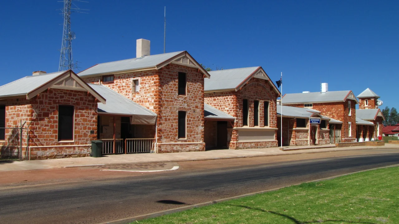
Drive into Cue and the main street ambushes you. Out here, 620 kilometres northeast of Perth in country that runs to red dirt and saltbush, you do not expect a parade of grand stone buildings - a courthouse, a Gentlemen's Club, a domed rotunda - built with the swagger of a place that believed it would be a city. Cue believed exactly that. In 1893 it was the beating heart of the Murchison goldfield with a population of around 10,000. Today 178 people live here. The difference between those two numbers is the whole story, and the buildings are what is left to tell it.
A Nugget, and a Name
Cue's gold was found on New Year's Day, 1892, by the prospector Michael Fitzgerald and an Aboriginal man known to the records only as 'Governor' - it was Governor who first produced the nugget that set the rush in motion, a contribution flattened by history into a single nickname. A man named Tom Cue rode to Nannine to register the claim, and when the townsite was gazetted in 1893 it took his name. Within days of the find the diggings became the scene of a stampede. By 1895 the town had seven ten-head stamp mills thundering around it, with names like the Rose of England and the Red, White and Blue, and the district had earned its proud title: Queen of the Murchison.
The Queen's Architecture
Gold money built in stone, and much of it still stands. The buildings that housed the Warden's Court, Post Office and Police Station were completed in local stone in 1896, with additions over the next two years - and remarkably, the courthouse and police station are still used for their original purposes today, more than a century on. The Shire of Cue runs its council from the historic Gentlemen's Club building, and twice a year a regional local-government forum meets here under the half-joking name the 'Cue Parliament.' A cast-iron rotunda built in 1904 honours the region's pioneers. To walk this street is to move through one of the most complete gold-boom streetscapes left in Western Australia, classified by the National Trust.
The Price of Water
In this climate, gold was the easy part; water was the daily crisis. Cue's first supply was a single well in the middle of the main street - until a typhoid outbreak forced the town to cap it and build a rotunda over the top, a public monument standing guard over a poisoned well. The replacement was hardly better: a new well near Lake Nallan, with water carted 20 kilometres south to town. And when the rain did come, it came violently. In 1913 the Cue Battery Dam burst under floodwater only months after being repaired, and in 1925 a two-day downpour of more than two and a half inches collapsed several buildings. Survival here was a constant negotiation with thirst and flood.
Rivals, Races, and Rock Art
Cue did not boom alone. The town of Day Dawn rose 8 kilometres south within a year, and the two struck up a fierce rivalry that, oddly, made life richer - a hospital and cemetery between them, three newspapers in print, and a sporting culture of cycling and horse racing that drew competitors from as far as Perth and Kalgoorlie. But the deepest history here predates every nugget. About 48 kilometres west stands Walga Rock, a granite monolith second in size only to Uluru, sheltering the largest gallery of Aboriginal rock paintings in Western Australia - goannas, snakes, handprints and spears, and a famous white-ochre sailing ship painted far from any sea. The Wajarri are the rock's traditional owners, and their connection to this country reaches back thousands of years before the gold that the maps now remember it for.
From the Air
Cue sits at about 27.42 degrees south, 117.90 degrees east, in the Murchison region of Western Australia's interior, at an elevation near 1,460 ft MSL. From the air the town is a compact, legible grid in vast empty country, its stone buildings clustered along a broad main street. Cue Airport (ICAO: YCUE) lies just 2 nautical miles southeast of town. Mount Magnet (YMOG) is about 74 km south and Meekatharra (YMEK) roughly 112 km north. The ghost towns of Day Dawn, Cuddingwarra and Big Bell ring the town to the south and southwest, and the great dome of Walga Rock rises about 48 km west - all worth a wider circuit. Fly the townsite at 3,000 to 4,500 ft MSL. Visibility in this dry interior is usually excellent; mornings avoid the worst of the afternoon heat haze.
Nearby Stories
- Austin, Western Australia 8.8 km away
- Dalgaranga crater 14 km away
- Wilgie Mia 32 km away
- Yarrabubba 38 km away
- Mullewa–Meekatharra railway 46 km away
- Meekatharra, Western Australia 53 km away
- Mileura Station 78 km away
- Sandstone, Western Australia 92 km away