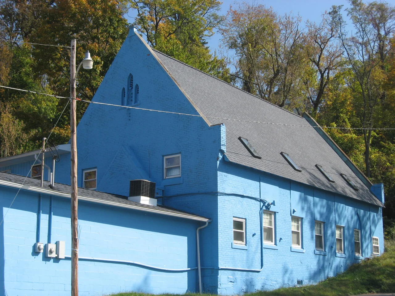

Avery Street Historic District
Between 1900 and 1910, Parkersburg's middle class did what middle classes in growing American cities were doing everywhere in that decade: they moved out of downtown into the country just beyond it. The country, in Parkersburg's case, was a hillside of farmland east of the original city grid, along a street called Avery. By 1910 it was no longer farmland; it was a neighborhood of about 109 acres, packed with new houses in every fashionable architectural style of the era, plus several that were not quite any of those styles but borrowed from all of them. The result, a century later, is one of the most architecturally diverse historic districts in West Virginia.
Parkersburg's First Suburb
Parkersburg in 1900 was one of the largest cities in West Virginia, riding the oil and gas industry that had been booming since the Civil War. The downtown core had filled up. Streetcar lines and the new fashion for single-family homes on individual lots made suburban living possible for families that could not have managed it a generation earlier. The historian Michael J. Pauley, who prepared the 1985 National Register nomination, described the Avery Street area as 'Parkersburg's first suburban development' - meaning not the bedroom communities of the postwar era, but the late-19th-century version: detached houses on tree-lined streets, within walking or streetcar distance of downtown jobs.
Twelve Styles
The National Register survey identified twelve distinct architectural styles within the district. The list is almost a syllabus of late-19th and early-20th-century American residential architecture: National Style, Gothic Revival, Italianate, Queen Anne, Romanesque, Folk Victorian, Classical Revival, Colonial Revival, Tudor and Jacobean Revival, Bungaloid-Craftsman-Prairie, International Style, and Victorian Eclectic. Each style had its decade of fashionability. Each had its core characteristics. The houses on Avery Street rarely follow any single style purely. Pauley noted that 'a strong thread of vernacularism runs through all of these styles, so that few distinctly pure examples of any of the historic architectural styles exist.' What the houses do instead is borrow.
The Pattern Book and the Builder
The vernacular blending Pauley identified was characteristic of how houses were actually built in early-20th-century American towns. A family commissioned a house. They consulted pattern books and architectural catalogs. They had opinions about what they wanted - a Queen Anne turret, a Craftsman porch, Colonial Revival window proportions. The local builder produced something that incorporated those preferences without strictly following any one style. The result was houses that architectural historians have a hard time categorizing. The 1985 National Register nomination uses phrases like Victorian Eclectic precisely because the surveyors needed a category for the considerable number of houses that did not fit any single style cleanly. Avery Street is a museum of how American houses actually got built when ordinary families, not wealthy patrons or trained architects, made the design decisions.
Churches, Schools, and a Corner Store
The district is primarily residential, but as Pauley's nomination notes, it also includes churches, a school, and a small commercial area. The commercial area - typically a small corner store or two, perhaps a pharmacy or a barber shop - was the standard pattern for early-20th-century streetcar neighborhoods. People walked everywhere they could, drove or rode streetcars where they had to, and needed basic services within walking distance of home. The churches and the school anchored the neighborhood's institutional life. The commercial buildings provided what the corner needed. None of this was unique to Parkersburg; it was the standard template of an early-American suburb. What is unusual is that so much of the original fabric survives a century later.
Preservation
The Avery Street Historic District was added to the National Register of Historic Places in 1986. The listing is one of three contiguous historic districts in this part of Parkersburg - Julia-Ann Square to the west, Parkersburg High School-Washington Avenue to the north, Avery Street here in the middle. Together they preserve a remarkably complete architectural record of Parkersburg's growth from the post-Civil War oil boom through the 1920s. The houses are still single-family homes, mostly. Some have been broken into apartments. Some have been carefully restored. Some need work. The district is a working neighborhood rather than a museum, which is the only way a historic district of this size and density can survive - by continuing to be useful to the people who live in it.
From the Air
Located at 39.27 degrees N, 81.56 degrees W in Parkersburg, Wood County, West Virginia. The Avery Street Historic District covers 109 acres east of downtown Parkersburg, on a hillside above the Ohio River. The district sits between the Julia-Ann Square Historic District to the west and the Parkersburg High School Historic District to the north. Mid-Ohio Valley Regional Airport (KPKB) is the nearest tower-controlled field about 6 nm north. Recommended viewing altitude 3,000 to 4,500 feet MSL. Expect dissected plateau terrain throughout the area; the Ohio River runs along the west side of the city.
Nearby Stories
- Mountaineer Power Plant 5.3 km away
- Burning Springs Complex 7 km away
- Glenville, West Virginia 10 km away
- Strouds Run State Park 11 km away
- Salem University 26 km away
- West Virginia Penitentiary 42 km away
- The Y-Bridge of Zanesville 44 km away
- The Wheeling Suspension Bridge: The Longest Span in the World 81 km away