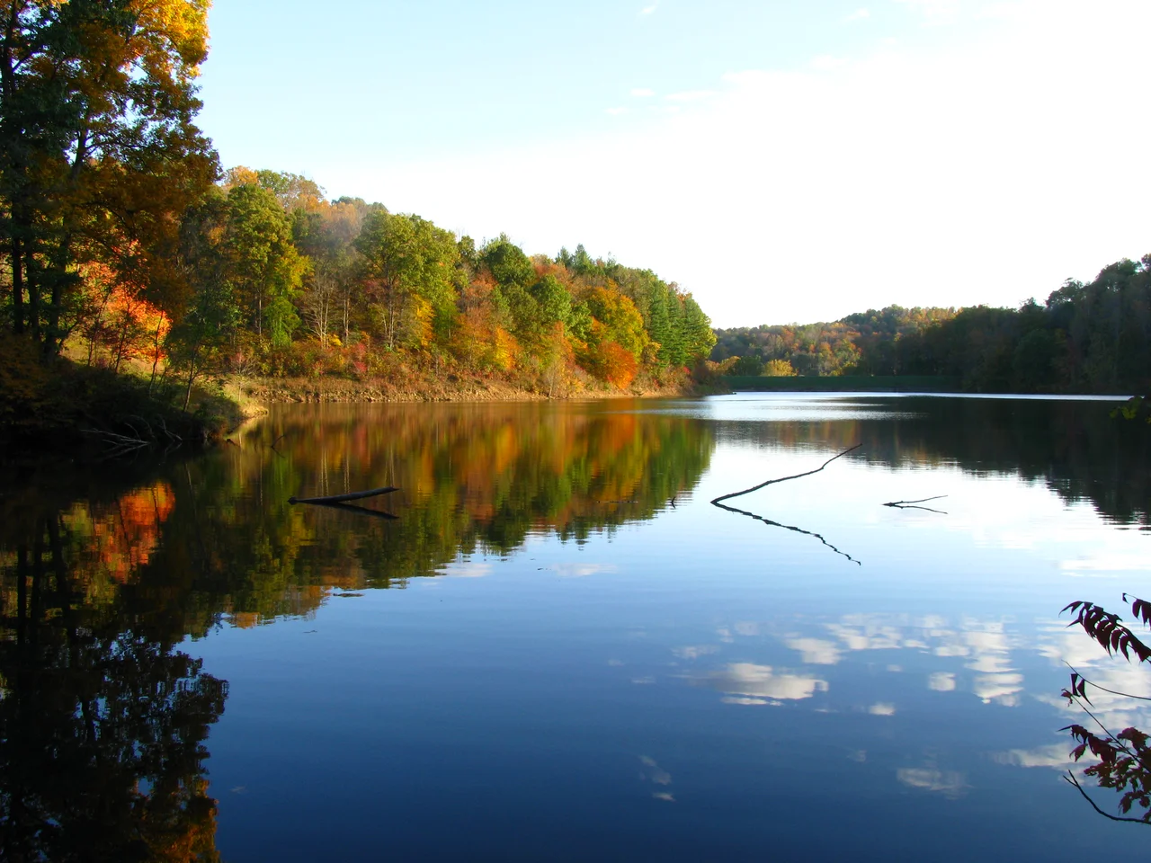

Strouds Run State Park
Strouds Run starts as a quiet creek meandering through the wooded hills east of Athens, Ohio. In 1960, the state finished building a dam across it. The water backed up across a small valley and turned into Dow Lake - 161 acres of impounded water surrounded by 2,606 acres of forest, hiking trails, and the kind of campground where the same families return for decades. The park abuts the city of Athens on its eastern edge; in several places, the park boundary and the Athens city limit are the same line. Strouds Run is, in effect, the city of Athens's own backyard - a state park you can walk to from Ohio University's College Green, where the steep ridges and Appalachian hollow geography of southeastern Ohio begin again immediately after the last block of houses.
From State Forest to State Park
The land was acquired piece by piece in the 1940s and 1950s as part of the Athens State Forest - one of the smaller working forests Ohio assembled in the wake of the Depression and the New Deal era of conservation. Pieces had been logged hard in the nineteenth century and partially abandoned by the 1930s, available for state purchase at low prices. The forest designation was a holding pattern. In the late 1950s, the Ohio Department of Natural Resources began constructing a dam on Strouds Run with the intent of converting the area into a recreational state park. The dam was completed in 1960, the lake filled, and the entire 2,606-acre tract was reclassified as Strouds Run State Park. The dam itself is an earth embankment, with the lake's outflow continuing as Strouds Run on the downstream side.
Dow Lake
The lake is named for C.L. Dow, a professor of geography and geology at Ohio University who championed the idea of a park and lake here beginning in 1942. At 161 acres, it is not large by Ohio standards - significantly smaller than nearby Burr Oak Lake, much smaller than Lake Erie's smallest bay - but it is big enough to support fishing, swimming, and the kinds of small-boat recreation the park offers. The lake is restricted to electric-motor and human-powered craft, which keeps the water quiet and the bird life relatively undisturbed. The 700-foot sand beach on the western shore is the most popular swimming area in Athens County. Dock facilities on the lake serve rental boats: canoes, kayaks, paddleboats. The fishing is mostly for bass, bluegill, crappie, and catfish, with the occasional musky that the state has stocked over the years.
Fifteen Miles of Trails
What makes Strouds Run feel larger than its acreage is the trail network. Fifteen miles of hiking trails wind through the hills above the lake, with elevation gains of two to three hundred feet between the lake shore and the ridge tops. The trails offer the kind of dense Appalachian deciduous forest experience that has become rare in Ohio - oak and hickory canopy above an understory of pawpaw, spicebush, and dogwood. Spring brings ephemeral wildflowers: trillium, Dutchman's breeches, bloodroot. An 8.5-mile bridle trail loops the park's perimeter. A backcountry camping area lets visitors disappear into the woods overnight. The Vinton Furnace, an old iron-smelting site, sits on private land adjacent to the park; remnants of nineteenth-century iron furnace operations are scattered throughout this stretch of the Allegheny Plateau.
What the Park Means to Athens
For a college town surrounded by national forest, having a state park immediately at its eastern edge is a peculiar kind of luxury. Ohio University students can run trails before class. Faculty can take seminars on flora identification in spring. Local families have a swimming beach, a fishing lake, and primitive campsites all within fifteen minutes of downtown Court Street. The park's smaller scale - compared with Burr Oak or Lake Hope, both of which are bigger - makes it more intimately Athenian. The boundary line shared with the city limits is more than a cartographic accident: it captures a relationship between a small town and the federal- and state-managed wild land that surrounds it. Athens is unusual in how completely it is wrapped by parks, forests, and protected acres.
Flying Over the Pocket Wild
From the air, Strouds Run reads as a lobed green inkblot pressed against the eastern edge of Athens. The lake is the obvious feature - a long, narrow water surface bending around the contours of the dammed valley, with the dam visible at the western end. Forested ridges rise on every side. The trails are mostly invisible under the tree canopy, but the trail terminals, the campground loops, and the beach all show as small clearings at the lakeshore. Beyond the park to the east, the forested hills continue without much development for many miles - the patchwork of private land and Wayne National Forest parcels that defines this part of Appalachian Ohio.
From the Air
Located at 39.34°N, 82.02°W, immediately east of Athens, Ohio, off State Route 690. The 161-acre Dow Lake and the surrounding 2,606 acres of forested ridges are the primary features. Look for the long narrow lake shape and the dam at its western end. Nearest airport: Athens-Albany (KUNI) about 8 nm southwest. Best viewed from 3,000-5,000 feet AGL, where the lake's shape and the adjacent city of Athens are both visible.
Nearby Stories
- Julia-Ann Square Historic District 1.9 km away
- Lakin State Hospital 7.7 km away
- Ratcliffe Mound 9.8 km away
- Burning Springs Complex 21 km away
- Hardin Village Site 41 km away
- The Y-Bridge of Zanesville 44 km away
- Columbus: The Test Market Where America Tries Things First 56 km away
- West Virginia Penitentiary 81 km away