
Balivanich
Baile a' Mhanaich. The Town of the Monk. The name carries a memory more than a millennium old, of a sixth-century Columban monastery whose stones still lie scattered in a field south of the village. The monks have been gone a long time. In their place came an airfield, a hospital, a council office, and an RAF refuelling station. Balivanich today is a flat, practical, slightly windswept place that runs the Uists, and most visitors pass through it in the first ten minutes after stepping off a Loganair turboprop.
Town of the Monk
The name points back to Teampull Chaluim Chille, an ancient church dedicated to Columba, the Irish saint who landed on Iona in 563 and seeded Christianity across the western seaboard. Whether the monastery here was Columban or older Pictish is still argued, but the church remains were significant enough that the whole settlement took its identity from them. The contrast with what came later is hard to miss. Where monks once chanted the Hours, the air now carries the whistle of turboprop engines and the occasional pass of a military helicopter.
The Airfield That Stayed
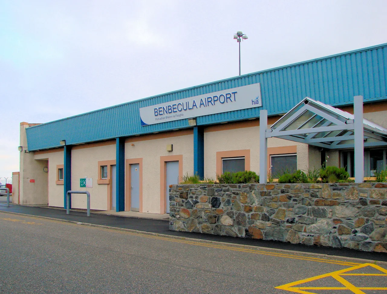
The airfield to the north was built during the Second World War, hammered out of machair on what had been crofting land. In 1957, with the Cold War deepening, it became the control centre for the Hebrides rocket range to the south on South Uist. Soldiers and engineers and their families poured in, English-speaking, mostly transient. The village changed. It became the only town in the Western Isles where Gaelic dropped below half the population: just thirty-seven percent in the 2001 census, compared to seventy-four percent in nearby Lionacleit. The airfield is now Benbecula Airport, ICAO EGPL, IATA BEB, run by Highlands and Islands Airports Limited. Daily flights connect to Glasgow and Stornoway, and the Royal Air Force still refuels here. Rescue helicopters use it as a launchpad to reach climbers in the Cuillins or fishermen in trouble off Barra Head.
The Centre of the Chain
What Balivanich lacks in beauty, it makes up for in centrality. The Comhairle nan Eilean Siar, the Western Isles Council, has offices here. So does the hospital that serves the southern Uists. There is a post office, a bank with an ATM that is genuinely the closest cash machine for many miles, and the new primary school, Sgoil Bhaile a' Mhanaich, which opened in 2011 after a storm destroyed its predecessor. Some 140 children aged one to twelve attend. They board buses on the B892 that wind south to Liniclate for secondary school, the only one for the whole island chain. The W17 bus, run jointly with PostBus, links Berneray in the north to Eriskay in the south, and a handful of taxis fill in the gaps.
Wind and Weather
Balivanich faces the full force of the North Atlantic. The maritime climate means cool summers and mild winters, but the defining feature is wind. The weather station at the airport has gathered decades of data showing how unrelentingly the place is brushed by Atlantic systems. Pilots learn to land sideways. Children learn to lean into the gust on the walk to school. The flatness of the village, every roof low, every building hunkered, is not an aesthetic choice. It is an answer to the sky.
From the Air
Located at 57.47 N, 7.38 W on the northwest coast of Benbecula. Benbecula Airport (EGPL/BEB) sits at the northern edge of the village with a single asphalt runway. The airfield is conspicuous from the air against the surrounding flat, lochan-dotted machair. Nearest alternates are Stornoway (EGPO) to the north and Glasgow (EGPF) to the southeast. Strong westerly winds are typical. Recommended viewing altitude 2000-3000 ft for the village and airfield.
Nearby Stories
- SS Politician 6.2 km away
- Dunvegan Castle 8.2 km away
- Canna 11 km away
- Leverburgh 16 km away
- Duntulm Castle 20 km away
- St Kilda, Scotland 54 km away
- German submarine U-516 138 km away
- German submarine U-764 163 km away