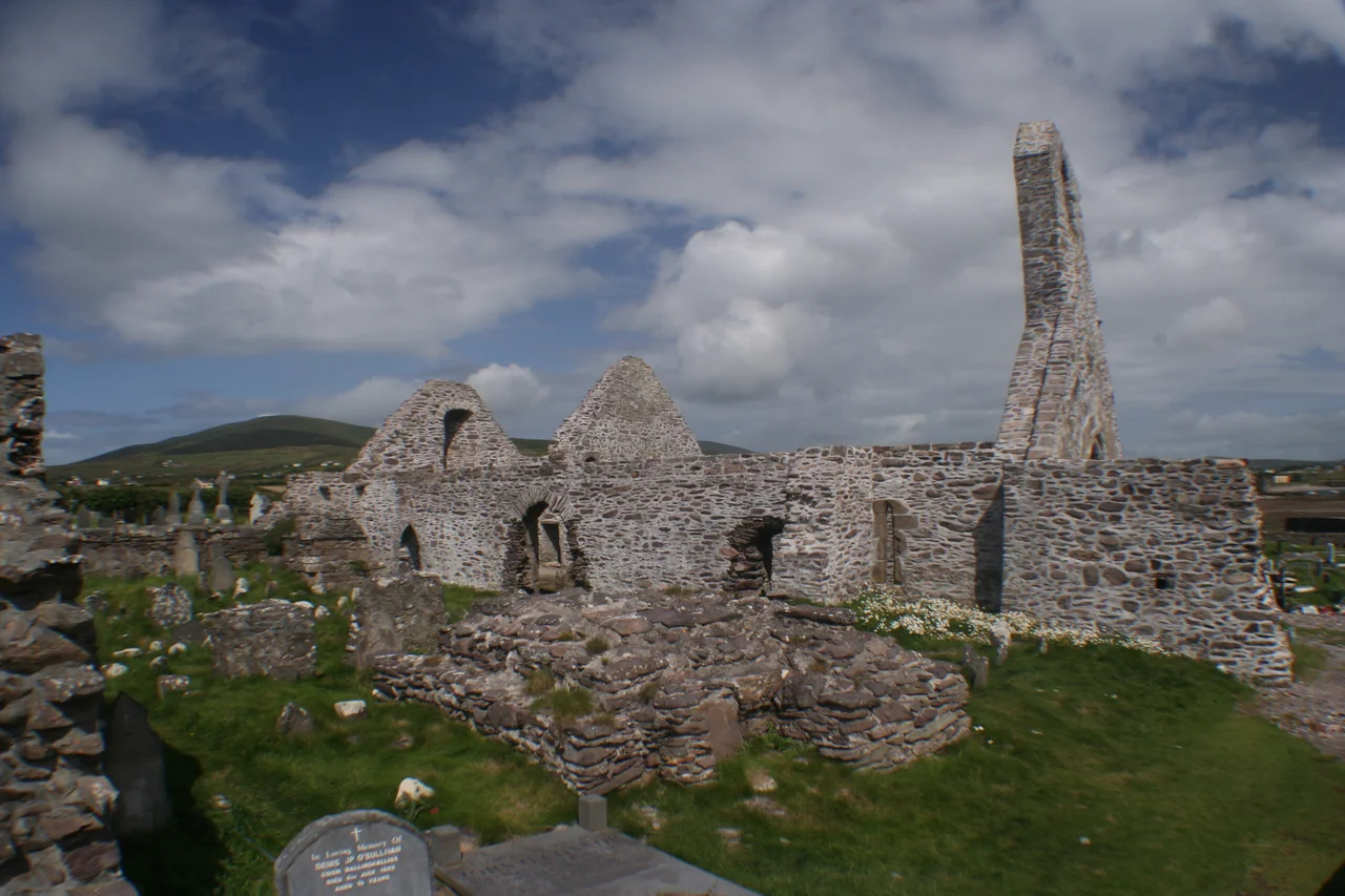

Ballinskelligs Abbey
The monks who built this priory had already lost a fight with the Atlantic. For centuries their brothers had clung to the bare rock of Skellig Michael, eight miles offshore, where the wind tore at beehive cells and prayer was a kind of survival. By the twelfth century, when storms became too much even for that famously hardy community, they came ashore here, to the western lip of Ballinskelligs Bay, and started over. The ruins on the headland today - cloister, refectory, prior's house, burial ground - are what remained when that second monastery, too, ran out of time.
From the Rock to the Shore
Skellig Michael had been a monastic outpost since at least the sixth century, and by medieval standards, it was extreme. Pilgrims who reach the island today still gasp at the climb. For the monks who lived there, the climb was the easy part - what wore them down was the relentless weather. The Augustinian Canons of the Arroasian reform took over the community sometime in the twelfth century, and they made the practical choice their predecessors had resisted: come in from the sea. Ballinskelligs Abbey was built as that refuge, a mainland counterpart that could function when the island could not. The bay itself, sheltered by the curve of the Iveragh Peninsula, was the kindest landing they were likely to find on this coast. They built where the water was calm enough to land a coracle and the ground was firm enough to bury their dead.
Stones That Remember a Cloister
Walk the site now and you can still read the plan. The church stands roofless on the headland, its long axis pointed roughly east, the way medieval churches almost always face. Around it lie the foundations of the cloister, the refectory where the canons ate in silence, and the prior's lodging - the small administrative heart of an Augustinian house. The burial ground continued in use long after the priory itself was disbanded; locals kept laying their dead alongside the monks for centuries. Coastal erosion has been the slow enemy here. The Atlantic that drove the monks ashore is steadily reclaiming the ground they chose. Concrete sea defenses now stand between the ruins and the surf, an admission that the building did not, in the end, escape the sea.
The Suppression and the Long Afterlife
The priory was occupied until 1568 and formally dissolved a decade later, in 1578, during the reformation under Elizabeth I. The property passed to a man named Gyles Clincher, and from him through two centuries of tenants - none of them monks. What had been a working religious community became, in legal terms, an estate, and then a romantic ruin, and finally a national monument. There is no museum here, no interpretive center, no ticket booth. The site sits at the end of a small road, low and weathered against the sky, and you can walk the boundary of what was once a daily round of prayer and labor. The Augustinians left, the landlords left, and the canon law that organized this ground for four hundred years has long since lost its grip on the place. What remains is the geography that drew them here in the first place: a bay, a headland, a horizon line where Skellig Michael still rises out of the water on clear days, like a memory the abbey cannot stop seeing.
Looking West From the Graveyard
From the abbey burial ground the sea is everywhere. Little Skellig and Skellig Michael show themselves on the western horizon - two crooked teeth in the mouth of the Atlantic. Ballinskelligs Castle, a sixteenth-century MacCarthy Mor tower house, stands on a separate promontory across the bay, slowly being undercut by the same erosion that menaces the abbey. To the north lie the great cliffs of the Iveragh Peninsula, and beyond them, on a clear evening, you can sometimes catch the haze of the Dingle Peninsula across the open water. The Skellig Ring drive passes within a short walk of the gate. Most visitors come for the dramatic offshore islands and stop here almost as an afterthought - which is fitting, in a way. This was always the supporting cast. The main stage was out at sea, and the monks who knew that best gave it up only when they had to.
From the Air
Located at 51.815°N, 10.272°W on the southwest tip of the Iveragh Peninsula. Recommended viewing altitude 1,500-3,000 feet AGL; the abbey sits on a low headland on the western shore of Ballinskelligs Bay, with Ballinskelligs Castle visible across the bay to the south. Nearest airport is Kerry (EIKY), about 35 nm northeast. Watch for the silhouettes of Skellig Michael and Little Skellig roughly 8 nm to the west - the abbey is best framed with those islands on the horizon. Atlantic weather changes fast; visibility can collapse in minutes when fronts roll in off the open ocean.
Nearby Stories
- Dunlough Castle 2.6 km away
- Beara Peninsula 4.2 km away
- Dunbeg Fort 8.4 km away
- Pouldergaderry Sinkhole 13 km away
- HMHS Llandovery Castle 40 km away
- The Laki Eruption: The Volcano That Changed World History 1404 km away
- The Northern Lights: The Sky Show That Vikings Thought Was Bridge to the Gods 1505 km away
- Sao Miguel 1906 km away