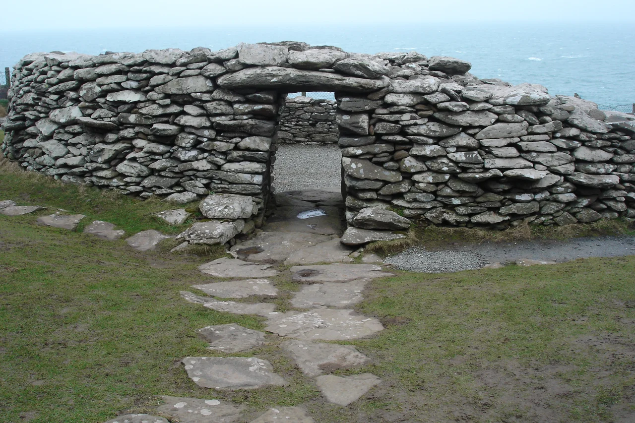

Dunbeg Fort
The cliff at Dunbeg has been retreating for as long as the fort has stood on it. Built more than two thousand years ago on a triangular promontory south of Slea Head, the fort was once a substantial defensive enclosure with four parallel ditches, a thick drystone wall, and a complex chambered entrance passage. Today, much of the western wall is gone. In January 2014, a single Atlantic storm tore another section into the sea. In late 2017 and early 2018 the entrance doorway itself was damaged enough that the Office of Public Works declared the site unsafe and closed it to visitors. Dunbeg is teaching, in slow motion, what coastal erosion does to human ambition.
How the Fort Was Built
When the antiquarian George Victor Du Noyer described Dunbeg in 1858, the structure was substantially intact. The wall ran roughly two hundred feet from one cliff edge to the other, cutting off the triangular promontory from the mainland. In front of the wall sat four parallel ditches separated by three banks of clay and gravel. A pathway threaded through this defence to the gateway. Originally, that path may have run through covered stone passages with flagged roofs, hidden as it crossed each bank — turning an approach into something close to a maze. The wall itself was at first about eight feet thick, with a landward face later built out to as much as twenty-two feet near the entrance. People built this to be hard to take.
The Strange Passage
The entrance is the most peculiar feature. A passage near the centre of the wall leads through to the interior, originally seven feet long with an arched ceiling. To the right of the passage is a rectangular chamber built into the thickness of the wall — accessible from the passage by a low square opening. A broad stone seat sits opposite. To the left is another chamber, also reached by a low opening, but only from inside the fort, not from the passage. Two long narrow corridors run along either side of the entrance, sealed at both ends. Their purpose is unknown. They may have been spaces for guards. They may have been ritual. They may have been something for which we no longer have a name.
Dating the Wall
Establishing when Dunbeg was built has proved difficult. A sample of wood found in a ditch lying partly under the stone wall was radiocarbon-dated to around 580 BC, meaning the wall cannot be older than that. Another piece of wood, in a deposit overlaying the base of a retaining wall, dated to around AD 800, meaning the wall must have been built before then. That gives a range of nearly fourteen hundred years for construction, which is not very satisfying. The fort's structure resembles Iron Age blockhouse forts in the north of Scotland — Crosskirk in Caithness, Clickimin and Ness of Burgi in Shetland — suggesting cultural connections along the Atlantic seaboard. The only later occupation was a single drystone clochán built inside the walls in the tenth century AD.
The Sea Returns
Walk the fence line at the cliff edge and you can see exactly what has been lost. Parts of the original wall now lie among the rocks below. The triangular interior is smaller than it was, the headland slimmer. Climate change is accelerating coastal erosion across western Ireland, and a 2022 study identified Dunbeg as one of the more vulnerable archaeological sites in County Kerry. Nearby on Slea Head are a scatter of clocháns — beehive huts built around 1000 BC, give or take — that have so far escaped the worst of the cliff retreat. They sit further inland. The fort, built right on the edge to make use of the natural defence, made a calculation two thousand years ago that the modern cliff is now revising.
From the Air
Located at 52.10°N, 10.41°W on a cliff-edge promontory just south of Slea Head, looking south across Dingle Bay and west into the Atlantic. The fort sits on rapidly eroding cliffs roughly 90 feet above sea level. Nearest airport is Kerry (EIKY), about 55 km east. Recommended viewing altitude 1,000–2,500 feet for a clear view of the triangular promontory, the line of ditches, and the wall's remaining curve. Best in oblique morning light to bring out the depth of the ditches.
Nearby Stories
- Ballyheigue Castle 1 km away
- Killemlagh Church 2.8 km away
- Pouldergaderry Sinkhole 6.8 km away
- Derreen Garden 11 km away
- Kilkee 59 km away
- The Laki Eruption: The Volcano That Changed World History 1366 km away
- The Northern Lights: The Sky Show That Vikings Thought Was Bridge to the Gods 1469 km away
- Sao Miguel 1935 km away