
Ballinskelligs
Baile an Sceilg means "town of the craggy rock," and the rocks in question are not visible from the village itself. To see them you walk down to the beach, look west, and wait for the haze to clear. There, eight miles offshore, sit Skellig Michael and Little Skellig - the craggy rocks that named this place and, for more than a thousand years, defined its imagination. Ballinskelligs is the mainland that watches them. It is also, against the odds, still a working Irish-speaking community, one of the last in Kerry where you can hear the language outside a classroom on a weekday afternoon.
A Gaeltacht That Held On
The Gaeltacht is what the Republic calls the regions where Irish is still spoken as a community language, and these regions have been shrinking for two centuries. Ballinskelligs is one of the holdouts. According to the 2016 census, about ten percent of the electoral division speaks Irish daily outside the school system - not large, but real, and remarkable for a coast that has been pushing emigrants toward Boston and Liverpool for generations. You hear it in the shops, in the bar, on the pier when the fishermen come back in. The bilingual signage around the village is not decorative. The civil parish that contains Ballinskelligs is called Prior, after the medieval Augustinian priory whose ruined walls still rise above the bay - a reminder that this windward corner of the peninsula has been a meeting point of languages and faiths for a very long time.
A Castle Built for Pirates
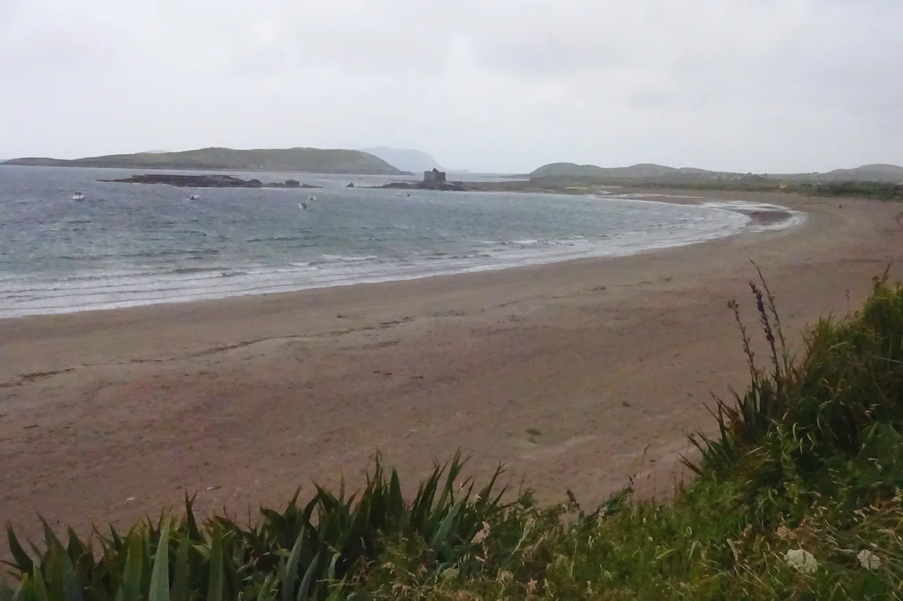
On a narrow promontory at the western edge of the bay, the MacCarthy Mor dynasty raised a tower house in the sixteenth century. The official explanation was defense - the Atlantic coast was thick with pirates in those years, French, English, and Algerian. The unofficial explanation was the same one that explains a lot of coastal castles in this part of Ireland: a chieftain who could control the entrance to a bay could charge a tariff on the ships that wanted to use it. Whether Ballinskelligs Castle ever collected on that arrangement is hard to say. What is certain is that the promontory it stands on is losing the war with the sea. The ground beneath the walls is eroding measurably year by year, and the tower leans toward the water it was built to watch.
The Cable From Nova Scotia
In 1875, a heavy submarine cable came ashore at Ballinskelligs after traveling 2,565 nautical miles across the open Atlantic from Tor Bay, Nova Scotia. It was one of the earliest transatlantic telegraph cables, and its landing in this small bay made Ballinskelligs, for a moment, a node in the wired world. A cable station was built. Specialist staff moved in. For decades the technology of long-distance communication, the most advanced industrial product of its century, terminated at the back of a beach in west Kerry, on a coast that had no electricity yet in most of its homes. The station is gone now. So is most of the obvious evidence. But the cable changed the village from a place at the end of the road into a place where the world arrived first.
Cill Rialaig and the Cliff
In the 1990s, a local resident named Noelle Campbell-Sharp acquired the abandoned village of Cill Rialaig, a row of pre-Famine stone cottages perched on a cliff above the Atlantic. Most such villages on this coast have crumbled past restoration. Cill Rialaig was saved and turned into an artist's retreat - painters, writers, and composers come from around the world, stay in a cottage by themselves with the open ocean below the window, and work. A complementary arts center opened down the hill in the village of Dun Geagan, where visitors can see the work being made. Two decades on, it is one of the more unusual experiments in cultural geography in Ireland: a vanished village resurrected not as a museum but as a place to make new things, with the same sea outside the door that emptied it the first time.
The Beach and the View
Ballinskelligs Strand is a long stretch of pale sand at the head of the bay. On a clear day the water is bright green over the shallows and dark blue further out, and the Skelligs sit on the horizon like notched chess pieces. Surfers and swimmers come in summer. The rest of the year the beach belongs to the locals and the weather. The Skellig Ring drive curls past, a quieter alternative to the Ring of Kerry that takes in the abbey, the castle, the beach, and the long view west toward the islands. Most visitors are passing through. The people who live here, in the language they have managed to keep, are not.
From the Air
Centered near 51.826°N, 10.272°W on the southwest coast of the Iveragh Peninsula. Recommended viewing altitude 2,000-3,500 feet AGL. The townland lies along the eastern shore of Ballinskelligs Bay; the long pale arc of the strand and the ruined castle on the western promontory are both visible from the air in clear weather. Skellig Michael and Little Skellig sit roughly 8 nm west on the open Atlantic - a useful set of waypoints when transiting this coast. Nearest airport is Kerry (EIKY), about 33 nm to the northeast. Expect strong westerly winds and rapidly changing visibility - this is exposed Atlantic coastline with very little shelter.
Nearby Stories
- Dunlough Castle 2.6 km away
- Beara Peninsula 4.2 km away
- Dunbeg Fort 8.4 km away
- Pouldergaderry Sinkhole 13 km away
- HMHS Llandovery Castle 40 km away
- The Laki Eruption: The Volcano That Changed World History 1404 km away
- The Northern Lights: The Sky Show That Vikings Thought Was Bridge to the Gods 1505 km away
- Sao Miguel 1906 km away