
Ballycarbery Castle
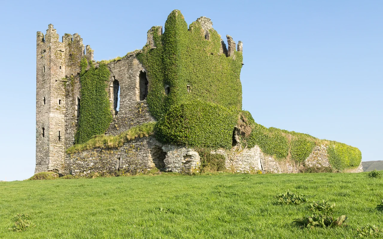
Travel guides love Ballycarbery for the same reason photographers do: the castle stands alone on a grass hill above the sea, three kilometers from Cahersiveen, with no other buildings in the frame. Half a wall is missing on the back side, which lets light fall through the windows in a way that intact castles cannot manage. The ruin photographs at almost any hour. What looks pleasingly picturesque from a parking area was, in 1652, the wrong end of an artillery duel - and the cannon won. The fall of Ballycarbery is the reason the ruin looks the way it does.
A MacCarthy Tower House
Some sources suggest a residence stood on this site as early as 1398, but what survives is a sixteenth-century tower house, built in the period when Gaelic and Anglo-Norman families across Munster were raising similar fortified houses across the countryside. The castle was associated with the MacCarthy Mor dynasty - the senior line of one of the great Munster ruling families - though whether it was occupied directly by the MacCarthys or by the O'Connells, who served as their wardens in this part of Kerry, has never been settled. After the death of Donal MacCarthy More in 1596, the property passed to Sir Valentine Browne, an English official and ancestor of the Earls of Kenmare. The transfer was part of the much larger process by which Gaelic Munster lands moved into English hands through the late sixteenth and early seventeenth centuries - usually following a marriage, a death, a confiscation, or some combination of all three.
The Cannon of 1652
The castle's working life ended in 1652. By that year, the Parliamentary armies of the new English Commonwealth had been working their way through Ireland for nearly three years, pacifying the last royalist and confederate strongholds after Oliver Cromwell's main campaign of 1649-1650. Ballycarbery was on their list. The cannon brought to the hill broke through walls that had not been designed for that kind of weapon. The roof came down. The back wall came down. What had been a working defensive house became a piece of military rubble. It joined a long list of similar Munster ruins from the same season - the War of the Three Kingdoms produced ruined castles across Ireland on an almost industrial scale, and Ballycarbery's fate was unremarkable except for the location. The hill it stands on gives the ruin its drama; the cannon gave it its shape.
What the Eighteenth Century Did With It
A ruined castle, in the eighteenth-century countryside, was a quarry. The Lauder family built a house on the site using one wall of the castle's barn as a structural element - a practical reuse that turned the medieval shell into a piece of domestic architecture. That house was eventually demolished in the early twentieth century, removing a layer but exposing the older one more completely. What is left now is the sixteenth-century core: arrow slits along the lower part of the surviving wall, a roofed chamber in the ground floor with a high ceiling and a staircase in one corner, two separate stairways climbing toward the first floor. Inside the wall a narrow staircase that almost no one finds. The first floor itself is now an open green platform, the second floor a memory of stones that fell away when the back wall did.
Closed Gates, Open View
Until around 2017, visitors could walk freely around the castle and climb the surviving stairs. The land is private, and the owner has since closed access for health and safety reasons. Falling stones and unprotected drops were not theoretical risks. Today, you view Ballycarbery from a small parking area about a hundred meters from the front of the castle. The change rankles some visitors and is unremarkable to others - the photograph that everyone takes is taken from exactly that distance anyway. The view is the thing: the hill, the half-castle, the bright water of Valentia Harbour behind, and the smaller ruins of the iron age stone forts at Cahergall and Leacanabuile within easy walking distance. The whole landscape around Cahersiveen has been a layered military and ritual space for at least two thousand years. Ballycarbery is the most recent fortified addition to the set.
From the Air
Located at 51.949°N, 10.259°W on a low coastal hill 3 km west of Cahersiveen on the Iveragh Peninsula. Recommended viewing altitude 1,500-2,500 feet AGL. The castle stands alone on a green hilltop facing Valentia Harbour - very photogenic from the air, especially in low afternoon light from the southwest. Cahergall and Leacanabuile stone forts are nearby (within 1 km) and make a useful cluster of waypoints. Valentia Island and Beginish Island lie to the west. Nearest airport is Kerry (EIKY), about 31 nm to the northeast; Valentia has a small grass strip (EIVT) about 4 nm west. Watch for Atlantic weather coming in from the west; visibility can drop fast.
Nearby Stories
- 1955 RAF Shackleton aircraft disappearance 3.8 km away
- Ballynavenooragh 5.4 km away
- French Expedition to Ireland (1796) 9.4 km away
- Tralee 12 km away
- Uragh Stone Circle 18 km away
- The Laki Eruption: The Volcano That Changed World History 1385 km away
- The Northern Lights: The Sky Show That Vikings Thought Was Bridge to the Gods 1487 km away
- Sao Miguel 1921 km away