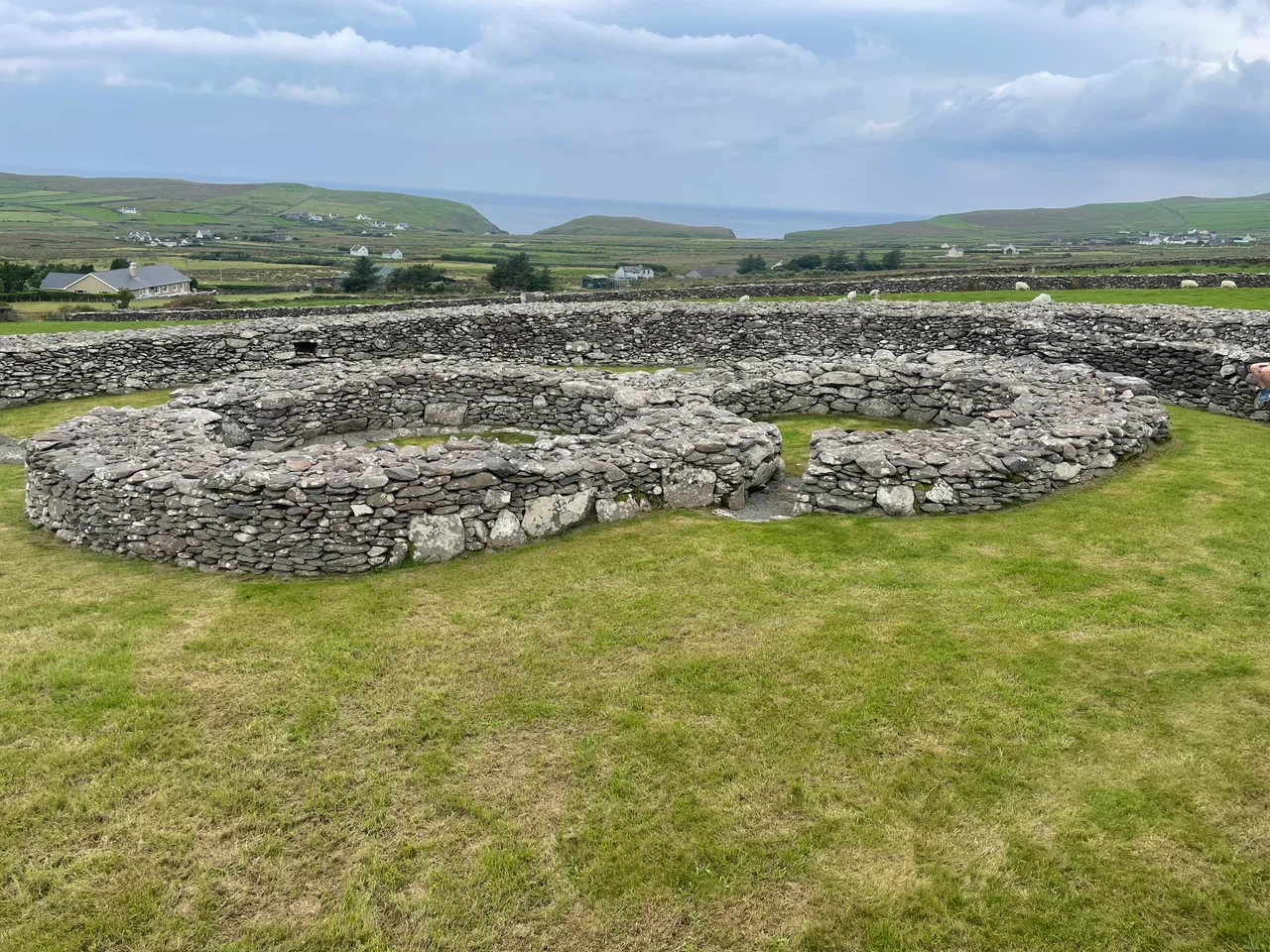

Ballynavenooragh
Late in the 1990s, an archaeologist named Erin Gibbons opened a pit inside the stone fort at Ballynavenooragh and lifted out a handful of seeds. Apple. Blackberry. Hazelnut. Grape. The grape seeds were the surprise, because grapes do not grow in West Kerry, then or now, and that small pile of organic remains was suddenly the most interesting thing about a fort that had been sitting quietly on the western slopes of Mount Brandon for more than a thousand years. Ballynavenooragh is one of those Irish sites where the headline is the building and the real story is what people were doing inside it.
A Drystone Town on the Side of a Mountain
The fort lies ten kilometres north of Dingle town, set into the green western flank of Mount Brandon, which rises behind it to over 950 metres. Around the cashel the slope is dense with archaeology: the broader Ballynavenooragh group includes forty ringforts, twenty-four clocháns (the small drystone beehive huts that dot this coast) and two cillíní, the burial grounds for unbaptised children that are scattered across the older Irish landscape. The cashel itself was in use from the seventh to the tenth centuries AD, then reused again in the thirteenth, which is a long second act for a structure that began life when the rest of Europe was still working out what the end of Rome meant. It is most similar in plan to the cashel at Leacanabuaile, but where Leacanabuaile feels neat and reconstructed, Ballynavenooragh feels lived-in.
Inside the Walls
Step through the gateposts, which are formed from a pair of upright stone slabs, and the interior reveals itself in pieces. Two clocháns sit inside the wall, their drystone domes still holding. A fireplace marks one of them; postholes show where timber partitions once stood. A souterrain, the underground passage that nearly every fort of this kind seems to need, runs from one side; its oblong chamber is 5.5 metres long, just enough for a few people to crouch in and wait for whatever was outside to lose interest. Stepped terracing along the inner face of the wall let the inhabitants climb to the parapet without ladders. Looking around the small enclosed space, with Mount Brandon at your back and Smerwick Harbour somewhere over the lip of the slope, it is hard not to imagine a family settling in for a long Atlantic winter.
The Pit and Its Surprises
Gibbons's excavation found more than seeds. Among the layers came stone tools, pottery, iron knives, a blue glass bead, fragments of a crucible used for melting metal, and two thirteenth-century coins — silver pennies struck in the reign of Henry III of England. Two lathe-turned objects suggested someone working wood with skill. The crucible tells one story: there was metalworking here, perhaps the kind of small jewellery production that a wealthy household might commission for itself. The glass bead is a survival of trade. The pennies, four hundred years younger than the fort's first occupation, are evidence of the thirteenth-century reuse, when somebody dropped or buried English silver inside walls that had stood since before England existed in the form we know it. The grape seeds remain the puzzle: imported wine, perhaps, brought in by trading ships running up the Atlantic coast and shared inside a stone room on a Kerry hillside.
Walking Up to See It
There is no visitor centre at Ballynavenooragh and no glossy interpretive panel. The fort sits at the end of a small road that runs out of green fields and into rougher country, and the approach itself is half the visit. Sheep have right of way; the wind has more. From the entrance you can stand and look down toward the harbour where Saint Brendan, by tradition, set out for the western ocean, and up at the mountain that took his name. Inside the cashel there is room for perhaps a dozen people, but on most days there are none. The drystone walls absorb sound. The seeds are gone now, lifted decades ago and catalogued in some museum drawer, but knowing they were found here changes how the place feels: less ruin, more pantry, less monument, more home.
From the Air
Ballynavenooragh sits at 52.226 N, 10.298 W, on the western slopes of Mount Brandon ten kilometres north of Dingle town. From the air the cashel reads as a circular pale ring set into green pasture, with Mount Brandon (951 m) rising sharply to the east and the inlet of Smerwick Harbour visible to the west. Nearest airport is Kerry (EIKY) about 65 km east; Shannon (EINN) lies about 95 km north-northeast. Best viewing altitude is 1,500 to 3,500 ft, taking care of the rising terrain inland. Mount Brandon generates its own weather, so cloud often caps the summit even when the coast is clear.
Nearby Stories
- Ardfert 7.4 km away
- Leacanabuaile 11 km away
- Kilkee 19 km away
- Killarney National Park 23 km away
- Siege of Carrigafoyle Castle 59 km away
- The Laki Eruption: The Volcano That Changed World History 1347 km away
- The Northern Lights: The Sky Show That Vikings Thought Was Bridge to the Gods 1451 km away
- Sao Miguel 1950 km away