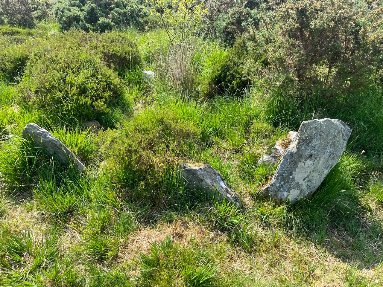

Ballygroll Prehistoric Landscape
In 1815, a farmer in Ballygroll heard there was treasure buried in a Giant's Grave on his land and went out with a spade to find it. He lifted two flag stones and dug into the tomb. He did not find treasure. He found a Neolithic burial that he had just damaged forever. Across the south and west flanks of Loughermore Mountain, in the rolling drumlin country of County Londonderry, there is a small eleven-acre site that holds one of the densest concentrations of prehistoric monuments in Northern Ireland. Cairns. Stone alignments. Standing stones. Three different kinds of grave. A barrow. An entire ancient field wall system. Most of it has never been fully excavated. Most of it still lies under a protective blanket of peat, doing what peat does, which is keep secrets.
Five Thousand Years on a Hill
The Ballygroll monuments span an enormous arc of time. The earliest constructions date to the Neolithic, perhaps 4000 BC, when farming first reached these islands and people began moving stones in patterns. The latest belong to the Late Bronze Age, roughly 1000 BC. That is three thousand years of continuous use on a single hillside, longer than the gap between us and the founding of Rome. Within that arc you can read a story of slow change: from the chambered tombs of the early Neolithic, where communities buried their ancestors collectively in long mounds; to the stone circles and alignments of the later Neolithic, which seem to track the sun and moon; to the wedge tombs of the Bronze Age, often built on the same uplands where their ancestors had walked. Ballygroll holds an example of nearly every major monument type these millennia produced.
What the Peat Saved
The peat that covers most of the site is also what preserved it. After the climate cooled and wetted in the late Bronze Age, blanket bog began to spread across the Ulster uplands, swallowing the field walls and standing stones and tombs together. For three thousand years the bog grew over them like a slow, kind blanket. In drier centuries farmers and treasure-hunters cut into the surface and damaged what they found. In wetter centuries the bog covered the damage again. The first archaeological description came in 1940, but full excavation of even one part of the site did not begin until 1978, when archaeologists opened a six-metre square in the field walls of Mullaboy townland just north of Ballygroll. The next year they excavated what turned out to be a covered barrow. The rest of the eleven acres is still as it was found.
A Save in 1973
Ballygroll almost did not survive. Around 1970 some of the ancient field walls in the neighbouring townland of Highmoor were completely removed as the land was turned from peat bog into arable ground. In 1978 a larger reclamation scheme was planned that would have destroyed much of what remained. Five years before that scheme, in 1973, the eleven-acre core of the site was transferred to the Department of the Environment for protection. It is now a Scheduled Monument and a Monument in State Care. The B49 from Dunamanagh to Claudy passes nearby. There is no visitor centre, no signposted walk, no carved interpretation panel. The monuments stand or lie where they have always been. Some are visible above the peat. Most are not. The ground holds them the way an attic holds family papers nobody has had the time to sort through.
The Field Walls Beneath
Among the most important discoveries at Ballygroll are the ancient field walls themselves. In Ireland the great pre-bog field systems at Céide in County Mayo have made archaeologists rethink the scale and sophistication of Neolithic farming. The Ballygroll walls, though smaller, belong to the same family of evidence. They show that the people who built the tombs and circles also farmed the land in a planned way. They divided it. They enclosed it. They cooperated. Excavating just six metres of wall in 1978 was enough to confirm that the system is genuine and substantial. Walking the surface today, you can sometimes catch the lines of buried walls running under the heather like stitching in old cloth. The fields they enclosed grew the grain and pastured the cattle that fed the people whose ancestors lay in the tombs across the hill.
What We Still Have Not Asked
Ballygroll's quiet is its great virtue and its great problem. Because so little of it has been excavated, every assumption about it can still be tested by digging. Were the stone circles aligned to the solstices, as similar circles in Beaghmore and Ballynoe were? When were the wedge tombs sealed, and what was left in them? What did the standing stones mean? Were they boundary markers, ritual focuses, memorials? Most of the eleven acres has not yet been asked these questions. In an age of laser scanning and ground-penetrating radar, the technology now exists to ask them without disturbing the peat. Ballygroll sits, patient under its blanket, waiting for whichever generation chooses to listen. The farmer who dug into the Giant's Grave in 1815 had it wrong: the treasure was never buried in the tomb. It was the tomb itself.
From the Air
Ballygroll Prehistoric Landscape lies at roughly 54.97 degrees north, 7.17 degrees west, on the south and west flanks of Loughermore Mountain in County Londonderry, between Donemana and Claudy along the B49. From the air the site is hidden under peat and pasture, but the surrounding landscape of low rounded hills with scattered farms is itself the setting. The nearest controlled airport is City of Derry (EGAE) about 14 km north-northwest; Belfast International (EGAA) lies about 80 km east. Donegal Airport (EIDL) is roughly 60 km west across the border. From cruise look for the broad valley of the Faughan River south of Derry and the rising Sperrin foothills further south; Ballygroll sits in the gentler country between.
Nearby Stories
- Portrush Lifeboat Station 1.9 km away
- Main Street, Letterkenny 2.1 km away
- Inishowen 6 km away
- Rosguill 6.3 km away
- County Tyrone 7.1 km away
- St Patrick's College, Maghera 9.6 km away
- St Patrick's Purgatory 11 km away
- Coalisland Canal 17 km away