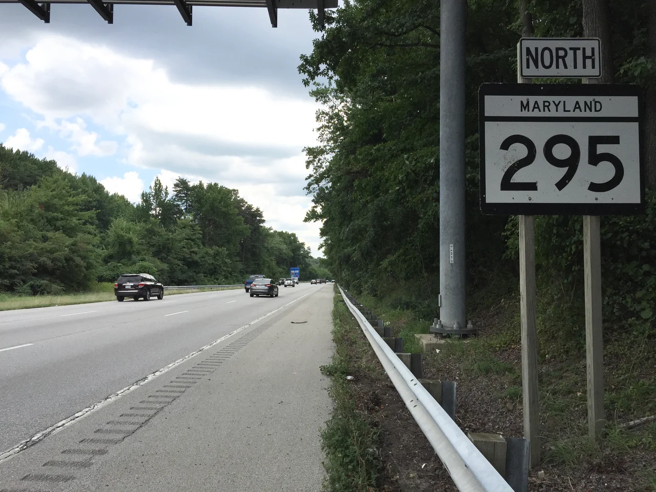
_just_north_of_Maryland_State_Route_175_(Jessup_Road)_in_Severn,_Anne_Arundel_County,_Maryland.jpg)
Baltimore-Washington Parkway
Driving north on the Baltimore-Washington Parkway feels different from any other commuter road in the region, and the difference is mostly trees. No commercial trucks. No billboards. A wide grassy median that the National Park Service kept thick with hardwoods. Brown park-service signs lettered in Clarendon typeface where green guide signs would be on an interstate. The parkway runs roughly forty miles from the edge of Washington, D.C., near Cheverly to downtown Baltimore. For most of its length below Fort Meade, it was, until very recently, one of the longer roads in the United States still maintained by the National Park Service rather than a state transportation department. The split personality - parkway in the south, ordinary state route in the north - is the result of a decision made when the road opened in stages between 1950 and 1954.
Built for the Cold War
Pierre L'Enfant sketched a parkway-like link between Baltimore and Washington in his 1791 plan for the federal city, but the road didn't take shape until the 1940s. By then U.S. Route 1, the existing two-lane connection between the cities, was one of the deadliest roads in the world - that's what contemporary press reports actually called it. The National Capital Park and Planning Commission, the Bureau of Public Roads, and the J.E. Greiner Company drew up designs in 1942. Two motivations drove construction: the accident toll on Route 1, and the perceived need to mobilize national defense as World War II approached. The Cold War deepened the second motivation. When the parkway opened, the federal government was already moving agencies out of the District to disperse them in case of nuclear attack. The parkway became the artery for that dispersal.
Two Roads in One
The parkway that opened in 1954 was administered in two halves. The state of Maryland built and maintains the northern segment, which extends from the Baltimore Beltway south to MD 175 near Fort Meade. The National Park Service maintains the southern segment, from MD 175 down to the U.S. Route 50 interchange at the D.C. line. The NPS section forbids commercial trucks. It is administered, oddly, as a unit of nearby Greenbelt Park. The Park Service stretch was named in 1983 for Gladys Noon Spellman, the Maryland congresswoman who represented Prince George's County until a heart attack ended her career in October 1980. She remained in a coma until her death in June 1988. Senator Paul Sarbanes introduced the dedication bill while Spellman was still alive in the hospital.
A Federal Corridor
Look at what the parkway touches and you see the federal government laid out along its length like beads on a string. Goddard Space Flight Center built its own interchange in 1965. Fort Meade, with the National Security Agency inside it, sits at the parkway's midpoint. The University of Maryland, College Park lies just west of an exit, as does College Park Airport - the world's oldest continuously operating airport, where the Wright Brothers taught the U.S. Army Signal Corps to fly in 1909. Beltsville Agricultural Research Center, NIST's Gaithersburg campus accessible via cross-routes, and the FBI's lab facilities at Quantico all sit within a short drive. The parkway didn't make these institutions; it linked them, and made it feasible to staff them with commuters who could live anywhere in the corridor.
Slow Deterioration, Slow Repair
The Park Service segment was already known as one of the most dangerous roads in the NPS system by the 1960s, and proposals to hand it to Maryland for full freeway reconstruction surfaced repeatedly - in 1963, in 1968 with an Interstate 295 designation that was granted and then withdrawn, and again in 2017 when Governor Larry Hogan proposed transferring it to the Maryland Transportation Authority as part of an express-toll-lane scheme. Every transfer attempt failed. Meanwhile the pavement aged. In March 2019, the Park Service had to lower the speed limit between MD 197 and MD 32 because the road was breaking up. After pressure from Maryland's congressional delegation, the NPS performed emergency pothole repairs that weekend and began a full repaving in April. The road has had its share of accidents: a 1989 overpass collapse at MD 198 injured fourteen people; a 2005 sinkhole closed the northbound lanes overnight; a 2007 incident dropped chunks of concrete from a Greenbelt Road overpass onto the lanes below.
The Wooded Strip
What makes the parkway worth driving, despite the potholes and the politics, is the median. The Park Service kept the right-of-way wooded, with mature trees screening the parkway from the surrounding sprawl. From the air the corridor reads as a band of green slicing northeast across Maryland - a forty-mile linear forest holding back the strip malls that line every other route between the capitals. The parkway was added to the National Register of Historic Places on May 9, 1991, recognition both of its historic landscape design and of what it represents: an idea about how roads should look and feel, made in the 1940s and mostly preserved against the impulse to widen, monetize, and ordinary-ize every commuter route in the country. Whether that idea survives the next round of widening proposals is, as it has been since 1963, an open question.
From the Air
The Baltimore-Washington Parkway runs roughly southwest to northeast between 38.92 N, 76.94 W (D.C. terminus near Cheverly) and 39.27 N, 76.61 W (downtown Baltimore). It passes within two miles of BWI Marshall Airport (KBWI) near Linthicum, and within one mile of the Goddard Space Flight Center east of Greenbelt. The parkway is the most visible north-south green corridor between the two cities on satellite imagery - a wooded median traceable from 10,000 feet. Civil aviation traffic departing or arriving BWI may overfly the parkway at low altitude on approach to runways 28 and 33L.
Nearby Stories
- Reston, Virginia 1.7 km away
- Thomas Viaduct 9.2 km away
- Monocacy Aqueduct 9.7 km away
- Stafford County, Virginia 26 km away
- Harriet Tubman Underground Railroad 28 km away
- Gunston Hall 30 km away
- Adkins Arboretum 31 km away
- Bombay Hook National Wildlife Refuge 71 km away