The Banda Sea: Where Continents Collide
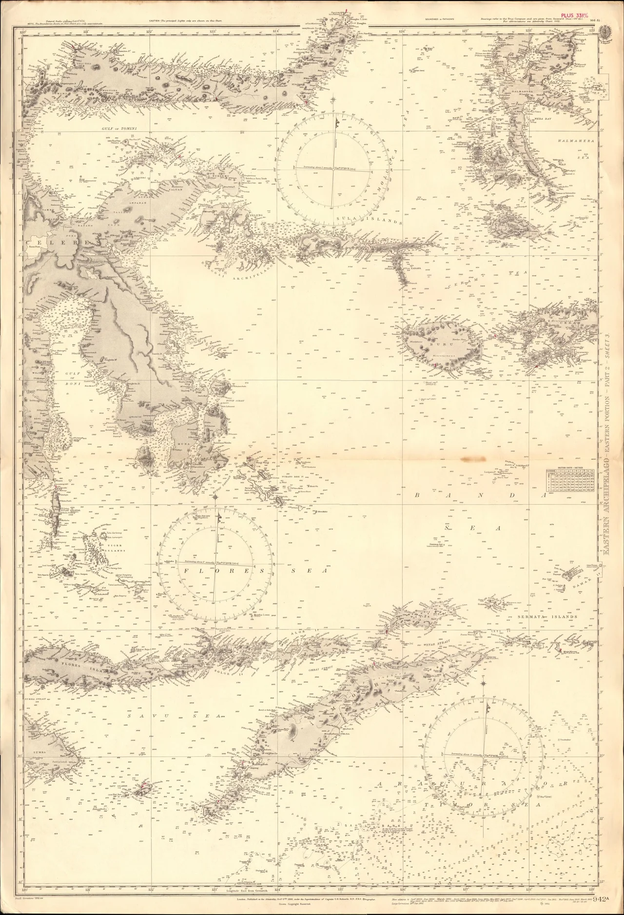
Somewhere beneath these waters lies the largest exposed fault on Earth. The Weber Deep plunges more than 7.2 kilometers below the surface of the Banda Sea, an abyss formed not by simple depth but by the ripping apart of oceanic crust as tectonic plates grind against each other in three directions simultaneously. The Eurasian, Pacific, and Indo-Australian plates converge here in eastern Indonesia, and the Banda Sea is their battleground -- a body of water ringed by volcanic islands, shaken by frequent earthquakes, and teeming with a density of marine life that ranks among the highest on the planet.
The Arc That Bends Back on Itself
Geologists have long been fascinated by the Banda arc, a chain of volcanic islands that curves 180 degrees around the sea's southern and eastern margins. This extreme curvature -- unique among the world's subduction zones -- is the product of the Australian continental margin colliding with a volcanic arc from the north. As the Indo-Australian plate pushes northward beneath the Banda Sea plate, it has crumpled the seafloor into a series of trenches: the Timor Trough to the south, the Tanimbar Trough to the southeast, the Aru Trough to the east. The island of Timor itself is made of fore-arc sediment that the subducting plate carried north and then folded upward like a crumpled rug. To the northeast, Seram Island marks a separate collision, where the Bird's Head plate of West Papua slides beneath the sea. The result is one of the most tectonically complex regions on Earth, a place where the planet's crust is being simultaneously pulled apart, pushed together, and twisted.
Islands of Tremor and Fire
Earthquakes are not occasional events in the Banda Sea. They are constant. The convergence of three major plates produces seismic activity so frequent that the region has generated some of the most powerful earthquakes ever recorded in Indonesia, including major events in 1852, 1938, and 2006. Volcanic islands punctuate the sea itself, most notably in the Banda Islands, where Gunung Api last erupted in 1988, sending lava flows into the sea and forcing the evacuation of nearby settlements. The smaller volcanic island of Manuk, uninhabited by humans, serves as a nesting site for seabirds whose populations thrive precisely because the island's volcanic nature has kept people away. This is the paradox of the Banda Sea: the same geological violence that makes the region dangerous also creates the conditions for extraordinary biological richness, building new land, churning nutrients from the deep, and isolating ecosystems long enough for evolution to take unique paths.
Wallace's Line and the Mixing Zone
The islands ringing the Banda Sea belong to Wallacea, the biogeographical transition zone between Asia and Australia named for the naturalist Alfred Russel Wallace, who first recognized its significance in the 19th century. These islands have never been connected to either continent by land bridges, even during the ice ages when sea levels dropped dramatically. The consequence is a mixing zone where Asian species from the Indomalayan realm and Australian species from the Australasian realm overlap, producing communities found nowhere else. The southeastern islands -- the Tanimbar, Kai, and Barat Daya groups -- harbor 21 endemic bird species, an extraordinary number for such a small land area. Only 22 native mammal species survive on these islands, among them the rare dusky pademelon, a small wallaby-like marsupial that testifies to the Australian lineage of the fauna. The endangered Kei myotis bat and the Indonesian tomb bat round out a mammalian roster shaped by isolation, ocean currents, and chance.
Coral Gardens and Blue Whales
The Banda Sea falls within the Coral Triangle, the global epicenter of marine biodiversity, and together with the adjacent Flores Sea it forms the Banda-Flores Sea ecoregion, recognized by the World Wildlife Fund as a priority for conservation. The reefs here support a staggering diversity of coral species, and the deeper waters serve as migration corridors for some of the ocean's largest animals. Blue whales -- possibly both the nominate species and the smaller pygmy blue whale -- have been recorded in the Banda Sea, along with the recently described Omura's whale, a species so elusive that its existence was not confirmed until 2003. The Kai and Banda Islands, though remote, attract divers and snorkelers drawn to unspoiled reefs and beaches that remain largely undeveloped. The island of Yamdena in the Tanimbar group retains extensive tracts of intact rainforest and is officially protected, though the greatest threats to the region's biodiversity come from introduced predators -- cats and rats that devastate ground-nesting bird populations and endemic species that evolved without mammalian hunters.
A Sea That Resists Knowing
The Banda Sea does not reveal itself easily. Its borders are a maze of rocky islets hazardous to navigation, though the central expanse is open water. Access to the surrounding islands typically begins with a flight or ship from Ambon, itself no simple destination. The sea's sheer scale -- hundreds of kilometers in every direction -- means that much of its marine life remains unstudied, its seafloor unmapped in detail. The Weber Deep was only confirmed as the world's deepest forearc basin in 2016, when researchers published findings that the feature is an exposed oceanic fault covering an area twice the size of Belgium. What else lies in this convergence of plates, currents, and evolutionary experiments is a question the Banda Sea guards closely. For those who cross it, whether by liveaboard dive vessel or on the deck of a passing ship, the experience is of a vast and ancient body of water whose depths hold more questions than any single expedition can answer.
From the Air
Coordinates: 5.36S, 127.21E. The Banda Sea is a large body of water in eastern Indonesia, ringed by the islands of Sulawesi (west), Buru, Ambon, and Seram (north), the Aru and Tanimbar islands (east), and Timor (south). From cruising altitude it appears as a broad expanse of deep blue water dotted with volcanic islands, particularly the Banda Islands group near the center. Nearest major airport: Ambon/Pattimura (WAPP/AMQ) on the northern margin. The volcanic cone of Gunung Api in the Banda Islands is a distinctive landmark. Recommended viewing altitude: 20,000-35,000 ft to appreciate the full extent of the sea and the curvature of the Banda arc island chain.
Nearby Stories
- Ambelau: The Spice Island the Empire Forgot 139 km away
- When the Banda Sea Stood Up: Ambon's 1674 Megatsunami 151 km away
- Five Days on Ambon 191 km away
- Wakatobi: Four Islands, One Name 311 km away
- Twenty-Five Thousand Islands Between Two Worlds 336 km away
- Mount Ile Lewotolok: The Fire Mountain on Its Own Peninsula 448 km away
- Lembata: Where Volcanoes Meet the Whale Road 499 km away
- Fort Dundas 713 km away