
Bandiagara
Bandiagara is a town built around a departure. Travelers rarely come here to stay; they come to leave - to set out on foot into the Dogon Country that spreads beyond it, one of West Africa's most extraordinary cultural landscapes. So the town has the particular character of all great trailheads: a place of last-minute provisioning and first-light starts, where you buy the rope and the water and hire the guide before walking off the edge of the map. It is small enough to cross on foot in an afternoon. But just beyond it rises the reason everyone comes: a wall of sandstone half a kilometer high, running across the horizon like the spine of the land.
The Gateway
Bandiagara is the primary entry point to Dogon Country treks, and it knows it. This is where you stock up on supplies, find a bed for the night, and arrange the guides and drivers who make a journey into the villages possible. Convenience has its price - because trekkers must pass through, goods here tend to cost more than in the surrounding towns, a small tax on the town's strategic position. The trade-off is that you can find almost anything at the last minute. Buses connect Bandiagara to the nearer towns of Mopti and Sévaré; reaching farther afield, like the capital Bamako, takes more planning, and locals will tell you the smart move is to time your departure for market day, when transport is easiest to catch.
The Cliff That Defines the Land
The Cliff of Bandiagara is no ordinary escarpment. A chain of sandstone stretching roughly 150 kilometers across the landscape, it towers roughly 500 meters above the sandy plains below - a sheer, sun-baked rampart of plateau, escarpment, and plain. In 1989, UNESCO inscribed it on the World Heritage List as the "Cliff of Bandiagara (Land of the Dogons)," recognizing it as one of West Africa's most impressive cultural landscapes. Hundreds of villages cling to the cliff, the plateau above it, and the plains at its foot. To walk along its base is to move through a place where geology and human culture have grown into each other over centuries, inseparable.
Builders in the Rock
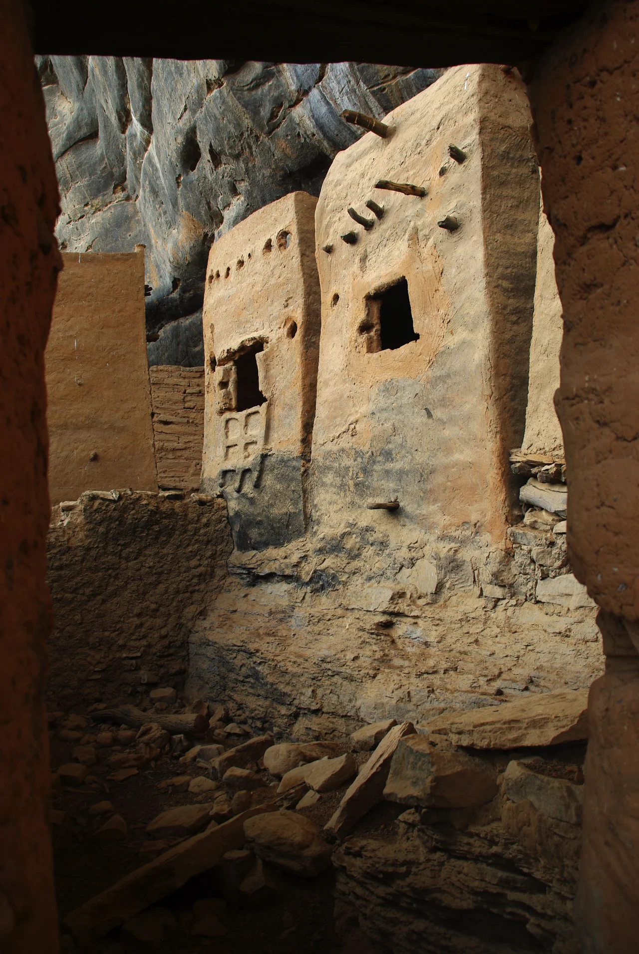
Look up at the cliff face and you will see structures wedged improbably into the rock high above the ground. Some of these are the work of the Tellem, the people who lived on these slopes before the Dogon arrived. The Tellem carved and built into the cliff to store their grain and bury their dead far above the plain, beyond the reach of the flash floods that swept the low ground - some of their caves have been found to hold the remains of thousands of people. When the Dogon came, they took up life along the same escarpment, adapting its ledges and hollows to their own purposes. The mud-brick dwellings still visible in the rock at villages like Teli are a record of this layered occupation, one culture building atop the memory of another.
Through the Town, Into the Country
Bandiagara itself is honest about its modest charms. It is not, as travelers freely admit, a town heavy on sights - the most interesting structure is the administration building at the central roundabout, an arresting bit of architecture in an otherwise workaday place. But that understatement is the point. Bandiagara is a threshold, not a destination. Beyond it lies Dogon Country, which is what everyone has come for; behind it lie Mopti and Sévaré, the larger towns of the Inland Niger Delta with their old quarters and their hotels. Stand at the roundabout, shoulder your pack, and walk: ahead is the great cliff, and beneath it, the villages that have made their home in the rock for a thousand years.
From the Air
Bandiagara lies at 14.35°N, 3.61°W in central Mali, on the plateau above the Inland Niger Delta. The town has no major airport of its own; the nearest is Ambdedjedji (Mopti) at GAMB / MZI, to the west. The dominant feature from the air is unmistakable: the Bandiagara Escarpment, a ~150 km sandstone cliff rising roughly 500 m above the plains, running southwest to northeast - a sharp line dividing the elevated plateau from the lower sandy lands of Dogon Country. Best viewed in the clear, dry harmattan-free air when low sun rakes the cliff face and throws its full relief into shadow.
Nearby Stories
- Bangime 26 km away
- Inner Niger Delta 30 km away
- Battle of Jenné 40 km away
- Old Towns of Djenné 59 km away
- Djenné 94 km away
- Ouahigouya 97 km away
- Yacouba Sawadogo 121 km away
- Hand of Fatima (rock formation) 163 km away