
Old Towns of Djenné
Two American archaeologists dug a deep trench into a mound southeast of Djenné in 1977, and again in 1981, and kept going down. Six meters of human occupation lay stacked beneath their feet - pottery, iron, the residue of generations. At the bottom they reached a settlement that had been founded around 250 BC, when iron-working herders and fishers first built here. Susan and Roderick McIntosh had located one of the oldest cities in sub-Saharan Africa, a place that challenged a long-held assumption: that great urban life in West Africa had to wait for outsiders to bring it. It had not. The city beneath the mound, Djenné-Djeno - 'Old Djenné' - had grown on its own.
The City That Rose and Vanished
Djenné-Djeno did not stay small. Over the centuries after its founding it grew into a substantial walled town, its people throwing up a mud-brick wall around the settlement by about 800 AD. At its height it may have held some twenty thousand people across the city and its satellites, sustained by fertile floodplain soil and a position astride regional trade. Then it faded. After 1100 AD the population fell, and by around 1400 the site was abandoned entirely - along with many smaller settlements nearby. No one is certain why. The leading guesses are sobering and human: new diseases arriving along the trans-Saharan trade routes, or warfare. A city that had lived for more than a thousand years emptied out, and the living town of Djenné carried on a short walk away.
Four Sites, One Story
When UNESCO inscribed this place on the World Heritage list in 1988, it did not list a single ruin but an ensemble. The 'Old Towns of Djenné' bundles together four archaeological sites - Djenné-Djeno, Hambarkétolo, Kaniana, and Tonomba - alongside the living town itself. The reasoning was deliberate. Reviewers argued that drawing a wide protective boundary was the only real way to shield both the buried archaeology and the natural setting of the inland delta from runaway development. The committee invoked two of its criteria at once: that the ancient sites bear exceptional testimony to a vanished civilization, and that the standing town is an outstanding example of a way of building that marks a real stage in human history. Past and present were protected as one thing.
Built on Hillocks Against the Flood
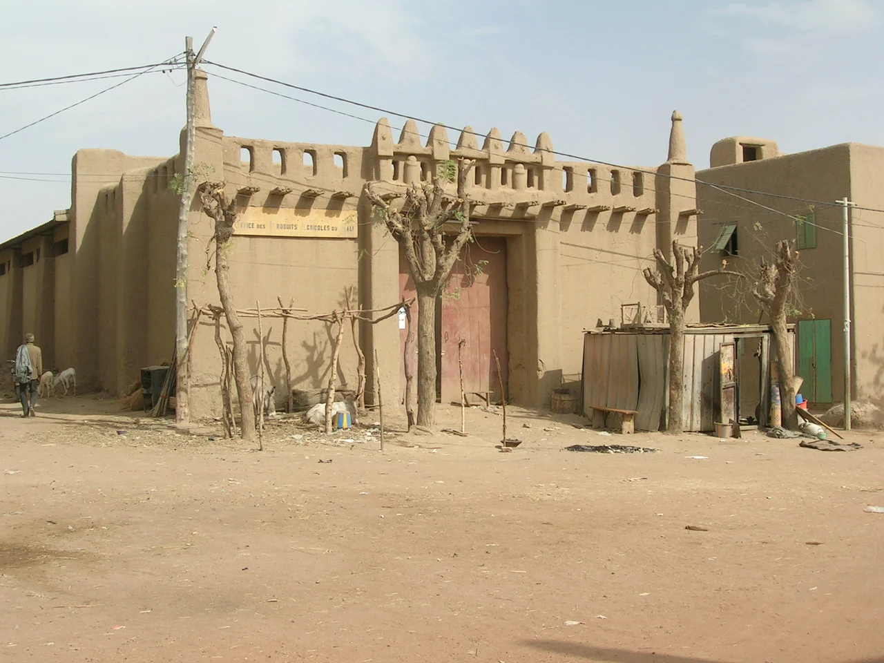
The deep history and the living town share a single problem: water. Every year the rivers rise. The ancient builders answered it the same way their descendants still do, raising their settlements on low mounds, called toguere, that lift the buildings above the seasonal flood. Nearly two thousand of the town's traditional earthen houses survive on these hillocks today - a continuity of method stretching back two millennia. This is what makes Djenné rare among ancient sites. It is not a dead ruin under glass. The techniques the McIntoshes uncovered at the bottom of their trench are, in their essentials, the same techniques being used a few hundred meters away to keep a town standing right now.
The Cost of Living History
Protecting a place where people still live is harder than protecting an empty one. From 2005 onward the World Heritage Committee grew openly critical of conditions at Djenné, and its reports captured a genuine tension. Residents and officials, one 2006 report noted, felt they were living in a zone where, as they saw it, 'nothing is allowed.' Families wanted more comfortable rooms and the freedom to use modern materials; the town lacked the money and technical capacity to manage its own development and sanitation; building rules went unobserved. The committee pressed for a real management plan and for maps marking exactly where the protected archaeology lay. The deeper question has no easy answer: how do you honor a two-thousand-year-old city without freezing the people who are its living continuation?
From the Air
The Old Towns ensemble centers on Djenné at roughly 13.906°N, 4.555°W in central Mali, with Djenné-Djeno lying just southeast of the modern town on the Inland Niger Delta floodplain. The archaeological mounds appear from the air as low rises above flat, often flooded ground. Nearest airport is Mopti / Ambodédjo (GAMB), about 75 km northeast; Bamako-Sénou (GABS) is some 400 km southwest. Best viewed in the dry season (November-March); during the July-October flood the toguere mounds stand as dry islands above the water.
Nearby Stories
- Dia, Mali 13 km away
- Dogon Country 30 km away
- Hamdullahi 34 km away
- Bandiagara 50 km away
- Tominian 52 km away
- Bozo language 80 km away
- Markala 125 km away
- Ancient Ferrous Metallurgy Sites of Burkina Faso 138 km away