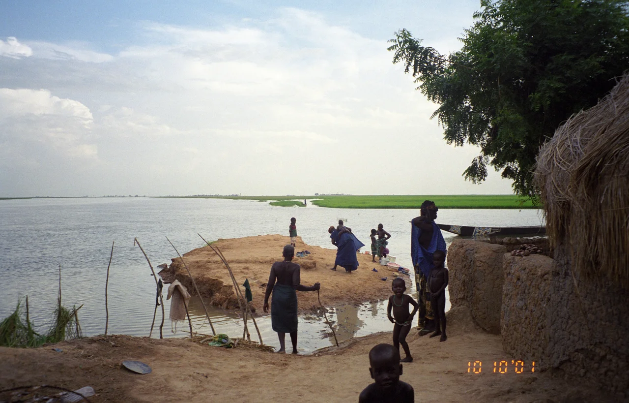

Dia, Mali
Most people have never heard of Dia, and that is part of its mystery. This small town on the western edge of Mali's Inland Niger Delta does not announce its age. But beneath and beside the modern settlement lie three great earthen mounds - the slowly accumulated debris of human life stacked layer upon layer - and the oldest of them began filling up in the 9th century BCE. That makes Dia older than the celebrated ruins of Djenné-Jeno downstream, older than the West African empires of Ghana, Mali, and Songhai that would later rise and fall around it. Here, on a floodplain watered by the only permanent river in the region, one of West Africa's first cities took root.
Three Mounds, Three Thousand Years
Archaeologists call them tells - artificial hills built not by quarrying but by living. As generation after generation built, collapsed, and rebuilt in mud brick, the ground level slowly rose, sealing the past beneath the present. Dia is really three of these sites clustered together: Dia-Shoma, Dia, and Dia-Mara. Dia-Shoma is the eldest and the largest, sprawling across 49 hectares and reaching back to around the 9th century BCE. Settlement at the complex peaked roughly in the 10th century CE, by which time Dia had been continuously inhabited for the better part of two millennia. The neighboring mound of Dia-Mara is a relative newcomer, with occupation beginning only in the 6th century CE - young, by the standards of this remarkable place.
Rescuing a Lost City
Much of what we know was nearly lost. Beginning in 1980, researchers set out to inventory the archaeological sites scattered across the Inland Niger Delta before erosion, farming, and looting could erase them. The vicinity of Dia was chosen in 1998 as the focus of a long-term Malian-Dutch cultural heritage program led by the Rijksmuseum voor Volkenkunde in Leiden. Their excavations revealed how an early West African city was structured - how its people lived, traded, and buried their dead. Dia sat on a vital artery: the water system that linked the southern savanna to the northern Sahara made it one of the key trading posts of the region, a place where goods and ideas from across the continent changed hands.
The Argument Beneath the Surface
Dia is often compared to Djenné-Jeno, and the two do share certain pottery styles - the same rim shapes, the same red slip on their vessels. For a time this looked like proof of a single connected people. But the closer archaeologists looked, the more the differences emerged. The decoration styles diverge. Djenné-Jeno's distinctive funerary urns, in which the dead were buried, are completely absent at Dia - and with 86 inhumations excavated at Dia-Shoma alone, that absence cannot be chalked up to chance. Different burial customs point to different communities, neighbors along the same river who shaped clay in similar ways but laid their dead to rest by their own traditions. The mounds, it turns out, hold an argument as much as a history.
Memory and Its Erasures
Dia raises a delicate question: who gets to tell its story? Oral history names the Bozo - hunters and fishermen - as the region's first inhabitants, and Dia today is governed by the Soninke rather than the Fulani who dominate the surrounding Macina. But the ground tells a story the spoken record sometimes resists. Excavations at the Shoma cemetery found most of the dead buried in clearly non-Islamic positions, with the few Islamic-style graves confined to the surface and dated only to the 18th and 19th centuries. Terracotta figurine heads from nearby Mara hint at a tradition of honoring ancestors that an exclusionary new faith would later condemn. As Islam took deep root from the 19th century onward, communities had reason to forget older practices - and Dia, whose people cherish the memory of their Muslim ancestors, shows how oral history itself can be quietly rewritten. The mounds remember what the stories have let go.
From the Air
Dia lies at 14.35°N, 4.96°W, on the western edge of the Inland Niger Delta in Mali's Mopti Region, watered by the Diaka distributary. The nearest sizable airport is Ambdedjedji (Mopti) at GAMB / MZI, well to the east across the delta. From altitude the area shows as a settlement on flat floodplain at the delta's dry western margin; the archaeological mounds appear as low rises rather than dramatic landforms. Best viewed in the clear dry season, when the surrounding delta has faded to tan and the permanent Diaka channel stands out as the region's only reliable water.
Nearby Stories
- Inner Niger Delta 8.1 km away
- Old Towns of Djenné 17 km away
- French West Africa 19 km away
- Bozo language 22 km away
- Grand Mosque of Mopti 44 km away
- Great Mosque of Djenné 61 km away
- Lake Débo 128 km away
- Ghana Empire 282 km away