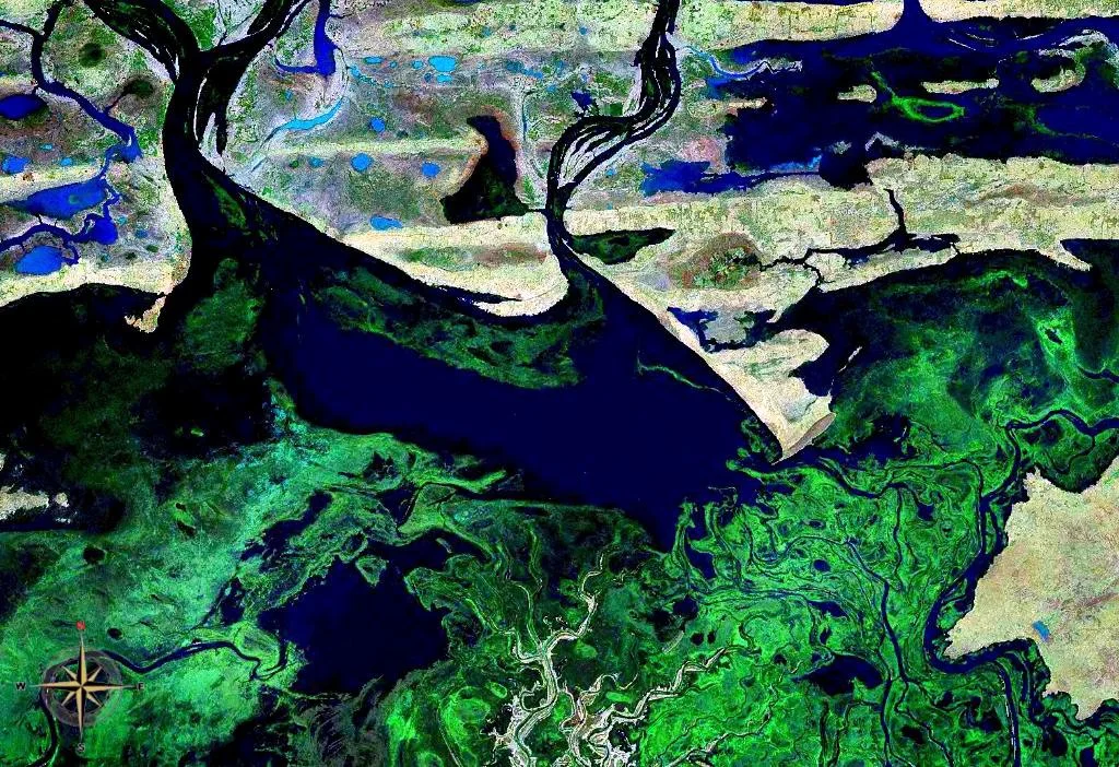

Lake Débo
For half the year it is barely there - a sprawl of marsh, channel, and drying mud. Then the Niger arrives. As the river's annual flood pushes north through central Mali, it spreads across the land and gathers into Lake Débo, the great lake of the Inner Niger Delta. At its fullest, the water reaches almost to the horizon, the air filling with the cries of gulls and waterbirds until, as one early account put it, you could almost mistake this landlocked corner of the Sahel for the sea.
The Lake That Breathes
Lake Débo is the largest lake in Mali, but calling it a lake at all requires a footnote. It exists only when the Niger floods, fed by the seasonal surge that turns the Inner Niger Delta into a shallow inland sea of channels, backwaters, and flooded marsh stretching some 200 miles long and 50 miles wide. At high water, Débo lies about 80 kilometers downstream of Mopti and 240 kilometers upstream of Timbuktu. Then, through the dry months from January to August, the water retreats and the lake shrinks dramatically, exposing the rich mud that makes the delta one of West Africa's most productive landscapes.
The Great Lake of Old Maps
Europeans knew of this water long before they ever saw it. The earliest reports reach back to the first millennium BC, and Ptolemy described a lake here shaped like a barbell. Cartographers gave it a parade of names over the centuries - Nigrite Palus, Lake Guarda, Lake Dibbie, Bahar Seafeena, and more - before it settled into Lake Débo. A study of more than 400 maps drawn between 1000 and 1900 AD found the "Great Lake" depicted on 95 percent of them. In all of Africa, only one feature appeared on more maps: the Nile. For a thousand years, this vanishing-and-returning lake was one of the continent's fixed points in the European imagination.
A Crossroads of Wings
When the lake is full, it becomes a haven for birds. Recognized as a wetland of international importance under the Ramsar Convention, the Lake Walado Débo area shelters around 350 species, including 118 that migrate - some arriving from as far as Europe to wait out the northern winter on these warm, shallow waters. Beneath the surface, the delta teems with around 130 fish species, among them the Synodontis gobroni, restricted to the Niger Delta and upper Niger, and at least 24 species found nowhere else in the world. The flooded grasslands grow thick with bourgou, a sweet aquatic grass that feeds vast herds once the waters fall. Few places concentrate so much life into so unreliable a supply of water.
Lives on the Water's Edge
The people here have shaped their lives around the lake's pulse. When the Niger and Bani Rivers are in spate, the Bozo - fishermen who have worked these waters for generations - cast their nets across the swollen lake. As the flood recedes and the bourgou pastures emerge, Fula herders arrive from the north, ending their long seasonal migration at Débo's drying margins, where their cattle graze the exposed grass. It is an old and finely tuned arrangement, each group reading the water's rise and fall, the whole delta turning on the question of how high the river will reach this year.
From the Air
Lake Débo lies near 15.34°N, 4.20°W in central Mali, the dominant water feature of the Inner Niger Delta. Its size varies enormously by season - broad and lake-like at peak flood in November and December, shrinking to marsh and channels from January to August - so its aerial appearance shifts through the year. It sits about 80 km downstream of Mopti (GAMB) and 240 km upstream of Timbuktu (GATB), making it a strong navigation reference between the two. Best viewed at high water; the surrounding Sahel can be hazy in the dry season.
Nearby Stories
- Battle of Konna 25 km away
- Tondidarou 42 km away
- Sangha, Mali 76 km away
- Dia, Mali 95 km away
- Bandiagara Escarpment 109 km away
- Kabara, Mali 131 km away
- French West Africa 153 km away
- Néma 307 km away