
Néma
The road simply ends here. The Road of Hope - Mauritania's great paved artery, running more than a thousand kilometers east from the Atlantic capital of Nouakchott - reaches the market quarter of Nema and stops. Beyond it lies open Sahel, the Malian border, and the deep desert. For a town that sits at the literal end of the line, Nema is anything but a dead end: it is the bustling capital of an entire region, a crossroads where cars, donkey carts, and the occasional camel still share the same dusty streets.
The End of the Road
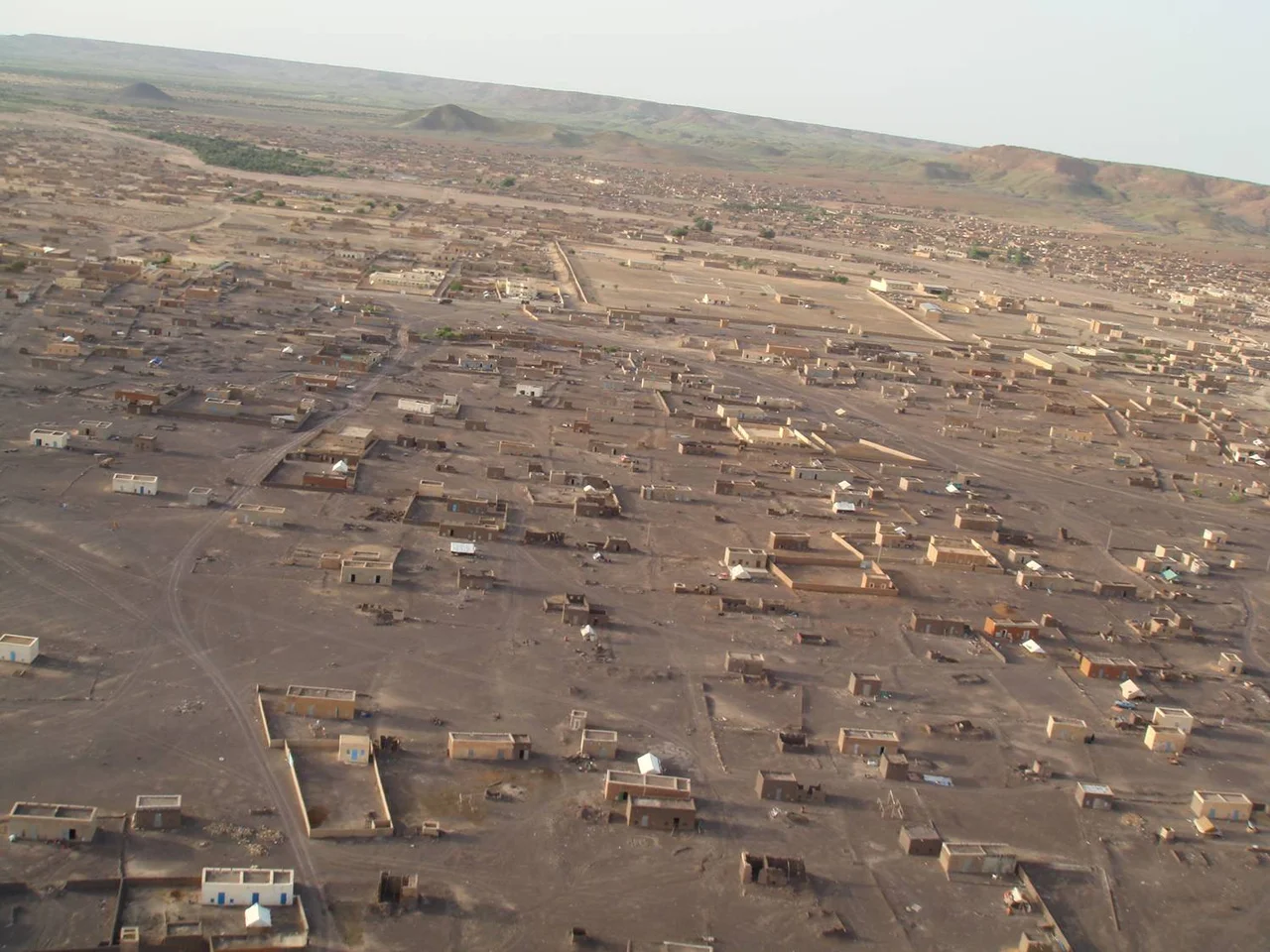
Nema anchors the far eastern corner of Mauritania, perched at the edge of the Aoukar depression close to the Malian frontier. It is the capital of the Hodh Ech Chargui Region and of the Nema Department, and although the town itself holds around twenty thousand people, the rural communities it serves push the department's population closer to a hundred thousand. The town is laid out in ten quartiers, and you can read its history in them: the oldest is Edelibu, northeast of the road, while Shovia - the only quarter south of the highway - dates only to the 1950s. Small mountain plateaus wall the town in on its north and east sides, giving the desert outpost an unexpected backdrop of high ground and, for the few who come, good hiking.
A Hard, Hot Climate
Nema's weather leaves little room for negotiation. The climate is hot and arid, classic Saharan-fringe BWh, and the numbers are stark: of the roughly 280 millimeters of rain that fall in a year, some 220 arrive in the brief July-to-September wet season. Yet even in those wettest months, evaporation outpaces the rain - the sun pulls moisture from the ground faster than the clouds can deliver it. It is a place defined by the absence of water, which makes the rhythm of life here a study in adaptation. Visitors who do come from Europe tend to arrive in November and December, the short window when the temperatures finally drop to something a traveler can bear.
Brousse and the Nomad's Memory
Mauritanians prize the brousse - country living - as a link to their nomadic roots, and Nema sits where that older way of life still presses close. The town's cultural makeup is predominantly Moor, with Pulaar and Bambara communities present as well, a meeting of peoples typical of a borderland between the Arab-Berber north and the Black African south. Traffic flows constantly across the nearby Malian frontier: south toward Mali through Adel Bagrou, east to Bassikounou and Lere, or north to the ancient caravan city of Oualata, pronounced Walata. Nema is small, but it is a hinge - the point where a paved modern highway hands travelers off to the older, unpaved routes of the open desert.
A Town That Governs a Region
For all its remoteness, Nema carries the full apparatus of a regional capital. It has a wali (the regional governor), a maire for municipal affairs, and a hakim for civil matters, in descending order of authority. There are eleven madrasas, two middle schools, and a lycee, overseen by a regional education director, and a hospital whose women's services section is noted as particularly well staffed despite the town having fewer than ten doctors in all. International organizations work here too - among them the French health group Sante Sud - and American Peace Corps volunteers were posted to the town in 2007 and 2008. For a brief period, Nema even had an airline: Mauritania Airways flew from the local airport to Nouakchott, Abidjan, and Las Palmas between 2007 and 2010.
Living on the Edge
The same isolation that makes Nema a frontier outpost also makes it a vulnerable one. Beginning in the summer of 2008, Al-Qaeda in the Islamic Maghreb became active across the desert regions of Mauritania, Hodh Ech Chargui among them, and the area has since been considered dangerous for Western foreigners. It is a sobering counterweight to the town's role as a place of passage and trade. Nema endures as it always has - a single hotel, a market at the end of the great road, and a steady current of people moving between the paved world behind and the open Sahel ahead, in a town that has long known how to live at the edge of things.
From the Air
Nema sits at 16.612°N, 7.260°W in southeastern Mauritania, at the eastern end of the Aoukar depression and close to the Malian border. From altitude, look for the abrupt terminus of the Road of Hope - the long paved highway from Nouakchott - against the town's grid of ten quartiers, framed on its north and east by small plateaus rising from otherwise flat hot-arid terrain. The surrounding country is true Saharan fringe: sparse, tawny, with seasonal green only briefly after the July-September rains. The town is served by Nema Airport (GQNI). Expect intense heat haze and, in winter, dust-laden Harmattan winds; the clearest viewing comes in the cooler November-December months.
Nearby Stories
- Oualata 51 km away
- Koumbi Saleh 71 km away
- Ghana Empire 109 km away
- Aoukar 212 km away
- French West Africa 233 km away
- Great Mosque of Niono 267 km away
- Niono 273 km away