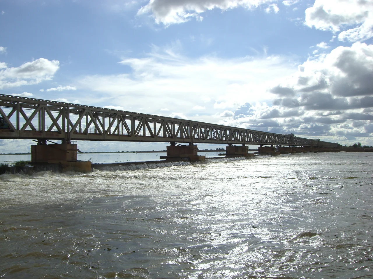

Markala
Stand on the bridge at Markala and you are standing on a wall nearly two and a half kilometers long, thrown across the entire width of the Niger. The river does not stop here so much as it is persuaded, its level lifted just enough to spill into a canal that runs 135 kilometers north into country that would otherwise be desert. This is the Markala dam, Mali's primary irrigation barrage, and it is the reason a stretch of Sahel once called the Delta Mort, the Dead Delta, now grows nearly half the nation's rice.
A Colonial Ambition in Concrete
The French colonial authorities built the dam between 1934 and 1947, and their ambition was specific: cotton, grown at scale to feed the textile mills of metropolitan France. The barrage is a weir, designed so water flows over its top rather than being held entirely back, and it diverts roughly 2.7 cubic kilometers of the Niger's flow each year, about 8.3 percent of the river's total. That water fans out through a canal network past the small towns of Niono and Sokolo, transforming dry plain into a checkerboard of irrigated fields. The cotton dream never fully materialized, but the infrastructure outlived the empire that poured it.
Mali's Rice Basket
What the canals grow today is rice, and a great deal of it. The scheme, managed by the Office du Niger, irrigates about 750 square kilometers of farmland, and in the 1999 to 2000 season it produced 320,000 tons of rice, around 40 percent of Mali's entire output. There is a quiet geography to this: the dam itself sits in the heart of Markala commune, but the fields it feeds lie outside the commune, spread across the plains to the north. The barrage is a giver that keeps little for its own neighborhood, sending the river's gift downstream and inland to farmers it will never see.
Where the River Becomes a Road
Markala is a commune of some 46,000 people across 30 villages and 318 square kilometers, and its largest village, Diamarabougou, sits on the right bank pressed up against the dam. The structure does double duty: the crest of the barrage carries an important road bridge, one of the relatively few fixed crossings of the Niger in this part of Mali, so the wall that tames the river also ties its two banks together. For decades the town had its own small airfield, Markala Airport, in service until around 2008, a reminder of how strategically the colonial planners viewed this point on the river.
From the Air
Markala lies at 13.67 N, 6.08 W on the Niger River, about 35 km downstream (northeast) of Ségou in central Mali. From the air the dam is unmistakable: a straight 2,450-meter line cutting square across the river, with the irrigation canal striking off to the north and a grid of green or flooded rice fields beyond it that contrast sharply with the surrounding dry plain. Nearest major airport is Bamako-Sénou International (GABS), roughly 230 km to the southwest. The flat Sahelian terrain and the geometric irrigation pattern make this one of the most legible navigation references on the middle Niger. Dry-season visibility is good apart from harmattan dust.