.jpg)
Koulikoro
For nearly seventy years, the trains from Dakar ended here. A traveler could board on the Atlantic coast of Senegal and ride the rails clear across West Africa, and the line would carry them as far as Koulikoro and no farther - because here, on the banks of the Niger, the iron road handed its passengers to the river. Just upstream, the Sotuba Rapids near Bamako break the water and forbid boats. So Koulikoro became a hinge: the place where one kind of journey ended and another began.
The End of the Line
Koulikoro is the terminus of the Dakar-Niger Railway, completed in 1904 - the great colonial artery that stitched the French Sudan to the sea. The geography made the town inevitable. Above Koulikoro the Niger is unnavigable, blocked by the Sotuba Rapids, so this is the first point where the middle river opens up and the great boats can run. When the rains come and the river swells between August and November, cargo loads onto vessels here and rides the current downstream to Ségou, to Mopti, to fabled Timbuktu, and on to Gao. The capital, Bamako, lies only 59 kilometers upstream, but those few kilometers of rapids make all the difference. Koulikoro is the port that Bamako could not be.
The Field at Kirina
But the town's deepest claim is older than any railway. Near Koulikoro lies Kirina, and in West African tradition, Kirina is where an empire was born. Around the year 1235, the exiled Mandinka prince Sundiata Keita assembled a coalition of smaller kingdoms and met the army of Soumaoro Kanté, the feared sorcerer-king of the Sosso, on the battlefield. Sundiata won. The Sosso power collapsed, and from that victory rose the Mali Empire, which would grow to command much of West Africa and the gold that made it legendary. The griots have sung the Epic of Sundiata for nearly eight centuries, and the field where it turned lies in the hills near this quiet river town.
River and Memory
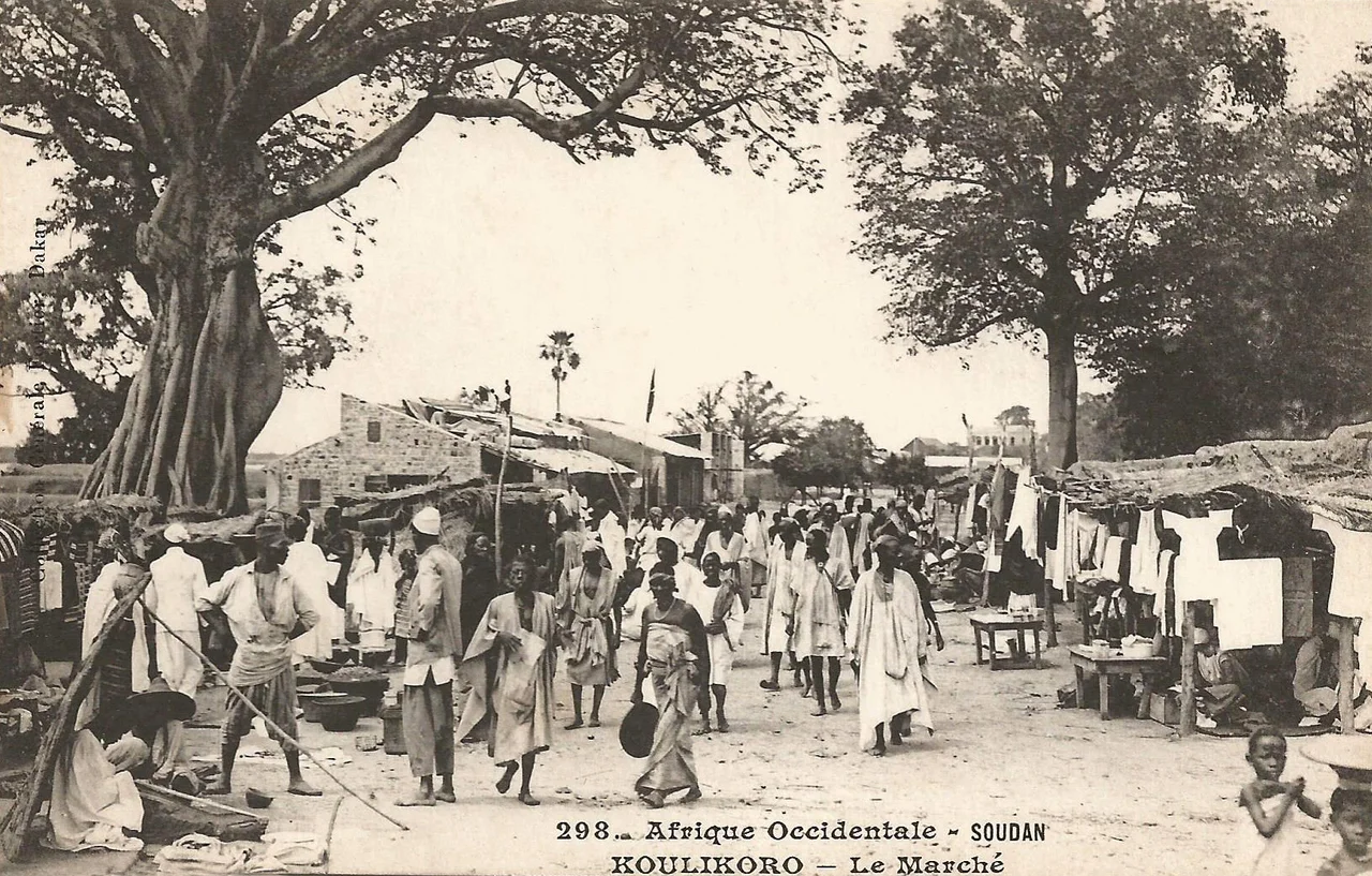
The Niger has always made Koulikoro a place of arrivals. An old photograph from 1898 shows the Hourst mission stepping ashore, French explorers charting the river that the empires of the Sahel had used for a thousand years before them. The town grew a market, a town hall, the workaday infrastructure of a regional capital - Koulikoro is the seat of its region, a modest administrative center on the great water. The same river that once carried Sundiata's world now carries grain and goods downstream every wet season, the rhythm of the flood as reliable as the rails that once ended at the quay.
Hard Histories
Koulikoro carries a heavier modern story too. Its prison has held a number of former Rwandan officers convicted of taking part in the 1994 genocide, sent to serve their sentences far from home under international arrangements. It is a sobering footnote for a town whose name otherwise belongs to railways and river trade and the founding legend of an empire - a reminder that the quiet places on the map are sometimes asked to hold the weight of distant tragedies. The Niger keeps flowing past all of it, indifferent and constant, as it has since long before any of these histories were written.
From the Air
Koulikoro lies on the north bank of the Niger River at 12.87°N, 7.57°W, about 59 km downstream (northeast) of Bamako. The nearest major airport is Bamako-Sénou International (ICAO: GABS), roughly 65-70 km southwest. From the air, follow the Niger northeast out of Bamako past the white water of the Sotuba Rapids; Koulikoro appears where the river broadens into navigable channels below the rapids, backed by low hills. The legendary field of Kirina lies in the surrounding country. Clearest viewing is the dry season, November to February, before harmattan haze thickens.
Nearby Stories
- Nyamina 15 km away
- Siby, Mali 41 km away
- Bamako 47 km away
- Narena 97 km away
- Tukulor Empire 100 km away
- Morila Gold Mine 110 km away
- Boucle du Baoulé National Park 132 km away
- Ségou 143 km away