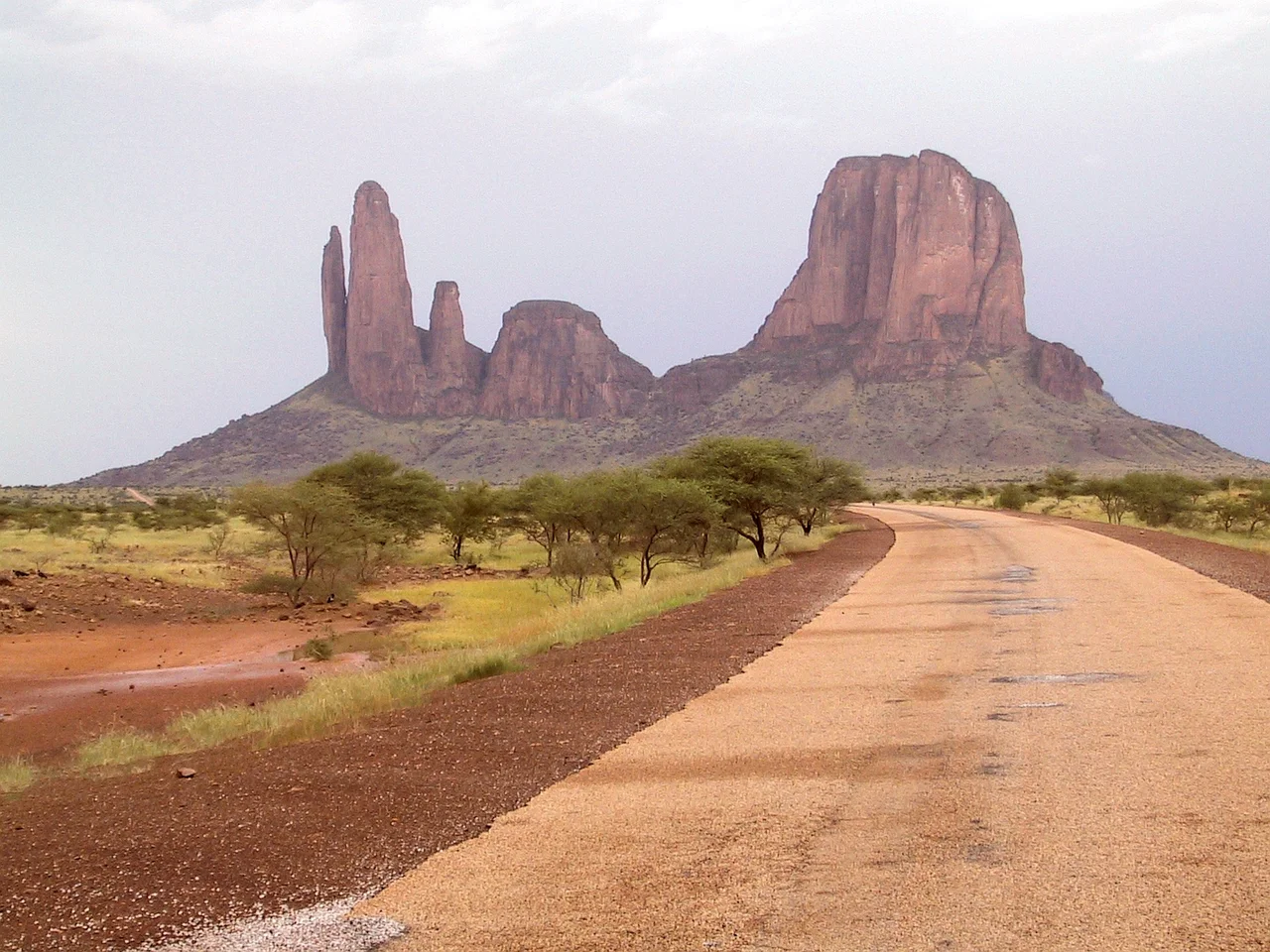

Hand of Fatima (rock formation)
From a distance they look exactly like what they are named for: five fingers of stone reaching out of the flat Malian desert toward the sky. The Hand of Fatima, known locally as Gami Tondo and to climbers as the Needles of Gami, is a row of sheer sandstone towers near the town of Hombori, in the Mopti Region of Mali. The name honors the daughter of the Prophet Muhammad, whose hand is a protective symbol across the Islamic world, and standing beneath these pillars, the comparison feels inevitable.
Fingers of Stone
The formation's individual towers carry their own names: Kaga Pamari, Kaga Tondo, Wangel, Debridu, and Suri Tondo. Largest of them is Kaga Tondo, whose name translates from the local tongue as something close to "Big Rock," a plain label for an extraordinary thing. These are not gentle hills. The walls rise almost six hundred meters from the desert floor, near-vertical faces of warm-toned sandstone that catch the low sun and glow at the edges of the day. The surrounding country, broken by similar buttes and mesas, has earned comparisons to America's Monument Valley, but the Hand of Fatima stands apart, a vertical exclamation point in a horizontal land.
World-Class Walls
Climbers found their way here for good reason. The Hand of Fatima offers some of the finest big-wall sandstone climbing anywhere, with routes graded into the serious end of the spectrum, around E4 in the British system or 7a in the French. Kaga Tondo's North Pillar has been called the longest sandstone route in the world, a climb stretching some 2,400 feet up a single face. In December 2006, the Italian climbing group known as the Lecco Spiders, one of the storied names in alpinism, came to the Hand and made numerous ascents, opening new lines on the towers. For those who pursue rock at its most demanding, this remote corner of West Africa became a name worth crossing a continent to reach.
Reaching the Hand
Getting to the Hand of Fatima was always part of the challenge. The towers rise from the Gourma region of central Mali, a long way from any city, near the small Songhai and Dogon town of Hombori and its neighbor, Mount Hombori, the highest point in the country. For a brief window the formation drew a steady trickle of climbers and adventurers, lured by the combination of untouched rock and genuine remoteness. In the years since, instability across the Sahel has made the region difficult and often dangerous to visit, leaving the towers largely to the wind, the heat, and the few who still know them. The fingers remain, indifferent to it all, reaching up exactly as they have for ages.
From the Air
The Hand of Fatima rises at 15.24°N, 1.80°W in the Gourma region of central Mali, a few kilometers from the town of Hombori. From the air the towers are unmistakable: a tight row of vertical sandstone pinnacles casting long shadows across an otherwise flat, tan landscape, with the bulk of Mount Hombori (Hombori Tondo, 1,155 m, Mali's highest point) nearby to the east. The pillars are best seen with low-angle light in early morning or late afternoon, when the sun rakes their sheer west or east faces and the fingers stand out in sharp relief. The nearest sizable airport is Mopti (GAMB), roughly 180 km to the west-southwest; Timbuktu (GATB) lies to the north across the desert. Dry-season Harmattan dust can soften the horizon; the clearest conditions come just after the summer rains.
Nearby Stories
- Djibo 99 km away
- Sangha, Mali 105 km away
- Agacher Strip War 108 km away
- Bandiagara Escarpment 127 km away
- Kabara, Mali 149 km away
- Gorom-Gorom 152 km away
- Azawad 170 km away
- Fall of Timbuktu 184 km away