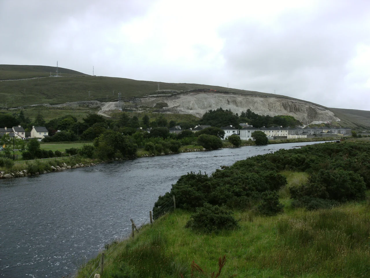

Bangor Erris
In February 1934, workmen widening a road outside Bangor Erris struck something solid ten feet down. They dug it out: a wooden box twelve feet long, three feet wide, bound by six sturdy copper hoops. When they opened it, they found thirty-six pikes with their handles still intact, several pike heads without shafts, and seven rusted rifles of a type that looked French. The pikes dated to 1798. The rifles resembled the muskets the French had carried ashore at Killala that same year, when they marched east with Irish allies in a doomed attempt to overthrow British rule. Someone had buried the arms in the bog and never returned for them. The road crew returned them to daylight after 136 years.
The Townagh Flood
December 1818. Heavy rain pounded the hills above Bangor Erris for days, swelling four small lakes until their banks could hold no more. In the dark, the lakes burst together and sent a wall of water down the valley. Seventeen people drowned. Most of them belonged to a single family, the O'Haras, whose cottage lay directly in the flood path. Three soldiers of the 92nd Highlanders died with them - revenue men on duty against the illegal stills of the region, billeted with the O'Haras as guests. All three had survived the Battle of Waterloo three years earlier. They had marched against Napoleon at Quatre Bras and across the field of Waterloo. They drowned in a Mayo bog in their sleep. During the same storm, two more soldiers got lost in the dark and died in the bog itself.
The Crying Stone
Just east of the village, beside the N59, stands a sculpture called the Crying Stone by Colm Brennan. It was commissioned for Mayo County Council's Millennium Initiative, and it commemorates the sorrow felt by the people of this area when their kinfolk sailed for America. Erris was one of the worst-hit regions of the Great Famine. Many who survived the 1840s left in the decades that followed - to Boston, to Chicago, to a continent that needed labour and offered survival. The Crying Stone marks the moment of parting. The roads out of Bangor Erris carried the young of generations westward to a coastline they would never see again.
The Bangor Trail
South of the town runs one of the oldest paths in Ireland. The Bangor Trail stretches roughly forty kilometres through the Nephin Beg mountains and Owenduff Bog to Newport, an ancient drover route believed to date back to the Iron Age and the principal way south from Erris since the sixteenth century. It is among the most demanding waymarked walks in the country - ten hours of bog and mountain for the fit, twelve for most others. Along the way the trail crosses traces of pre-Famine settlement, the stone footprints of cabins where families lived before hunger and emigration emptied this landscape. The walk passes through some of the largest tracts of unsettled wilderness left in western Europe. It is one of the few corners of the island where, for hours at a time, you can see no road, no house, no human structure at all.
The Bingham Lodge
On the western edge of town stands Bingham Lodge, built in 1823 by Major Bingham, the same Bingham who introduced the Revenue Police to Erris to stamp out illicit poteen distillation - and, according to local tradition, to give himself personal protection. The lodge was attacked and burned during the Irish Civil War in 1922 but never fully destroyed. Despite decades of neglect, it still stands beside the Owenmore River, its carved timber surrounds and central hall preserved. Two upheavals - the great flood of 1818 and the lodge's near-destruction in 1922 - bracket the building's first century. It has outlived both.
Eileen Lynn Kato
Among the people born around Bangor Erris is Eileen Lynn Kato, an academic and translator who spent her career rendering classical Japanese poetry and Noh theatre into English. In 1991 she was appointed Gakari, or advisor, to the Japanese emperor - an extraordinary distinction for a scholar from a remote Mayo town. The path from Bangor Erris to the Imperial Court of Japan ran through translation, through patient study of waka and Noh, through decades of work that bridged two of the most distant corners of the world. The town has produced an Ireland-international Gaelic footballer in Johnny Carey, and through Kato, a voice trusted in the most refined courts of Asia. Distance from the centre is not, as it turns out, the same as remoteness from the world.
From the Air
Bangor Erris sits at 54.143 N, 9.740 W in remote north County Mayo, on the N59 trunk road between Ballina and Belmullet. The nearest airport is Ireland West Airport Knock (EIKN), about 80 km southeast - a meaningful drive. Sligo (EISG) is even further. From 3,000 feet on a clear day, you can pick out the thin road threading west through the immense brown expanse of the Owenduff Bog and Nephin Beg mountains, with the Atlantic glinting at Broadhaven Bay to the north. This is some of the least populated airspace in Ireland - expect long stretches of unbroken bog and few visual reference points beyond the coast.
Nearby Stories
- Inishkea Islands 11 km away
- Newport, County Mayo 12 km away
- Swinford 13 km away
- Easky 13 km away
- Glencolmcille 36 km away
- Inishbofin Island 39 km away
- The Laki Eruption: The Volcano That Changed World History 1156 km away