.jpg)
Glencolmcille
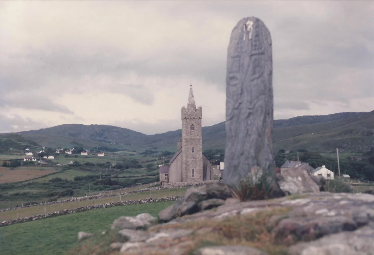
On 9 June every year, in a tiny village on the northwest coast of Donegal, the locals walk five kilometres around fifteen holy sites in the order Saint Colm Cille is said to have walked them. Traditionally, the procession starts at midnight. Traditionally, it is done barefoot. The route winds past court tombs constructed three and a half thousand years before Christianity reached Ireland, past holy wells, past stones inscribed with crosses, past a Church of Ireland chapel built in 1828. Queen Anne tried to outlaw this kind of pilgrimage in 1703, declaring such assemblies to be 'Riots and unlawful.' The proclamation has not particularly stuck.
The Valley of Colm Cille
Glencolmcille means 'the valley of Colm Cille,' the sixth-century Irish saint better known abroad as Columba. Born in Donegal around 521, he studied on the east coast, got mixed up in the dispute that produced the Battle of Cul Dreimhne, and exiled himself to Iona in Scotland, where he founded the great monastery that would later send the Columban federation back across Ireland and into the Hebrides. He travelled by sea everywhere. There is no firm documentary evidence that he ever stood in this particular glen, but the local tradition is old, the legend is plausible, and the place feels chosen. The main settlement is called Cashel. Beyond it the road meanders through Malin More to end at Malin Beg, where Silver Strand opens beneath a horseshoe of cliffs.
Stones Older Than the Saint
The pilgrimage walks through landscape that was already sacred long before Colm Cille's name attached to it. The court tomb at Cloghanmore, reached up a lane branching inland from Malinmore, was constructed around 3500 BC. It is aligned east-west so that the midwinter sun peaks over the mountains to shine straight into its chambers. Farranmacbride, four hundred metres north of St Columba's Church, is another ruined court tomb. It has a perforated standing stone two metres tall. Local tradition says heaven may be glimpsed through the perforation by the pure and devout. At Malin More, a portal tomb dated to around 2000 BC still stands. The Christian sites layered themselves onto this older sacred geography rather than displacing it, and the annual Turas walks both at once.
Silver Strand and Slieve League
Just outside Malin Beg, a long flight of steps descends to Silver Strand, also called An Tra Bhan, a horseshoe cove of pale sand walled by cliffs. There is no boat ramp; the only way in is the steps. A sea stack at the western end of the cove draws rock climbers. The next inlet west, the Uaig, holds a small fishing pier. Two kilometres offshore from Malin Beg sits Rathlin O'Birne island, uninhabited since the lighthouse was automated. The waters around it are hazardous; in 2017, anglers needed rescue twice in two months, and the second rescue ended in two recovered bodies. Further east along the coast rise the Slieve League cliffs, among the highest sea cliffs in Europe, reached by boat tours from Killybegs or by hiking trails from Teelin.
An Irish-Speaking Place
Glencolmcille is in the Gaeltacht, the area where Irish remains the daily language for a significant portion of the population. The percentage of daily Irish speakers has been declining for decades, but the language is still here, in the pubs, the shop, the school, the festivals. Since 1984, Oideas Gael has run Irish-language courses out of the village, drawing students from across Ireland and abroad. The Folk Village Museum at the edge of Cashel preserves several traditional thatched cottages and demonstrates what daily life looked like before electricity reached this coast. Sliabh Liag Distillers operate from Carrick near Teelin, making gin while their whiskey distillery is built near Ardara. Two pubs, John Eoinin's and Roarty's, anchor the village social life, often with traditional fiddle music.
The Road In
From Donegal Town, you take the N56 west to Killybegs, then the R263 over the hills. The lane twists and rises, sheep ambling out of the way at their own pace, and eventually delivers you to the glen. Local Link bus 293 makes the trip from Donegal Town five times a day. Buses out are sparser. Mobile signal is patchy from Three and Vodafone, nothing from Eir, no 5G. The Wild Atlantic Way, the marketing brand that runs 2,500 kilometres from north Donegal to Kinsale in Cork, threads through Glencolmcille on the scenic R230 from Ardara before resuming east on the R263. Most visitors come, see Silver Strand and the cliffs, eat at the Rusty Mackerel in Teelin or An Chistin in the village, and leave. Some stay for the language courses. A few walk the Turas on June 9th, and a smaller number still walk it barefoot at midnight.
From the Air
Located at 54.71°N, 8.72°W on the southwest tip of County Donegal, between Slieve League and Glen Head. Best viewed at 2,000-4,000 feet to catch the dramatic sea cliffs, Silver Strand cove at Malin Beg, and the scattered villages set in the glen. Nearest airport is Donegal (EIDL), 55 km northeast; Sligo (EISG) 75 km southeast. The coastline here is among the most dramatic in Ireland; weather can change in minutes off the open Atlantic.
Nearby Stories
- Glenveagh Castle 7.8 km away
- Classiebawn Castle 10 km away
- Owey Island 11 km away
- Lough Erne 18 km away
- St Patrick's Purgatory 21 km away
- Ballycastle, County Mayo 28 km away
- RMS Empress of Britain (1930) 52 km away
- Killala 61 km away