
Ballycastle, County Mayo
Seven kilometres north of this small village in north Mayo, hidden under a metre of blanket bog, lies the most extensive Stone Age site of its kind anywhere on Earth. The Ceide Fields are a network of stone walls, enclosures, and dwellings dating to about 3,500 BC - older than the pyramids of Egypt and older than Stonehenge. Neolithic farmers built them, divided the land for cattle and crops, and then watched the climate turn against them. The bog crept across the fields and sealed them in place for five thousand years. When archaeologists began to uncover the walls in the mid-twentieth century, they revealed something staggering: a settled agricultural landscape that had survived intact because the wet that ended it had also preserved it.
The Cross Pillar at Doonfeeny
Two miles west of the village stands the Doonfeeny Cross Pillar, an eighteen-foot stone shaft inscribed with bird-head designs and two simple Christian crosses. It is among the oldest standing stones in this part of Ireland, originally raised in pre-Christian times and later marked with crosses to bring it into the new faith. The pillar still leans against the wind on the slope of an old churchyard. The bird heads are stylised and worn but still legible. They speak of a religion that preceded the one carved over them, and of a community of craftspeople who saw no reason to topple the older stones. Better to mark them, claim them, fold them into the new story.
Tommy Langan
Tommy Langan was born in Ballycastle in 1921 and grew up to become one of the great forwards of Gaelic football. He won All-Ireland Senior Football Championships with Mayo in 1950 and 1951 - the only senior titles Mayo has won since. In 1999 he was named on the Football Team of the Millennium, selected by GAA experts as one of the fifteen finest footballers Ireland had produced across the twentieth century. Langan's name is a banner in north Mayo, where the long shadow of those 1950 and 1951 victories has stretched across decades of near-misses by subsequent Mayo teams. Each September, when Mayo's senior side reaches another All-Ireland final and falls short, the names of Tommy Langan and his teammates resurface in the conversation. They remain the last to bring Sam Maguire west.
The Stags of Broadhaven
Look west from Ballycastle on a clear day and you can see, far out in the Atlantic, the jagged silhouettes of the Stags of Broadhaven - four steep sea stacks rising sharply from the water, their cliffs slick with white guano from breeding seabirds. They are uninhabited and rarely landed on, accessible only to the most skilled climbers. East lies Killala Bay, the wide inlet where General Humbert's French fleet appeared in August 1798. Both views from this village contain stories: one geological, one historical, one ancient and one modern. The Stags have stood there for millions of years. The French came and went in thirty-two days. The village watches both directions and waits for the weather.
On the Gaeltacht's Edge
Ballycastle sits on the edge of the Mayo Gaeltacht - close enough that Irish is still spoken in the parishes just west, far enough east that English dominates the local conversation. The parish was formed by joining the two ancient parishes of Kilbride and Doonfeeney. The name Ballycastle was already in use by 1470. For centuries this was a small market town on a long single street, its life turning on Wednesday markets and the seasonal arrival of fishing boats at the small harbour. Today it lies on the R314 and R315 regional roads, served by a few Bus Eireann routes a day. Healyfest, the annual music event held each August Bank Holiday in a village pub, draws visitors who might otherwise pass straight through.
Bunatrahir Bay
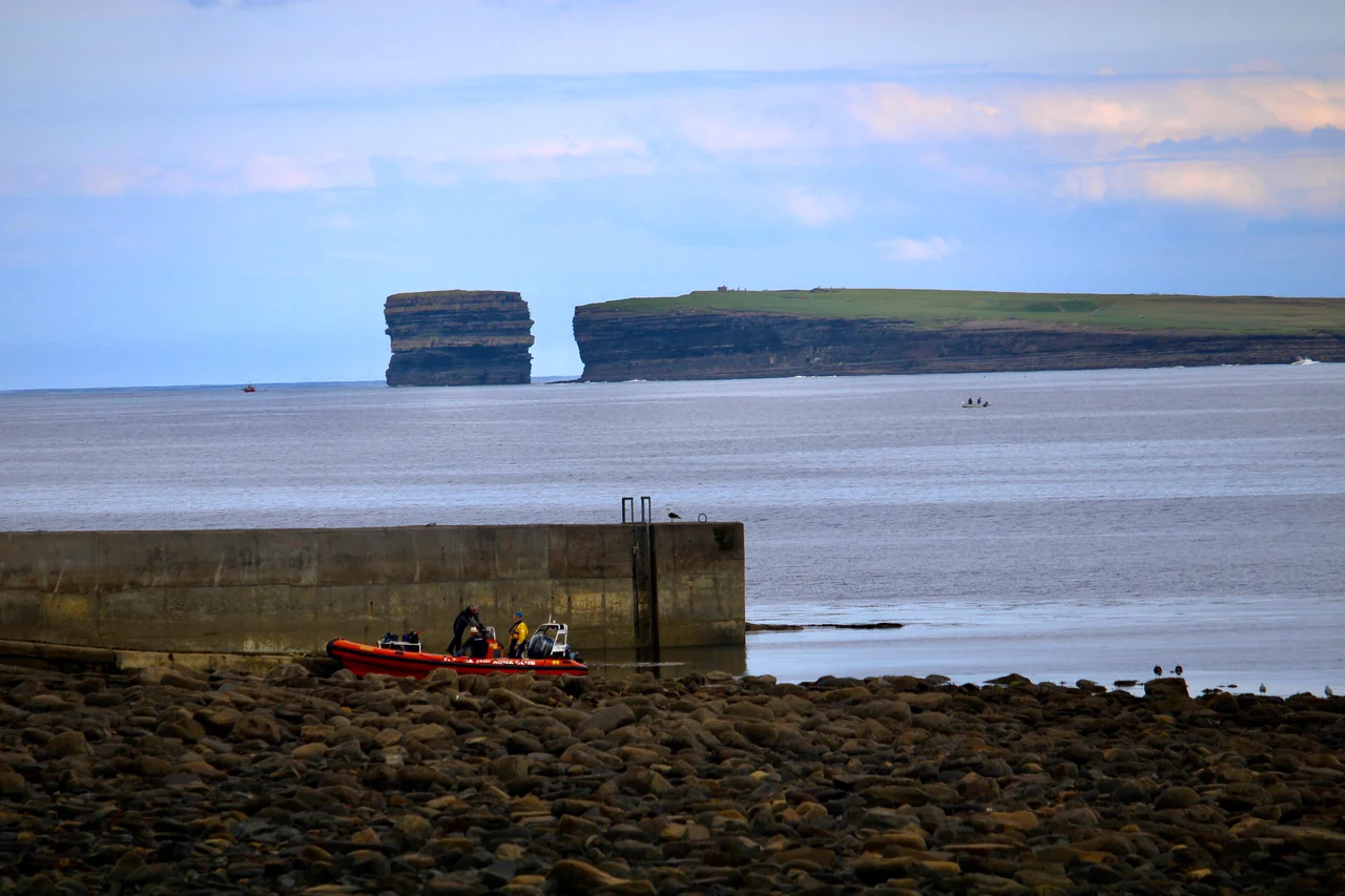
Just east of the village, the small inlet of Bunatrahir Bay opens onto the Atlantic. From here, the cliffs roll along the north Mayo coast toward Downpatrick Head - a famous sea stack and headland a few kilometres further on. The whole coastline from Ballycastle east to Killala forms part of the Wild Atlantic Way, the long tourist route that traces the western edge of Ireland from Donegal to Cork. The Ceide Fields visitor centre, opened in 1993 with its distinctive pyramidal design, sits between Ballycastle and the cliffs. From its observation deck you can see the bog stretching south toward the Nephin Beg mountains and the Atlantic stretching north. The Stone Age farmers who built the walls below the bog had this same view of the same ocean. Their evenings ended the same way ours do. The difference is what came after.
From the Air
Ballycastle sits at 54.283 N, 9.367 W on the north coast of County Mayo, at the junction of the R314 and R315. The nearest airport is Ireland West Airport Knock (EIKN), about 65 km south. From 3,000 feet on a clear day, you can see the Ceide Fields visitor centre on the cliffs north of the village, the Stags of Broadhaven offshore to the west, and the wide opening of Killala Bay to the east. This is exposed Atlantic coast - expect westerly winds and changeable visibility. The view east toward Downpatrick Head includes one of Ireland's most photographed sea stacks.
Nearby Stories
- Tonragee 1.6 km away
- Inver, County Mayo 2.8 km away
- Townlands of Kilcommon 8.4 km away
- Kilmovee 11 km away
- Strandhill 14 km away
- Glencolmcille 25 km away
- The Laki Eruption: The Volcano That Changed World History 1164 km away