
Townlands of Kilcommon
A townland is a unit of land measurement that does not really translate into other systems. It is older than the county, older than the parish, older than the Anglo-Norman invasion that arrived in Ireland in 1169. Many townland boundaries were already ancient when the Normans arrived. Some are demonstrably pre-Christian. They were the practical units by which Irish farmers thought about their own world: who owned what field, who held grazing rights in which patch of bog, where one family's responsibility ended and the next family's began. The civil parish of Kilcommon, in the wild Erris region of northwest Mayo, contains 37 of these ancient units. Most of them have populations in the dozens or low hundreds. Some are uninhabited. All of them have stories that go back further than any building in them.
Carrowteige and the Gaeltacht
Most of County Mayo lost the Irish language in the twentieth century, the way most of Ireland did, as English replaced Irish in the schools, the marketplaces, and eventually the home. A few corners held on. Carrowteige, called Ceathrú Thaidhg in Irish, is one of them, a Gaeltacht village of just over 400 acres near the end of the Dún Chaocháin peninsula. It still has a Catholic church, a national school, a shop, and the office of Comhar Dún Chaocháin Teo, the community development cooperative that has worked since the 1990s to preserve the language and the local economy. Marked cliff walks begin in the village and loop out across the headlands. To the west, the Cill Ghallagáin townland has a seventh-century graveyard, a rare survival from the early Christian period when this stretch of coast was being slowly Christianised by monks from elsewhere in Ireland.
The Willows of Glengad
In the 1650s, Oliver Cromwell's settlement of Ireland forced thousands of native families off their lands in the east and pushed them west, often with the phrase 'to hell or to Connaught' attached. Some of those displaced families ended up in the Erris bogs, in the townland that became Glengad. They brought their basket-weaving craft with them, and they planted willows in the wet ground to provide the rods they needed. The willows took root and have grown in Glengad's streams ever since, more than three centuries later. The name Glengad comes from the Irish word for those willows: gads. The townland is laid out as a linear village, houses and farms strung along a single road. When the Irish Land Commission divided up the land in the early twentieth century, each farm became a narrow strip running from the mountain down to the sea, the last surviving trace of the older rundale system of communal land division.
Sandhills and Promontory Forts
Almost every coastal townland in Kilcommon has prehistoric ruins. Cornboy has a Sandhills Settlement, an Iron Age occupation site half-buried by drifting dunes, with what may be cairns and middens scattered through the sand. Portacloy has the remnants of a promontory fort, a defensive earthwork thrown across the neck of a peninsula by some Iron Age community that wanted the sea on three sides as their walls. Glinsk has the ruins of an English watchtower from 1798, built when British forces were watching for another French landing after Humbert's Killala expedition. Inver, on the Dún Chiortáin peninsula, has the gateposts of a castle where one Michael Cormuck lived in 1636, claiming to own most of the surrounding land while the Protestant Bishop of Killala officially held 'the right of the sea all around Erris'. The same townland features in the mythological story of Táin Bó Flidhais, with a mound said to be the burial place of Flidhais's husband.
Lace Schools and Lady Dudley
Several townlands in Kilcommon had lace schools, organised by the Congested Districts Board, the British government agency set up in 1891 to combat the poverty of Ireland's western seaboard. These were practical training centres where local girls and women learned crochet, knitting, and lace-making, then sold their work for cash income. The schools peaked during the First and Second World Wars, when they made uniform buttons and other goods for armies serving abroad. Aughoose hosted the local headquarters of the Lady Dudley Nursing Scheme, founded in 1903 by Countess of Dudley, the wife of the Lord Lieutenant of Ireland. The scheme provided trained nurses to remote parishes that had no doctor or hospital nearby. The Aughoose nurses cared for patients across the entire parish until the scheme was absorbed into Ireland's public health service in the early 1970s. The dance hall in Aughoose closed in the 1950s. The lace schools were already gone.
The Corrib Gas Controversy
In the late 1990s, Shell discovered natural gas off the coast of Erris, in a field called Corrib about eighty kilometres offshore. The plan was to pipe the gas to a refinery built on a Coillte forestry plantation in the townland of Bellanaboy, then onward to the national grid. The refinery and pipeline ran straight through several of Kilcommon's townlands, including Rossport, Aughoose, Glengad, and Pollathomas. Local residents opposed it on grounds of safety and environmental risk. The pipeline route ran close to their homes, the refinery's location was contested, and the high-pressure gas line was felt to pose unacceptable risk in a place where evacuation would be nearly impossible. The dispute went on for years. Protests were met with arrests. Five men, known as the Rossport Five, were jailed in 2005 for refusing a court injunction. In June 2009, the fisherman Pat O'Donnell from Porturlin reported that his boat was sunk by armed men allegedly connected to the project. The refinery eventually opened in 2014. The bitterness in the parish has not gone away.
From the Air
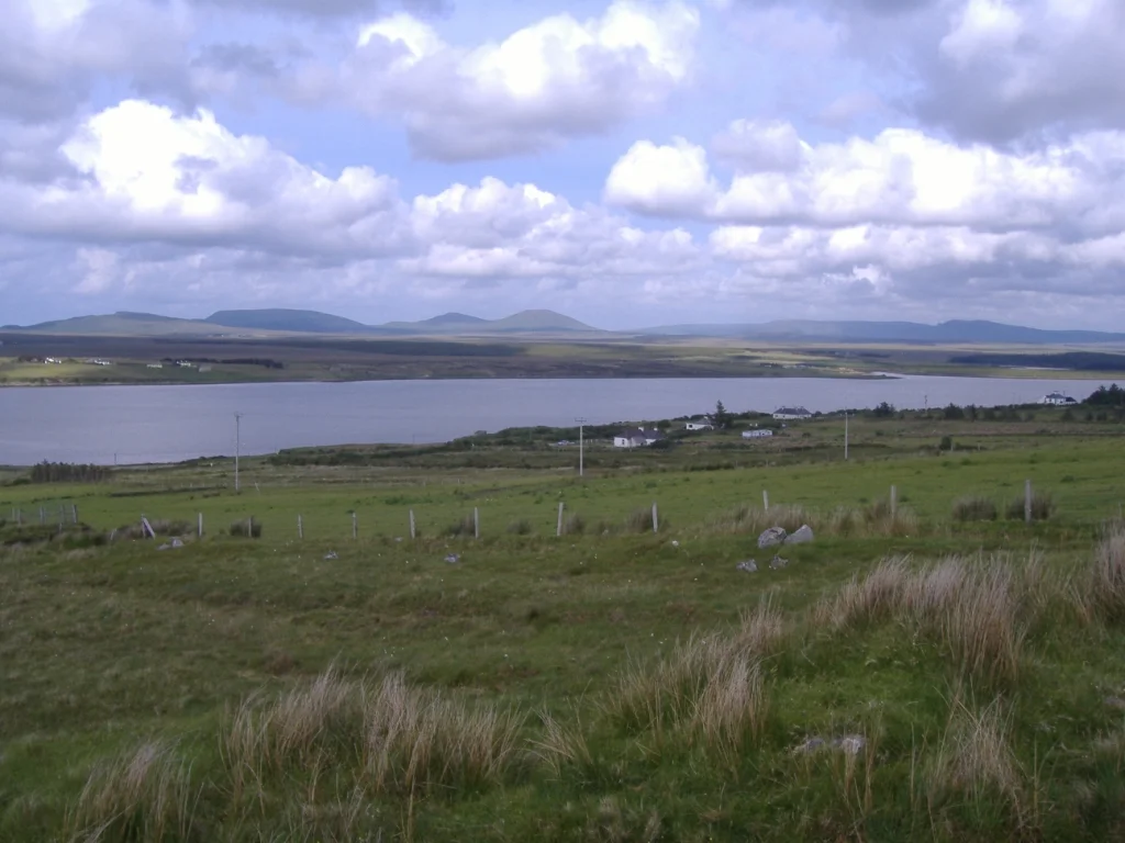
The Kilcommon townlands cover the wild peninsulas of Erris in northwest County Mayo, roughly between 54.0-54.4°N and 9.5-10.0°W. The terrain is blanket bog, mountain, and indented Atlantic coast with two main peninsulas (Dún Chiortáin and Dún Chaocháin) framing Sruwaddacon Bay. Best viewed from 3,000-5,000 ft AGL. Ireland West Airport Knock (EIKN) is approximately 60 nm east-southeast. Watch for low Atlantic cloud and high winds. The coastline features the Stags of Broadhaven sea stacks visible from the cliffs.
Nearby Stories
- Corraun Peninsula 4.7 km away
- Glencastle 5.4 km away
- Aghalard Castle 6.4 km away
- Kylemore Abbey 6.5 km away
- Kilmovee 6.7 km away
- Killala 10 km away
- Glenamaddy 16 km away
- Strandhill 19 km away