
Glencastle
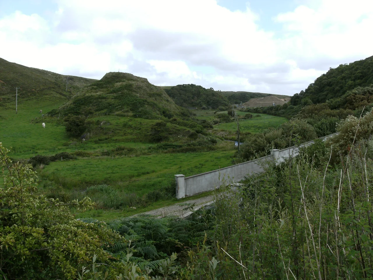
After miles of brown moor between Crossmolina and Bangor, the road dips. The antiquarian Thomas Johnson Westropp described the moment in 1912, and his words still match the experience: you 'suddenly dip into a stream runnel and, without preparation, drop into a lovely wooded glen, at first so narrow that there is barely room for the road and the brook.' This is Glencastle, the Gates of Erris, the only gentle place between the bare bog and the windswept Mullet beyond. In the middle of the valley a grassy moat-like mass of rock rises 90 feet above the stream. This is Dun Donnell, the fort of Domhnall, and the story attached to it is older than written Irish.
The Toll-Keeper of Erris
Glencastle takes its name from the fort that sits at its heart. The fort is called Dun Donnell, or the fort of Domhnall, and Domhnall belonged to the Gamanraige, a mythological warrior tribe of Connacht in the Ulster Cycle. He was an ascendant of Ailill Finn, the husband of the goddess-figure Flidhais, and he appears in the great early Irish tale Táin Bó Flidhais. The legend assigns Domhnall a specific job: he closed the gates of Erris at night and charged tolls on anyone who wished to pass through. The geography fits the story exactly. The glen is the only practical way through the surrounding hills, and a single guarded mound in the centre would have controlled it. The mounds you see today, three of them, have never been archaeologically investigated. The myth and the earth still keep their secrets together.
Westropp's Glen
Thomas Johnson Westropp, an antiquarian who toured Erris in the early twentieth century, left the best description of what Glencastle feels like when you reach it. After the dreary moors, he wrote, you pass 'a regular brown dyke of volcanic rock and a thickly-wooded hillside, hovered over by hawks, and reach the more open valley, the Gates of Erris.' The dyke is geology: a basalt intrusion from some long-ago volcanic event that left a vertical brown wall through the rock. The hawks are still here. The trees, hazels and birches, climb the eastern face of the central fort. A second mound 'like an overturned boat' lies further down the valley. To the north, a mountain swells 760 feet, dominating the view from the fort. Westropp's prose has aged remarkably well, because nothing here has changed.
Old Stones and Lost Stones
Glencastle townland holds more than its central fort. The official record lists several ring forts and cairn sites, the kind of small Bronze Age and Iron Age monuments that dot the west of Ireland in numbers most visitors never notice. A larger megalithic structure once stood here too. The engineer Patrick Knight, who laid out the new road from Belmullet to Bangor in the 1820s, recorded a 'Druidical altar' or cromlech in his notes. It was demolished during the road's construction. Knight himself was a careful documenter of what was being lost; in his book Erris in the Irish Highlands he complained that workers 'unnecessarily destroyed the fine dolmen in the glen rather than divert the road a few feet to one side.' The road still runs where they ran it. The dolmen is gone.
The Barretts of Inver
After the early Christian period, the Clan Barrett took possession of these lands. They held them for about two centuries. The Barrett family produced a Bishop of Elphin and a Baron of Irrus, the old Latinate name for Erris, and the variation of the castle's Irish name reflects their tenure. They lost the lands through revolt and shifting allegiances in the seventeenth century. The fort at Glencastle does not appear to have served as their primary residence; that role went to Inver Castle further north. But the toll-keeping function of the glen would have suited any medieval lord just as well as it suited the mythological Domhnall. The geography is the geography. Whoever holds the gates of Erris controls who passes.
From the Air
Glencastle sits at 54.18°N, 9.88°W in a narrow wooded valley running roughly east-west between hills, about 8 km east of Belmullet town. The valley is the only soft point in the otherwise bare moorland separating the Mullet Peninsula from the rest of Mayo. From low altitude, the green wooded glen and the central rocky mound of Dun Donnell stand out vividly against the surrounding brown bog. Belmullet Aerodrome (EIBT) is roughly 10 km west; Ireland West Airport (EIKN) is about 70 km east-southeast. Best photographed in low morning light when the valley shadows reveal the relief.
Nearby Stories
- Achill Island 1.4 km away
- Ballycastle, County Mayo 10 km away
- Battle of Castlebar 17 km away
- Action of 7 May 1794 27 km away
- Glencolmcille 55 km away
- RMS Carinthia (1925) 84 km away
- RMS Empress of Britain (1930) 87 km away
- The Laki Eruption: The Volcano That Changed World History 1149 km away