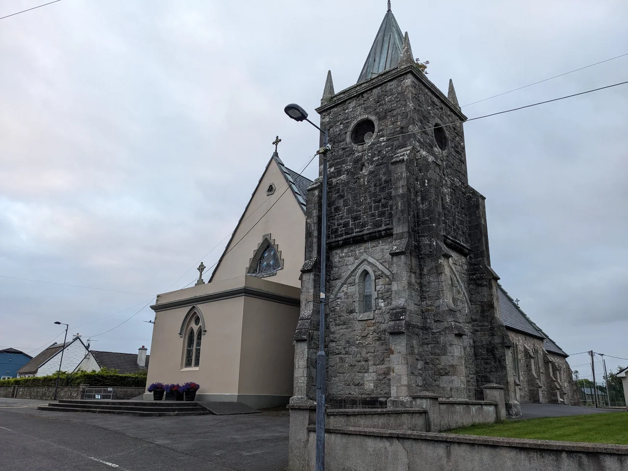

Kilmovee
There are three wells on a quiet patch of ground in Kilmovee, and beside them stands a damaged ogham stone bearing letters worn nearly past reading. Local tradition holds that the wells sprang from the earth when Saint Mobhi struck the soil with his staff, finding no water to baptise the people who had gathered to him. The stone itself is older still. Its scratched edges spell out fragments of an Irish name in a script that predates Christianity. Both relics now share the same small clearing, the pagan beside the Christian, in a parish that has spent fifteen hundred years layering one story on top of another.
Mobhi the Teacher
Kilmovee takes its name from Cill Mobhi, the Church of Mobhi, after a sixth-century cleric known as Mobhi the Teacher. His name is a pet form of Berchan, and he is believed to have died in 544 during a pestilence that swept Ireland and scattered his disciples. One of those disciples was Columba, who left for Ulster and would later sail for Iona. The teacher is gone, the original church long vanished, but the village still carries his memory in its name. The three wells beside the ogham stone are folk memory anchored to landscape - the kind of story that survives because the place itself refuses to let it die.
The Kingdom of Sliabh Lugha
Before the Normans arrived, this corner of Mayo belonged to the Kingdom of Sliabh Lugha, ruled by the O'Gadhra Dynasty. Sliabh Lugha was a subdivision of the larger Gailenga kingdom, the name surviving today in the modern barony of Gallen. Then came the Nangles - the de Angelo family - riding southwest from De Lacy territory in Carrick-on-Shannon. They forced the O'Gadhras from their stronghold at Airtech Mor and raised their own castle on the site in 1225. It became known as Castlemore, and the surrounding region took the name Castlemore-MacCostello. The kingdom dissolved into a barony, the chiefs into tenants, the old order into a new one written in stone and Latin charter.
The Sraheens Barracks
Three Royal Irish Constabulary barracks once stood in the parish - at Kilkelly, Rathnagussaun, and Sraheens. The Sraheens building is still there, derelict but standing, a low grey shell that has outlived the empire it was built to police. In June 1921, during the War of Independence, the Kilkelly Company of the East Mayo IRA opened sniper fire on the barracks under the command of Mick Moffett. A single Black and Tan was wounded. That was enough. The barracks was abandoned, and the constabulary's grip on this corner of Mayo quietly slipped. The walls of Sraheens still mark the spot where one small skirmish helped end an occupation.
Ceoltoiri Mobhi
In 1975, a teacher named Seosamh Mac Gabhann founded a senior ceili band in the village and named it Ceoltoiri Mobhi, after the long-dead saint. The band found audiences beyond the parish, and two of their tunes entered the trad repertoire as The Kilmovee Jigs. Two years later, in 1977, the village opened one of the first rural swimming pools in Ireland - a small civic miracle for a place this size. Mac Gabhann died in 2008. Since 2011, the Seosamh Mac Gabhann Summer School has gathered each year in Kilmovee to honour the Irish-language playwright and music teacher who spent most of his life here. The Cois Tine Heritage Centre, opened in March 2004, anchors the village's cultural calendar.
The Flattest Ten in Ireland
Since April 2010, Kilmovee has hosted an annual charity ten-kilometre run that draws competitors from across the country. Its reputation rests on a single boast: locals call it the flattest ten in Ireland. In a country of hills and weather, that is a serious claim and a serious draw. The route loops through the rural parish where weavers once worked and where, in 1837, Samuel Lewis described a quiet country settlement on the road to Ballaghaderreen. The runners pass the same fields, the same hedges, the same wide Mayo sky. The course beneath their feet hasn't changed much. Only the speed has.
From the Air
Kilmovee sits at 53.887 N, 8.688 W in central County Mayo, on the R325 between Kilkelly and Ballaghaderreen. The closest major airport is Ireland West Airport Knock (EIKN), about 18 km west, with Sligo Airport (EISG) roughly 60 km north. From 3,000 feet on a clear day, the parish reveals itself as a patchwork of small fields and stone-walled townlands, the River Lung threading through low rolling country. Atlantic weather rolls in fast from the west - plan visual flight here for the high-pressure days.
Nearby Stories
- Glenamaddy 4.4 km away
- Neale, County Mayo 7.1 km away
- Townlands of Kilcommon 7.6 km away
- Killala 9.6 km away
- Ballysadare 10 km away
- Scramoge Ambush 13 km away
- Glangevlin 14 km away
- Athlone Castle 23 km away