
Battle of Heavenfield
The night before the battle, according to Bede, the exiled Northumbrian prince Oswald had a vision of Saint Columba telling him he would win. The next morning, in 633 or 634, beside the line of an already four-hundred-year-old Roman wall, Oswald raised a wooden cross, prayed aloud with his soldiers, and waited for the enemy to come up the slope at him. The Welsh king Cadwallon ap Cadfan of Gwynedd, who had laid waste to Northumbria and killed two of its kings in a year, came on. He never went back south.
A Year of Disaster
Northumbria, the great northern Anglo-Saxon kingdom, had been broken in less than twelve months. On 12 October 633, at the Battle of Hatfield Chase, an unlikely alliance between Cadwallon of Gwynedd (a Christian Briton) and Penda of Mercia (a pagan Anglian) killed King Edwin of Northumbria. The kingdom split between its two old sub-kingdoms, Bernicia in the north and Deira in the south. Cadwallon's army ravaged both. Eanfrith, returning from exile, became king of Bernicia. Osric, Edwin's cousin, took Deira. According to Bede, Cadwallon killed Osric while Osric was trying to besiege him in summer 633, then ruled the two regions as a tyrant. Eanfrith was killed soon after when he came to negotiate. Both Northumbrian sub-kings were dead within a year. The new heir was Eanfrith's brother Oswald, returning from seventeen years of exile, which may have included time among the Christian Gaels of Dál Riata in western Scotland.
Standing Beside the Wall
Cadwallon advanced north from York along Dere Street, the old Roman road. Oswald took up a defensive position beside Hadrian's Wall about four miles north of Hexham, facing east, with his flanks shielded by Brady's Crag to the north and the Wall itself to the south. The Welsh army was larger, but the narrow front between crag and wall meant they could not outflank the Northumbrians. Cadwallon had to come at Oswald head-on. According to Bede, Oswald raised a wooden cross and prayed for victory with his troops before they engaged. We do not know how long the fighting lasted or how many died. We know only that the Welsh line broke and the survivors fled south, pursued by Northumbrians who had a year of devastation to avenge. Cadwallon was caught about ten miles south at a stream Bede called Denisesburna, the Brook of Denisus, identified by some scholars as the Rowley Burn near Whitley Chapel.
The Saint-King
After the battle, Oswald reunited Deira with Bernicia and became king of all Northumbria. Bede, writing a century later, saw the victory as the moment Christianity was restored to the kingdom. Oswald reigned for eight years before he was killed at the Battle of Maserfield in 641 or 642, fighting Penda of Mercia (Cadwallon's old ally). His brother Oswiu succeeded him. Oswald was venerated as a saint almost immediately; his hands, his head, and various other relics were distributed across Europe over the following centuries. The site where he raised his cross became a place of Christian pilgrimage. The Welsh name for the battle, recorded in the Annals of Wales as Bellum Cantscaul, may carry an echo of the original landscape. The Welsh word cant means a circular enclosure; ysgawl means a warrior or hero.
The Site Today
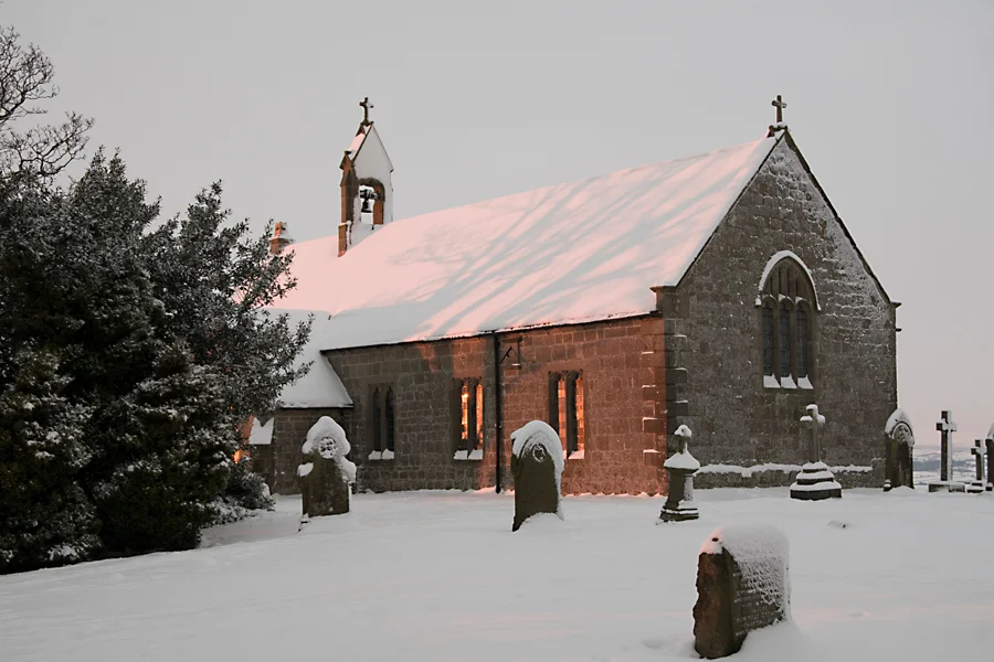
On the B6318, the military road that follows Hadrian's Wall east from Chollerford, a wooden cross stands at the roadside marking the traditional battle site. On the hill north of the cross stands St Oswald's Church, Heavenfield, on the spot where Oswald is said to have raised his battle standard. The site is around 2.8 miles east of the River North Tyne. The exact location is debated. The historian Max Adams, drawing on a 1233 charter rediscovered in 1864, has argued for a site near Devil's Water, with the battle beginning on the east bank and moving to the ford at Peth Foot. St Oswald's also features in an episode of the British TV detective series Vera (series 10, episode Dirty).
Flying Over Heavenfield
Coordinates 55.020 N, 2.100 W, geohash gcy90. Cruise 1,500 to 3,000 ft AGL for the best read of the wall and the rolling pasture. The traditional battle site lies along the B6318 military road, which traces Hadrian's Wall east-west across the moor. From the air, look for the distinctive straight line of the Wall stretching toward the horizon in both directions, and the small isolated church of St Oswald's on the rise just north of the road. The River North Tyne flows north-south to the west; the South Tyne joins it at Warden about 4 miles south. Hexham sits 4 miles south on the south bank of the Tyne. Newcastle International Airport (EGNT) lies 19 miles east-northeast, the closest IFR field. Carlisle Lake District Airport (EGNC) is 37 miles to the west along the wall.
From the Air
Coordinates 55.020 N, 2.100 W. Cruise 1,500-3,000 ft AGL. Look for Hadrian's Wall as a straight line east-west across the moor; the small church of St Oswald's, Heavenfield, sits just north of the B6318 road. Hexham 4 miles south. Newcastle International (EGNT) 19 miles east-northeast.
Nearby Stories
- Seaham 4.3 km away
- Murder of Harry Collinson 6.6 km away
- Kielder Water 8.8 km away
- Battle of Hedgeley Moor 11 km away
- MS Oslofjord (1937) 12 km away
- Jedburgh 13 km away
- Cross Fell 16 km away
- HMS Nottingham (1913) 17 km away