
Kielder Water
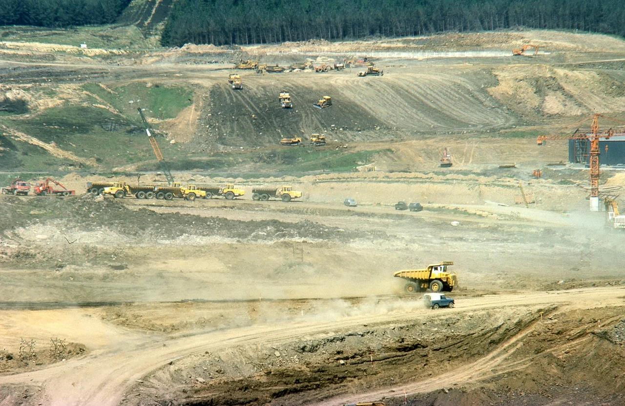
When the Kielder Water scheme was approved by Parliament in 1974, the planners were trying to solve a problem that would not exist by the time their solution was finished. They expected the heavy industries of the North East - steel, chemicals, shipbuilding - to keep demanding more and more water through the 1980s and 1990s. They were preparing for an industrial future. They got a deindustrial one. By the time the dam was complete in 1981 and Queen Elizabeth opened the project in 1982, the steel mills had shut, the shipyards had closed, and the predicted water demand had vanished. The lake now holds two hundred billion litres of water that the region does not really need, in a valley that once held farms, a school, and ninety-five people.
What Was Drowned
Building Kielder Water meant flooding the upper valley of the North Tyne, a remote stretch of Northumberland upland that had been farmed in a thin, hard way for centuries. The reservoir absorbed numerous farms, a school, and most of the valley's tiny population - about ninety-five people in all - who were bought out and relocated. The old line of the Border Counties Railway, which had run along the valley before Beeching closed it in 1956, was submerged. So were stone bridges, farm tracks, and field walls that had taken generations to build. The hamlet of Yarrow, where the dam was sited, ceased to exist. What replaced them is now the longest shoreline of any reservoir in Northern Europe - twenty-seven and a half miles, looped around drowned valleys and submerged hills. On a still day, when the lake is glass, the geometry of vanished fields can sometimes still be sensed just under the surface.
The Forest That Came With It
Kielder Water sits inside Kielder Forest, one of the largest man-made woodlands in Europe. The forest was planted by the Forestry Commission from the 1920s onward, mostly with non-native conifers - Sitka spruce, Norway spruce, Scots pine - that would grow on poor upland soils that nothing else profitable would touch. By the time the reservoir filled in 1984, the forest had reached maturity, and the lake came into being already surrounded by 250 square miles of dense, dark woodland. The combination created something unusual in England: a genuinely large, genuinely empty landscape. Red squirrels still hold out here against the grey invaders that have driven them out almost everywhere else in England. Ospreys have returned to breed. The dark sky observatory at Kielder is one of the best places to see stars in the country, because there are almost no lights for thirty miles in any direction.
The White Elephant Question
Kielder has been called a white elephant since before it was finished. The scheme was justified by projected industrial water demand that never materialised, and the reservoir's primary water-supply function - transferring water through pipelines and rivers to Teesside, Tyneside, and Wearside in times of drought - has rarely had to operate at the scale originally imagined. Whether the scheme was foolish or merely unlucky depends on how charitably you regard 1970s economic forecasting. The reservoir does have other jobs. It generates electricity through England's largest hydroelectric plant, a six-megawatt installation opened by the Queen in 1982 using a 5.5 MW Kaplan turbine and a smaller 500 kW Francis turbine that runs continuously on the compensation flow into the North Tyne. It saves around 8,500 tonnes of carbon dioxide a year. It supports trout fishing, sailing, kayaking, cycling, and over 250,000 visitors a year. It may not solve the problem it was built for. It solves several other problems instead.
Brittonic Roots
The name Kielder was first recorded in 1309 as Keldre, and it began life as a river name. Linguists trace it to Brittonic caleto-, the same root that gives Welsh caled meaning hard, suggesting either a hard rocky river bed or a tough piece of country to live in - probably both, given the upland geography. The Brittonic Celts named these northern uplands long before the Anglo-Saxon and Norse settlement that followed. Their language has almost vanished, but it survives in dozens of river names across northern England: Kielder, Tyne, Wear, Derwent. The hard country has stayed hard. The drowned valley simply became hard underwater instead. Standing on Tower Knowe in the cold spring rain, watching the surface of an entirely man-made lake ripple over what used to be somebody's pasture, the antiquity of the place name feels appropriate. It is the kind of land that has always been called hard.
From the Air
Coordinates 55.1833°N, 2.5°W. Kielder Water sits in the high country of west Northumberland, only a few miles south of the Scottish border, in the heart of Kielder Forest and Northumberland International Dark Sky Park. From the air the reservoir is unmistakable - a large irregular lake stretching about 7 nm northwest-to-southeast through dense conifer plantation, with a 27.5-mile shoreline and the main dam at the southeast end above Falstone. The surrounding forest extends for many miles in every direction, with very few roads or settlements. Best viewed 3,000-5,000 ft in clear conditions; the reservoir is a striking feature against the dark forest. Nearest airports: Newcastle (EGNT) about 35 nm east-southeast, Carlisle Lake District (EGNC) about 30 nm west-southwest, Durham Tees Valley (EGNV) about 50 nm south-southeast.
Nearby Stories
- Kirtlebridge Rail Crash 7.1 km away
- Battle of Heavenfield 9.7 km away
- Hawick 11 km away
- Ireby 12 km away
- Alston Moor 13 km away
- Weardale Railway 13 km away
- Battle of Hedgeley Moor 16 km away
- Oliver Castle 23 km away