
Cross Fell
England has only one named wind. The Helm Wind howls down Cross Fell's western escarpment with such force and such regularity that locals gave it a name centuries ago, and it still arrives most reliably in spring, dropping cold air off the high plateau into the Eden Valley below with a shrieking sound and a long dark cloud roof, called the helm bar, hanging above. Cross Fell was known to its medieval neighbours as Fiends Fell, said to be the haunt of evil spirits. The story goes that St Augustine of Canterbury blessed the hill on his travels, banishing the demons and renaming it Cross Fell. The fiends, as anyone caught in the Helm Wind will testify, may have moved but they have not entirely gone.
Roof of the Pennines
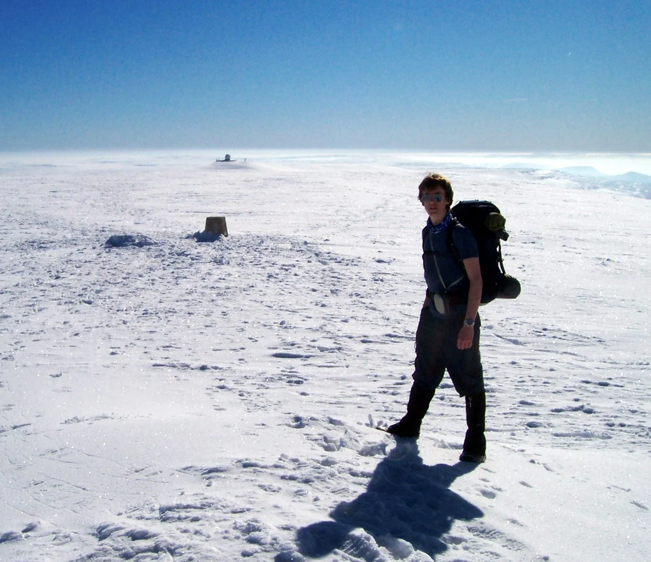
At 893 metres, Cross Fell is the highest point in the Pennines and the highest ground in England outside the Lake District. The summit is a stony plateau rather than a peak, part of a long ridge running north-west to south-east that also takes in Little Dun Fell at 842 metres and Great Dun Fell at 848 metres, the latter crowned by the white golf-ball radome of an air traffic control radar that is visible for forty miles in every direction. The three fells together form a single block of high ground above 800 metres, the largest such block in England, and the ridge rises in a steep escarpment above the Eden Valley to the west while descending more gently east toward the South Tyne and Tees valleys. On the summit itself, a cross-shaped dry-stone shelter offers brief refuge from the wind. There are excellent views across the Eden Valley to the Lake District mountains and, on the north side, across the Solway Firth to the Southern Uplands of Scotland.
The Helm Wind
The Helm Wind forms when easterly air rises over the Pennines, cools, and then spills down the steep western escarpment at high speed. Above the descent, a long lenticular cloud forms the helm bar that gives the wind its name. Below, the wind hits the Eden Valley as a blustering, dust-raising stream that can last hours or days. Farmers learned to expect it. Walkers learned to dread it. It is most common in spring, though it can appear any time the conditions align. The shrieking noise as the wind tears through gullies and over crags is what gave the old place name its menace. England has plenty of strong winds, but only this one has its own page in the meteorology textbooks and its own folklore.
Snow That Lasts
Snow lingers on Cross Fell longer than almost anywhere else in England. The high plateau, the latitude, and the persistent cloud combine to keep gullies on the north side filled with old snow well into May in most years. In some years it persists until July. Fresh snowfall in June, technically mid-summer in the northern hemisphere, is common. Precipitation averages around 2,800 millimetres per year, far higher than the Eden Valley below, and much of it falls as snow between November and April. The fell is covered by what scientists call siliceous alpine and boreal grassland, vegetation more typical of Scotland and Scandinavia than England. Cross Fell is its southernmost outlier. Rare alpine plants survive in pockets, including the Starry Saxifrage and a mountain Forget-me-not. The whole area is a designated Special Area of Conservation, and local farmers are required to keep free-roaming sheep off the tops to protect the flora.
Greg's Hut and the Pennine Way
About half a mile north of the summit stands Greg's Hut, a mountain bothy at 700 metres on the contour line, the highest in England. The Mountain Bothies Association looks after it, and refurbished it between 2010 and 2023 with new windows, flooring and a stove. Walkers crossing the Pennine Way often stop here, especially in foul weather, grateful for walls and a roof in country where weather can change in minutes. Cross Fell dominates the skyline along almost the entire 20 mile length of the A66 between Penrith and Stainmore, and it can be picked out from many points in the Lake District, including the summit of Helvellyn. It is reportedly visible in rare clear conditions from the top of Carnedd Llewelyn in Snowdonia, 123 miles to the south-west, an extraordinary line of sight across northern England and the Irish Sea. Most days the fell is hidden in cloud. On the days when it is not, it stands at the centre of the country, fiends or no fiends.
From the Air
Located at 54.7028°N, 2.4872°W, on the main Pennine ridge between the Eden Valley to the west and the South Tyne and Tees valleys to the east. Cross Fell summit at 893 m is part of a connected ridge that includes Great Dun Fell at 848 m, whose white radar dome is the key visual landmark for navigation. Greg's Hut bothy lies about half a mile north of the summit. Nearest airports: Carlisle (EGNC) about 22 nm west-north-west, Newcastle (EGNT) about 34 nm north-east. Caution: severe mountain weather, the Helm Wind can produce strong easterly downdrafts on the western escarpment with little warning, and dense hill fog is common. Maintain safe altitudes well clear of the ridge in marginal weather.
Nearby Stories
- Battle of Heavenfield 0.6 km away
- RAF Spadeadam 2.3 km away
- Ireby 2.3 km away
- Great Gable 3.7 km away
- Kirtlebridge Rail Crash 4.6 km away
- Weardale Railway 7 km away
- Howgill Fells 14 km away
- Bolton Castle 22 km away