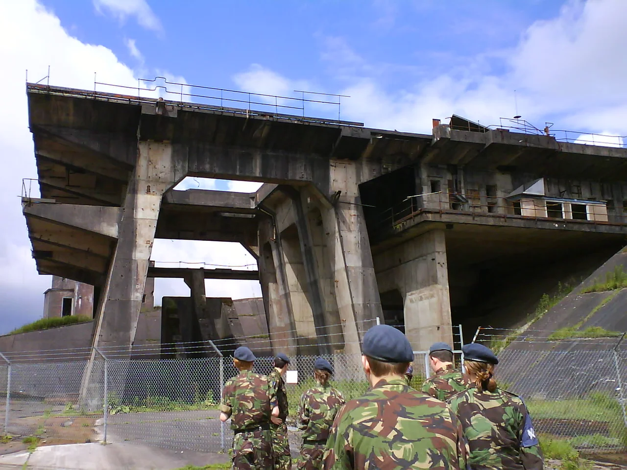

RAF Spadeadam
In 1955, a remote stretch of Cumbrian peat bog known as Spadeadam Waste was chosen for something the British government did not want anyone to see. Engineers blasted concrete launch stands into the hillsides at Greymare Hill, large enough to mount a full Blue Streak ballistic missile. A British Oxygen Company plant rose to manufacture liquid oxygen on site. For nearly a decade, rocket engines roared across the moor, testing the warhead delivery system that was meant to be Britain's nuclear deterrent. Then the programme was quietly cancelled, the silos abandoned, and the trees grew back over the evidence. The truth only surfaced in 2004, when tree felling exposed the remains of an experimental missile silo and confirmed what locals had long suspected.
Britain's Forgotten Rocket Country
The Blue Streak project was Britain's bid to stay in the superpower game. Built in 1955 as the Rocket Establishment, the Spadeadam site was divided into five operational zones spread across the high moorland: administration, the liquid oxygen plant, component test areas, the engine test ranges at Prior Lancy Rigg, and the static firing stands at Greymare Hills. Four concrete engine mounts stood at Prior Lancy Rigg, where Rolls-Royce RZ.2 engines were fired in place. Spadeadam was probably intended to be one of around 60 silo launch sites planned for remote locations across the United Kingdom. None of the others were built. The programme was cancelled in 1960 as ballistic missile technology shifted, leaving Britain with concrete monuments to a nuclear future that never arrived. For decades the silo excavations sat hidden beneath forestry plantation, secret in plain sight.
The Largest Base in Britain
The RAF took over the site in 1976 and reopened it the following year as Europe's first electronic warfare tactics range. The transformation was complete: from launching warheads to teaching aircrews how to survive against modern radar and missile threats. At 9,000 acres, Spadeadam is the largest RAF base in the United Kingdom by area. NATO allies fly missions across the moor, threading between simulated surface-to-air missile sites that test pilots' reflexes and electronic countermeasures. Since 2006, this has been the only mainland UK location where aircrews can drop practice bombs. Joint forward air controller training runs here. Close air support exercises wheel above the heather. In July 2021, the British Armed Forces conducted their first drone swarm trials over Spadeadam, marking another quiet first for a place built on quiet firsts.
Peat, Newts, and Red Squirrels
The moor itself has become an unlikely conservation success. The trees planted after the First World War sat atop a pristine peat bog, one of the rarest habitats in lowland Britain. Between 2008 and 2009, the Forestry Commission made a difficult decision: fell 145,000 trees to let the bog return. Carbon sinks lost; carbon-storing peat reclaimed. The mathematics of climate is rarely simple. The result is a landscape dotted with still ponds and slow watercourses, where otters slip through the reeds and all three native British newt species share the same wetland. Endangered red squirrels still cling to surviving stands of forestry, and the remoteness that made Spadeadam suitable for rocket testing now makes it a refuge from the grey squirrels that have displaced them almost everywhere else. The course of Hadrian's Wall, two millennia old, runs a few miles to the south, a reminder that this borderland has always been a place where empires test their edges.
Hazards and Pipelines
When DNV needs to destroy a pipeline to study what happens, they bring it to Spadeadam. The site hosts industrial hazard testing on a scale impossible almost anywhere else in Britain: full-scale fires, pipeline ruptures, gas releases. The remoteness that drew the rocket engineers in 1955 still draws the engineers who need to break things safely in 2026. RAF Spadeadam received the Freedom of Brampton in June 2017 and the Freedom of Carlisle in June 2018 during the RAF's centenary celebrations. The honours came late, fitting for a place whose work has so often been done behind the wire.
From the Air
Coordinates: 55.025°N, 2.602°W. Recommended viewing altitude 6,000-10,000 ft AGL; airspace restrictions and active EW operations apply. Active danger areas EG D510 cover the range; check NOTAMs before transiting. The course of Hadrian's Wall and the B6318 Military Road run a few miles to the south as a navigation reference. Nearest airports: Carlisle Lake District (EGNC) approximately 20 nm west-southwest, Newcastle (EGNT) approximately 35 nm east-southeast.
Nearby Stories
- Kirtlebridge Rail Crash 7.1 km away
- Battle of Heavenfield 9.7 km away
- Hawick 11 km away
- Ireby 12 km away
- Alston Moor 13 km away
- Weardale Railway 13 km away
- Battle of Hedgeley Moor 16 km away
- Oliver Castle 23 km away