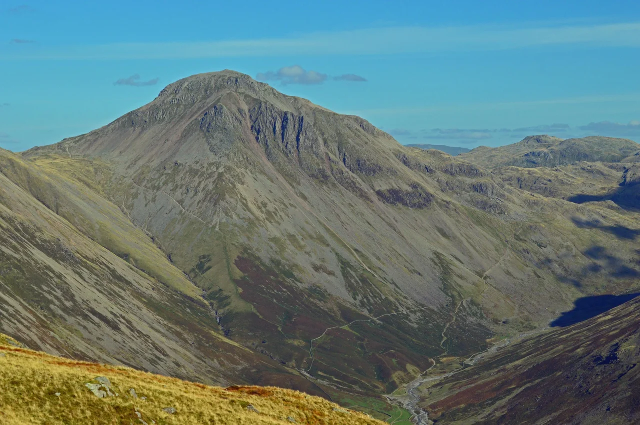

Great Gable
From Wasdale, it looks like a perfect pyramid - the kind of mountain a child would draw. Walk a quarter of the way around it and the pyramid melts into a dome, the dome into a slumped shoulder. Great Gable does not have a true face; it has angles, depending on where you stand. And on Remembrance Sunday each year, a small crowd of climbers gathers at the boulder-strewn summit, takes off hats in the wind, and remembers a war that ended more than a century ago.
A Hub of High Country
Great Gable sits in the middle of everything in the western Lake District. Spread a map and you'll see ridges fanning away from it like spokes - the Western Fells form a horseshoe wrapped around the Ennerdale valley, and at the central hub of that horseshoe stands Gable, with its smaller sister Green Gable beside it and the walkers' pass of Sty Head behind. South of the summit, the ground drops 2,300 feet straight to Lingmell Beck, one of the main feeders of Wastwater, England's deepest lake. The southern flank holds Kern Knotts, Raven Crag and the climbing playground of Great Napes, all footed by long tongues of scree that move underfoot like loose sand. Across to the west, the col of Beck Head at 2,050 feet leads the eye onto Kirk Fell, and a small tarn sits in the dip there - a blind tarn, with no inlet or outflow that anyone can find.
The Climbers' Cenotaph
The summit is a confused tumble of boulders, with a cairn marking the highest point. Set into the rock is a bronze plaque honouring members of the Fell and Rock Climbing Club who died in the First World War. The original plaque had errors in the spelling of the dead men's names - errors that had to be carried for years before they could be put right. On 10 July 2013, thirteen soldiers carried the 70-kilogram bronze down the mountain on a stretcher, the way you might bring an injured climber home. A replacement, properly spelled, was installed by Royal Engineers in September of the same year. Every Remembrance Sunday since, families and climbers walk up in any weather to read those names aloud at the top of England's most central fell. The summit has also become, by quiet consent, a place where ashes are scattered. The mountain remembers.
Westmorland's Cairn, Wainwright's Walk
About 150 yards south of the true summit, on the lip overlooking Great Napes, sits another cairn - smaller, older, with a more personal story. Two brothers named Westmorland built it in 1876 to mark what they considered the finest view in the Lake District. From there the ground drops away into the upper Wasdale valley, and on a clear day the whole western Lakeland trio of Wast Water, Crummock Water and Windermere is visible - three of the four largest lakes of the district in a single glance. Alfred Wainwright, the patient illustrator who taught generations to love these hills, described a walk he called the Gable Girdle, a circuit around the fell at mid-height that takes in the great crags without committing to the summit itself. It is one of the most photographed walking routes in England, a sort of contemplative lap around a sacred space.
Routes Up, and the Reason to Take Them
There is no single best way up Great Gable. Routes lead in from every dale - from Wasdale by the steep direct line, from Borrowdale up Sour Milk Gill out of Seathwaite and over Green Gable, from Ennerdale along the wild north flank. Each approach reveals a different mountain. The Borrowdale connection is tenuous, geographers will tell you - Gable barely touches that valley - but in practice the peak is prominent in almost every view up Borrowdale's lake, and so it feels like a Borrowdale mountain too. That ability to belong everywhere may explain why the Fell and Rock Climbing Club chose this summit for their memorial. Whichever valley you live in, Great Gable is your mountain. The dead they remembered came home to all of it.
Flight Context
Great Gable rises near 54.48 degrees north, 3.22 degrees west, in the central western Lake District. The summit reaches roughly 899 metres (2,949 feet); approach from the south reveals the classic pyramid profile, while approaches from north and east show a broader dome. Best viewed from 5,000 to 7,000 feet AGL; lower altitudes risk wave and rotor turbulence in the lee of the surrounding fells, particularly with westerly winds off the Irish Sea. Nearest airfields: Carlisle Lake District (EGNC) about 30 nm north, Walney Island Barrow (EGNL) about 25 nm south. Cloud frequently caps the summit even on otherwise clear days.
From the Air
Great Gable summit is near 54.48 N, 3.22 W, central Lake District. Best viewed from 5,000-7,000 ft AGL to avoid wave and rotor turbulence in westerly conditions. Nearest fields: Carlisle Lake District (EGNC) about 30 nm N, Walney Island Barrow (EGNL) about 25 nm S. Summit cloud is frequent even on clear days.
Nearby Stories
- Isel Hall 3.3 km away
- Walney Island 7.1 km away
- Kendal 9.7 km away
- Lancaster Priory 10 km away
- Raeberry Castle 15 km away
- Cross Fell 21 km away
- Ramsey Bay 29 km away
- Santon Railway Station 47 km away