
Walney Island
The wind is the first thing anyone says about Walney. The North-West Evening Mail says it. The kitesurfers who come here every year for the British Kitesurfing Championship say it. Even the geranium that grows nowhere else in the world - Geranium sanguineum var. striatum, the Walney geranium - has adapted to constant gales coming off the Irish Sea. Eleven miles long from north to south, never more than a mile across at any point, Walney is a narrow strip of windswept till lying between the western edge of England and a bay full of small Furness islands. The Reverend W. Awdry put a fictional version of it in his Railway Series. He called it Sodor.
How a Glacier Made an Island
Walney was born during the last glacial period. When the ice retreated, the River Duddon left behind a massive lake at its mouth, and the till - the rocky debris carried by glaciers - piled up to form what is now a low ridge of land. Neolithic people lived among its sand dunes; flint tools and pottery fragments have turned up in the south. The Norse settlers who arrived in Low Furness from Ireland and the Isle of Man left the suffix -ey, meaning island, on dozens of local names including this one. The first part, waln, is harder to trace - possibly a corruption of haugr, meaning hill, referring to the manor of Hougun listed in the Domesday Book. Walney stayed pastoral for most of its existence. William Wordsworth, climbing Black Combe in 1810, looked down and described seeing Walney's early fields of corn.
Barrow Builds, Vickerstown Follows
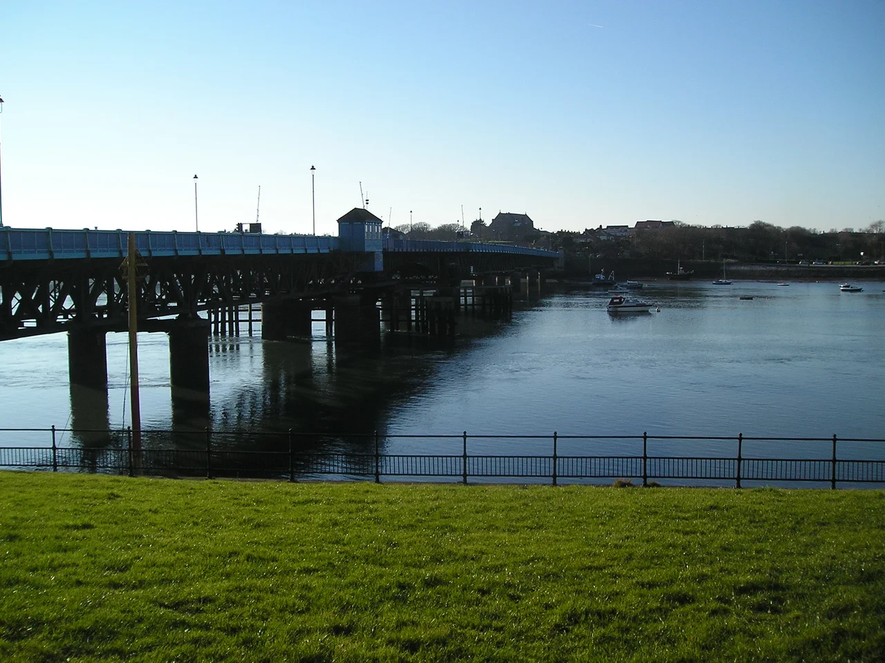
The nineteenth century rewrote everything. Barrow-in-Furness, on the mainland directly opposite Walney's east coast, exploded with shipbuilding. The narrow Walney Channel, dredged to allow large ships into the Port of Barrow, became one of the world's most important deep-water docks. In 1897, faced with thousands of immigrant workers and nowhere to put them, the Vickers company proposed a planned town on the island. The first tenants moved into Vickerstown in 1900. The Jubilee Bridge, a bascule bridge across the channel, was opened in 1908 and is still the only road link to the mainland. The island's population at the 2011 census was 10,651, divided almost evenly between Walney North and Walney South wards. Today the population is about one-fifth of the entire town of Barrow.
Eider, Toads and a Bird Observatory
At each end of Walney sits a nature reserve, and they could not be more different from the dense housing in the middle. South Walney is salt marsh, shingle and brackish ponds, a stopover for thousands of migrating birds. Common eider, Eurasian oystercatcher, ringed plover, herring gull and lesser black-backed gull all breed here. The Walney Bird Observatory has been counting them for decades. North Walney is a habitat for natterjack toads, which are protected in the UK, and for that one-of-a-kind geranium. The west coast is wide sandy beach all the way; the east, facing Barrow, is muddier and built-up. North of Earnsie Point are secluded beaches backed by dunes, where naturists tend to gather. The Furness Abbey records from 1292 mention a monastic grange at Biggar, on the east coast - making that little farming village possibly the oldest settlement on the island.
Sodor, Vicarstown and a Cockfight Song
The Reverend W. Awdry, who wrote the Railway Series books that became Thomas the Tank Engine and Friends, set his stories on a fictional island called Sodor. Sodor's geography is unmistakably Walney's, only bigger - the main town on the east coast is called Vicarstown, located exactly where Vickerstown actually sits. Walney also features in the folk song Wa'ney Island Cockfight, which describes a fight between the lads of North Scale and Biggar; Fiddler's Dram and Martyn Wyndham-Read have both recorded versions. The island has its own football and rugby league clubs. The flat wide beach at Earnse Bay is one of the best windsurfing spots in northern England, which is why the British Kitesurfing Championship comes here every year.
Turbines and Tomorrow
Since 2005, the sea off Walney's western coast has become one of the most important offshore wind farm zones in the world. The Walney Extension, opened in 2018, was briefly the largest offshore wind farm on Earth. From the island's beaches you can watch the turbines turning all the way to the horizon. Walney Airport at the south end of the island, owned by BAE Systems, opened in 1935 and has been a private military and corporate field for most of its life. Scheduled passenger services have come and gone; none has lasted longer than two years. Since 2023 Walney has been part of the new unitary authority of Westmorland and Furness. From the sky it still looks like what it is - a long thin wall of land between the Irish Sea and the bay, holding the bay still while England gets on with its business.
From the Air
Walney Island lies at 54.10 N, 3.25 W, off the western edge of Cumbria. From altitude it appears as a distinctive 11-mile-long, 1-mile-wide strip running north-south, with sandy west coast and built-up east coast facing Barrow-in-Furness across the dredged Walney Channel. EGNL Barrow/Walney Island Airport sits at the island's southern end (private, BAE Systems). Nearest public field is EGNH Blackpool, about 45 nm south; EGNS Ronaldsway, Isle of Man, is 45 nm west across the Irish Sea. Major visual landmark from any direction: the offshore wind farms west of Walney, with turbines visible from cruising altitude in clear weather. Best viewed mid-morning with the sun behind, when the contrast between the white beaches, the green centre, and the offshore turbine arrays is most striking.
Nearby Stories
- Lancaster Priory 0.5 km away
- Kendal 4.5 km away
- Muncaster Castle 5 km away
- Ribble Steam Railway 5 km away
- St Annes Lifeboat Station 21 km away
- Ramsey Bay 28 km away
- Celtic Array 36 km away
- Laxey Bay 38 km away