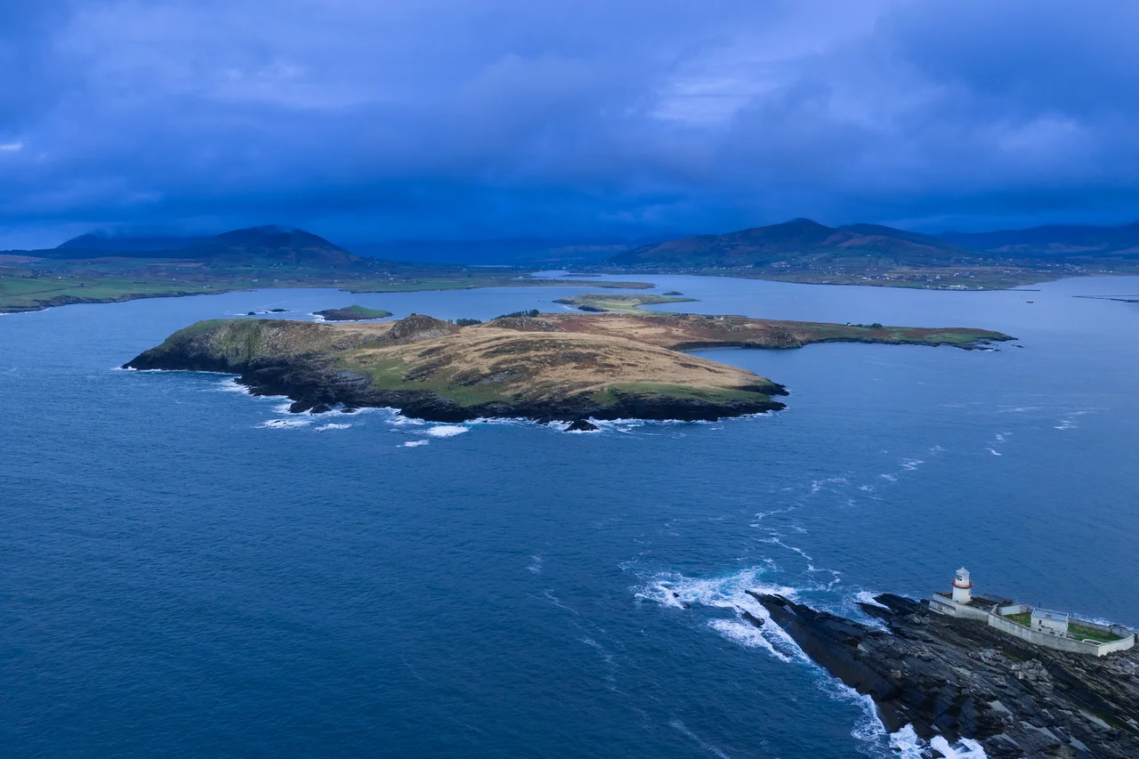

Beginish Island
Two elderly brothers were the last people to live here permanently. They left Beginish in the 1990s, and the island has been technically uninhabited ever since - though sheep still graze it in summer, holiday homes still get a few weeks of use, and tourists land for the beaches. Sometime in the eleventh century, a different inhabitant of this same island carved a small cross and a line of runes into a sandstone lintel above his door. The inscription, when later scholars read it, said: "Verr erected this stone and Munulfr carved the runes." The lintel is now in the Cork Public Museum. Verr's house is still here, sunken into the ground, the shape of it still readable in the grass.
A Viking Settlement on a Kerry Island
Between roughly the ninth and the twelfth centuries, Beginish hosted a small Norse-Irish community - eight houses, fifteen cairns, a network of low stone walls dividing tiny fields, and the inevitable middens, the rubbish heaps that archaeology depends on. The main dwelling still visible was dated to the eleventh century, a circular building 6.75 meters across, with walls of dry-laid stone and a sunken floor a meter and a half below the surrounding ground level. A thatched roof would have covered it, supported by beams set into holes in the walls. The settlement was excavated by Michael J. O'Kelly in the 1950s and reanalyzed by John Sheehan in more recent work. The combination of Scandinavian construction techniques with Irish materials and setting is what makes the site important: this was not a Viking raiding camp but a working community, with one foot in each culture, on an island small enough to walk across in twenty minutes.
The Lintel With the Runes
The runic inscription is short - a single line of futhark above a small carved cross - but it is one of a very small number of runic inscriptions ever found in Ireland. Verr and Munulfr are Old Norse names. The fact that one of them carved an inscription in his own language above his doorway, while also carving a cross beside it, fits a community that had been Christianized but still spoke and wrote Norse at home. The lintel was lifted from the house wall during excavation and transported to Cork; the original opening is now a gap in a low stone enclosure. The find suggests, more than any single artifact in this corner of Kerry, that the Atlantic fringe of medieval Ireland was wired into a much larger world. Verr would have known sailors who had been to Iceland. Possibly to Greenland. Possibly further.
Columns Like the Causeway
On the northern edge of the island, a small section of cliff shows columnar basalt - the same hexagonal rock formations that have made the Giant's Causeway on the north coast of Northern Ireland a UNESCO World Heritage site. Beginish's columns are far less famous and far less developed for visitors; the cliff section is small and not easy to reach. The geology is doing the same trick: cooling basalt that contracted into roughly hexagonal columns as it solidified, producing a regular crystalline structure on a scale that startles eyes used to irregular rock. The Giant's Causeway is the textbook example, but the same Tertiary volcanism that produced it touched scattered points along the western and northern coasts of Ireland, and Beginish is one of the southern outliers.
Sheep, Seals, and a Footballer
Today Beginish is used mostly for summer sheep grazing, with a few holiday homes that see seasonal use and tourist landings from Valentia by small boat. A seal colony hauls out at Casey's Landing, on the southern shore - a cove named for one of the families who once farmed and fished here. The other historical surnames - O'Connell and McCrohan - are still common in the area. The legendary Kerry Gaelic footballer Mick O'Connell, regarded as one of the great midfielders in the history of the sport, came from a family with Beginish roots. An open-water swim of roughly four miles around the island has been held intermittently since the 1990s. The island's busiest day of the year is the day of that swim. Most other days, it is the seals' island and the birds' island and the sheep's island, with the Viking foundations slowly settling further into the grass.
From the Air
Located at 51.933°N, 10.300°W in Valentia Harbour, just north of Valentia Island and west of Beginish Sound. Recommended viewing altitude 1,500-2,500 feet AGL. The island is small (about 1 km across) but distinctive - low and grassy with visible field walls. Doulus Head and Killelan mountain rise on the mainland to the north; Valentia Island and Knightstown lie to the south. Ballycarbery Castle is visible about 3 nm to the southeast. Nearest airport is Kerry (EIKY) about 32 nm northeast; Valentia has a small grass strip (EIVT) within 2 nm. Watch for low-level traffic from Valentia and around the working harbor. Atlantic weather rolls in from the west fast.
Nearby Stories
- 1955 RAF Shackleton aircraft disappearance 3.8 km away
- Ballynavenooragh 5.4 km away
- French Expedition to Ireland (1796) 9.4 km away
- Tralee 12 km away
- Uragh Stone Circle 18 km away
- The Laki Eruption: The Volcano That Changed World History 1385 km away
- The Northern Lights: The Sky Show That Vikings Thought Was Bridge to the Gods 1487 km away
- Sao Miguel 1921 km away