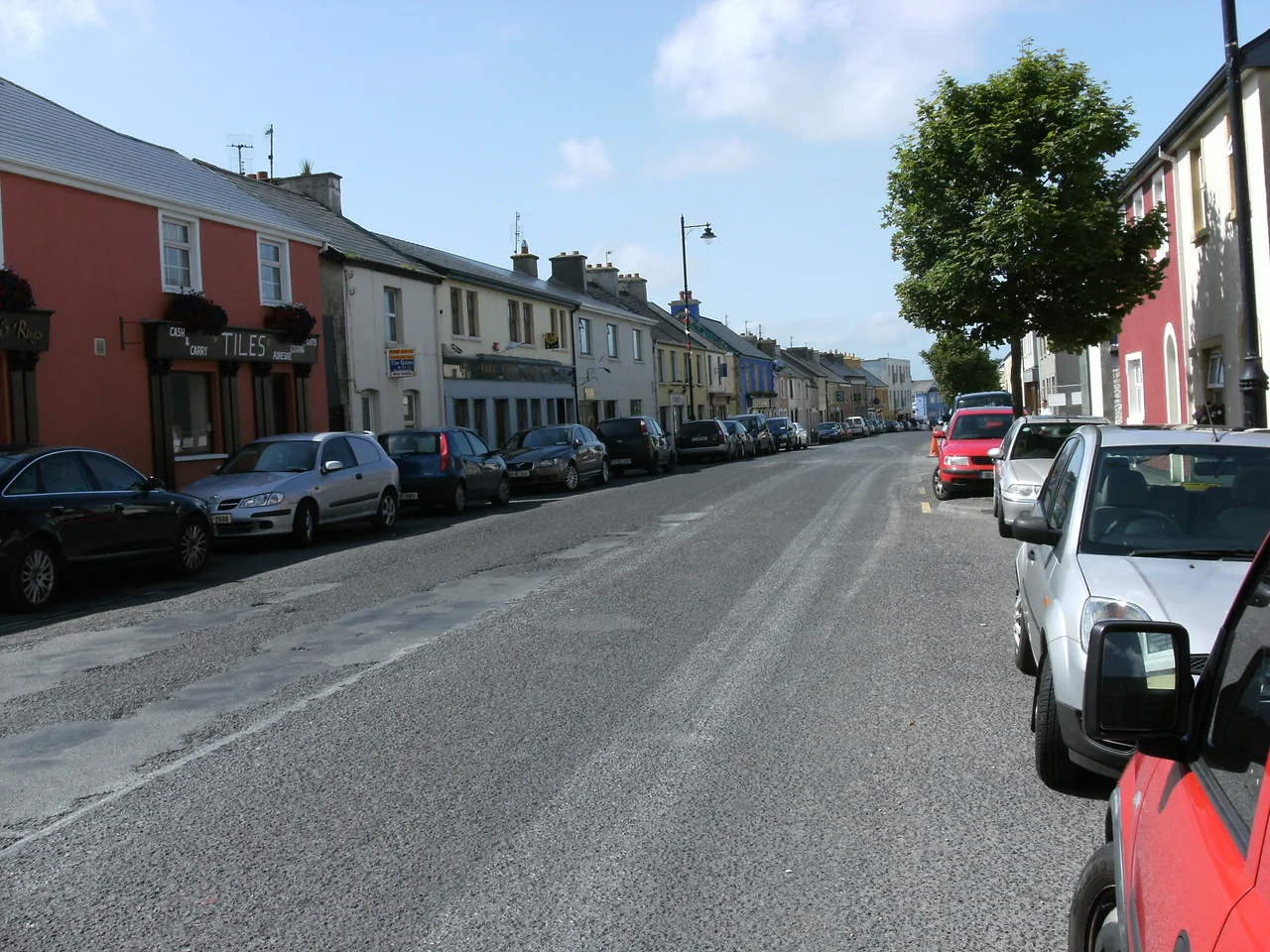

Belmullet
In 1958 the Minister for Lands, Erskine Childers, ordered a fence built across a hill near Belmullet. The local workmen refused. The hill, they said, was a fairy place, and they would not run a fence through it. The government tried to find other men to do the job and could not. In the end, the fence was bent around the hill, and Belmullet went into print in The New York Times under the headline 'Ireland Bows to Fairies and Will Shift a Fence.' This is the kind of town Belmullet is. It is also a Gaeltacht of 1,019 people on an isthmus narrow enough that a canal cut through the town centre lets boats pass from Blacksod Bay to Broadhaven Bay in a few minutes.
A Mirage in the Desert
Belmullet was planned. In 1820 the first post office in the wider Erris region opened here on land that had been little more than thatched cabins and bog. The visionary was William Henry Carter, who had inherited the estate by marriage. He hired Patrick Knight, an engineer from Castlebar, to lay out a proper town between the two bays. In his 1836 book Erris in the Irish Highlands, Knight called Belmullet 'a mirage in the desert,' picturing it as a future Atlantic trading port served by safe anchorage on both sides. A pier large enough for 100-ton vessels went up in 1825. A new road from Castlebar arrived a year earlier. By 1829, the engineer Alexander Nimmo could write that the place 'only commenced four years ago; it now consists of about seventy respectable houses,' with five ships loading grain, coal coming in, and the fishery feeding a market that had not existed within thirty miles.
The Workhouse and the Famine
The boom did not last. The Great Famine struck Erris savagely, and the workhouse built on the site of the current hospital filled to overflowing. At the height of the catastrophe, 3,000 starving people were recorded inside its walls. Charles Trevelyan, head of the Treasury in London, decreed that relief would be given only to those in the workhouse, a policy that turned hunger into bureaucracy and dragged tens of thousands more to their deaths. The canal that Sir Arthur Shaen had first cut in the early 1700s, blocked again for a century, was being re-excavated when the Famine struck in 1845. Work staggered on. The footpaths of Belmullet were laid as Famine relief work in 1846 and 1847. The canal was not finished until 1851. From this town, and the rest of Erris, the great emigration began: to the United States, to England, to anywhere else.
Synge in the Square
John Millington Synge came to Belmullet in 1904 and recorded what he saw with the unflattering clarity that made his name. 'Belmullet in the evening is noisy and squalid, lonely and crowded at the same time and without appeal to the imagination,' he wrote. 'When one has passed six times up and down hearing a gramophone in one house, a fiddle in the next, then an accordion and a fragment of a traditional lullaby, with many crying babies, pigs and donkeys and noisy girls and young men jostling in the darkness, the effect is not indistinct.' On St John's Eve a bonfire burned in the Town Square. A market in that same square the next day sold heather brooms, homespun flannel, second-hand clothes, blackening brushes. The Playboy of the Western World, Synge's most famous play, drew on stories he heard around here, and a poem he called 'Danny' was set on the road back from Bangor Erris.
Wild Atlantic, Bilingual Town
Half the people of Belmullet can speak Irish; only four percent use it daily outside the classroom, but the Gaeltacht designation still shapes the town's summer, when language students fill the place. The Áras Inis Gluaire arts centre, opened in 2007, has hosted Mick Flannery and Damien Dempsey on a stage at the western edge of Europe. Carne Golf Links, the last completed design of Eddie Hackett, sits a few kilometres south and lands regularly on world top-100 lists. The Wild Atlantic Way drove tourists this way; in 2014 The Irish Times named Erris the 'Best Place to Go Wild in Ireland,' and the visitor numbers have not slowed since. Two festivals frame the summer: Féile Iorras in July, Lá an Logha and Féile na Seachtaine around 15 August, when people who left for America and Britain decades ago come home in numbers.
From the Air
Belmullet sits at 54.23°N, 9.99°W on the narrow isthmus joining the Mullet Peninsula to the County Mayo mainland. Carter's Canal cuts through the town centre, the easiest landmark from the air. Belmullet Aerodrome (EIBT) is 2 NM west of town and serves general aviation. Ireland West Airport (EIKN) is roughly 75 km east. Blacksod Bay opens to the south, Broadhaven Bay to the north; in clear weather you can see Achill Island to the southwest. The Atlantic side of this coast generates fast-moving weather; westerlies and showers are common year-round.
Nearby Stories
- Achill Island 1.4 km away
- Ballycastle, County Mayo 10 km away
- Battle of Castlebar 17 km away
- Action of 7 May 1794 27 km away
- Glencolmcille 55 km away
- RMS Carinthia (1925) 84 km away
- RMS Empress of Britain (1930) 87 km away
- The Laki Eruption: The Volcano That Changed World History 1149 km away