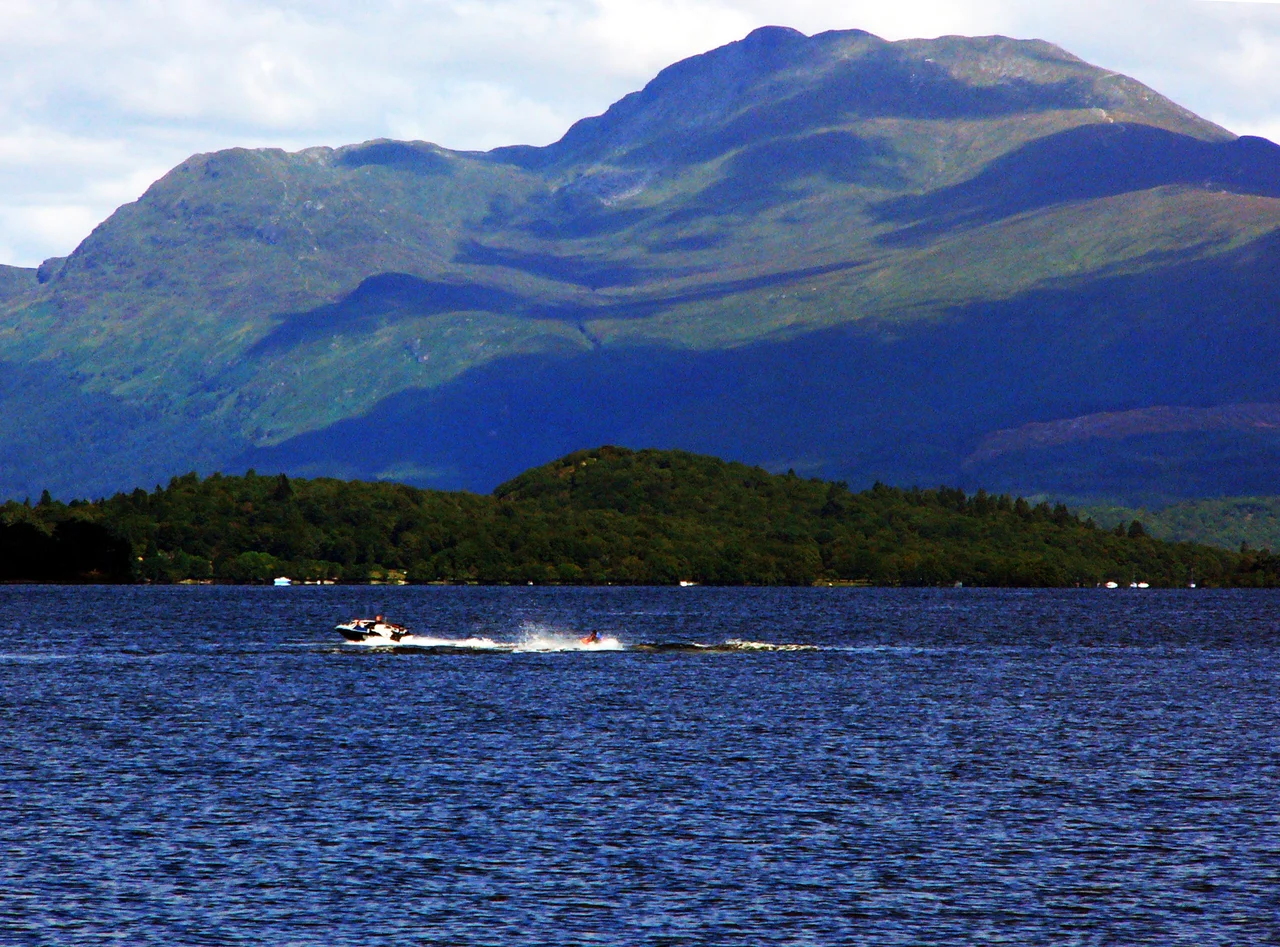

Ben Lomond
By the bonnie banks of Loch Lomond, the song goes. Look up from those banks and you will see the mountain it is talking about. Ben Lomond rises 974 metres straight from the loch's eastern shore, the southernmost of all the Munros — meaning the southernmost of the 282 Scottish mountains over 3,000 feet that take their collective name from Sir Hugh Munro, who first listed them in 1891. About 30,000 people reach the summit every year. Many of them are climbing their first Munro, and many of those will keep climbing them.
The Beacon Mountain
Lomond is older than English in this landscape. The name comes from a Brittonic element, lumon, meaning a beacon — preserved in modern Welsh as llumon and in Scots as lum, still used today to mean a chimney. Ben Lomond, in other words, is the beacon mountain, and the name probably refers to the practical signalling function of high peaks: lit fires that could be seen across long distances, used to call clansmen to arms or to warn of approaching ships. The mountain is the southernmost survivor of the great geological divide that splits Scotland in two. The Highland Boundary Fault runs roughly through Loch Lomond itself, and Ben Lomond stands on the Highland side, looking down across the fault toward the Lowland fields beyond.
The Geology Underneath
The bedrock here tells the story of Scotland's long collision with Avalonia, the continental fragment that includes most of England and southern Ireland. Ben Lomond's geology is dominated by granite, mica schist, diorite, porphyry, and quartzite — the metamorphic rocks of the Dalradian, cooked and folded under enormous pressure when continents collided around 470 million years ago. The mountain lies on the Scottish watershed, the drainage divide that separates rivers flowing east toward the North Sea from those flowing west to the Atlantic. The summit is grassy and rocky, marked by a triangulation pillar — one of thousands placed across Britain by the Ordnance Survey in the mid-20th century for the Retriangulation of Great Britain, before GPS made them obsolete and historically valuable.
Two Ridges Up
The mountain comprises two parallel south-southeasterly ridges that meet at the summit: Sròn Aonaich to the east and the Ptarmigan ridge to the west. The standard ascent, often called the tourist path, starts from the car park at Rowardennan on Loch Lomond's eastern shore and follows the gentler Sròn Aonaich ridge — a wide, well-worn track that has been eroded into a wide scar across the mountainside by all those thirty thousand annual visitors. The summit ridge above it is rockier and narrows to a triangulation pillar with views, on a clear day, that take in Ben Nevis itself more than forty miles to the north. The Ptarmigan ridge offers an alternative route — steeper, rockier, less crowded, with the option of returning by the tourist path to make a circular walk.
Eagles and Ptarmigan
The higher reaches of Ben Lomond support an alpine tundra ecosystem of the kind that survives only on a handful of British summits. Peregrine falcons hunt the slopes. Merlins, the smallest British falcon, nest in the heather. Rock ptarmigan — small grouse that turn white in winter — live here at what may be the most southerly breeding population of the species in Scotland. Studies by the British Trust for Ornithology have noted decline elsewhere, particularly on Goatfell and the Arran mountains, possibly linked to climate change shrinking the cold habitat ptarmigan need. Golden eagles soar overhead. Red grouse rise from the heather. The mountain area also supports sheep farming, and the National Trust for Scotland, which owns it, balances grazing with habitat conservation as part of the wider Ben Lomond National Memorial Park.
The Memorial Park
The Ben Lomond National Memorial Park was opened on Armistice Day, 11 November 1997, by the Right Honourable Donald Dewar — then Secretary of State for Scotland, and later the first First Minister of Scotland after devolution. At the opening, Dewar unveiled a granite sculpture by the Scottish artist Doug Cocker, who had won a Scottish Sculpture Trust competition to design a permanent monument for the park. The dedication is to the Scots who died in the World Wars. When the Loch Lomond and the Trossachs National Park was established in 2002 as Scotland's first national park, the whole Ben Lomond National Memorial Park was included within its boundary. The West Highland Way, Scotland's first long-distance footpath, runs along the western base of the mountain by the loch — most walkers passing through stop to look up at the beacon mountain, and some leave the trail to climb it.
From the Air
Ben Lomond's summit sits at approximately 56.19°N, 4.63°W on the eastern shore of Loch Lomond, with a summit elevation of 974 m (3,196 ft). Recommended viewing altitude 5,500-8,000 ft to clear the summit with margin for turbulence. Nearest airport: Glasgow International (EGPF) 22 nm south-southeast. The mountain stands alone above the loch and is one of the most visually identifiable peaks in central Scotland — the Highland Boundary Fault runs roughly through Loch Lomond itself, with Ben Lomond rising on the Highland side. The summit is often cloud-capped; mountain weather changes rapidly. Visible from Ben Nevis 40+ nm to the north on exceptionally clear days.
Nearby Stories
- Ardchattan Priory 4.3 km away
- Old Firm 5.5 km away
- Callander 9.1 km away
- Skelmorlie Castle 10 km away
- Loch Fyne 11 km away
- HMS Vandal 21 km away
- Fortingall 22 km away
- Rannoch Moor 23 km away