.jpg)
Bere Island
Bere Island's official Irish name is *An tOileán Mór*, the Big Island, which is hopeful: it covers 17.68 square kilometres and held 218 people at the last census. But size is relative, and on Bantry Bay, set against the long Beara Peninsula and the open Atlantic beyond, Bere is large enough to have hosted a Royal Navy fleet, four Martello towers, a barracks for 150 men, and a string of fortifications that the British did not relinquish until 1938. It is large enough today for the French novelist Michel Houellebecq to have made it his hideaway, and large enough to keep two ferries running across to the mainland.
The O'Sullivan Bere and the Siege
Until 1602, the island belonged to the O'Sullivan Bere, the Gaelic chieftains who controlled this corner of the Beara Peninsula from Dunboy Castle on the mainland. That year, Sir George Carew, the English commander tasked with breaking the Gaelic resistance after the Battle of Kinsale, ordered a road built across Bere Island so that troops could be marched across to attack Dunboy. The siege ended badly for the O'Sullivans - Dunboy fell, and at the same moment a smaller force attacked the O'Sullivan garrison on Dursey Island just to the west, where Philip O'Sullivan Beare later claimed three hundred islanders were killed. The aftermath was Donal Cam O'Sullivan Beare's famous winter march of a thousand people across Ireland to seek shelter with the O'Rourkes of Leitrim, of whom only thirty-five survived. The Gaelic order of Beara was broken. The island's military future, for the next 336 years, would belong to outside powers.
Among Ireland's First Martello Towers
Two centuries later, in 1803, with Britain again at war with France and Napoleon's invasion fleet a possibility on the southern Irish coast, Lieutenant-Colonel William Twiss was sent to review Ireland's defences. Rear-Admiral Sir Robert Calder, commanding the Royal Navy squadron at Castletownbere, wrote to the spymaster William Wickham in December 1803 asking for protection for the store ships and victualers based at the Berehaven anchorage. The answer, agreed by the Earl Cathcart's engineers, was Martello towers. Four were built on Bere Island in the round, thick-walled style designed to mount a single heavy gun and resist French naval bombardment. They were reported ready on 2 February 1805, which makes them among the earliest Martello towers completed in Ireland. A barracks for two officers and 150 men went up alongside them, with a signal tower, a quay, and storehouses. The end of the Napoleonic Wars left them largely silent, but they would not stay silent long.
The Treaty Port
In 1898, the British administration in Dublin Castle issued compulsory purchase orders on large areas of Bere Island to build modern coastal artillery batteries protecting the Royal Navy's Atlantic Squadron at anchor in Berehaven Harbour. The strategic logic was that a fleet hidden inside this deep natural anchorage could sortie quickly against a German or French naval threat. During the First World War the harbour buzzed with destroyers, oilers, and capital ships. After the war, during the Irish War of Independence, IRA prisoners were interned on Bere Island - including Canon William Kennedy, head of St Flannan's College in Ennis from 1919 to 1932. When the Anglo-Irish Treaty was signed in 1922, Britain withdrew from most of the new Free State - but kept three deep-water Treaty Ports, including Berehaven, as sovereign bases. Bere Island remained, in effect, British territory until 1938, when Éamon de Valera negotiated their return. Without that handover, Ireland's wartime neutrality after 1939 would have been impossible to maintain.
Stones Older Than Soldiers
Beneath the layers of military stone, Bere Island holds older traces. The townland of Greenane contains a circular enclosure, a ringfort, and a standing stone. At Ardaragh West there is a prehistoric hut site and a collapsed wedge tomb. Cloonaghlin West holds another ringfort. These are the marks of people who farmed and lived here through the Bronze Age and the Iron Age, long before the O'Sullivan Bere arrived, longer still before British engineers carved gun emplacements out of the headlands. The island's highest point, Knockanallig, gives a view that takes in the open Atlantic to the west, the long ridge of the Beara Peninsula to the north, and the curve of Bantry Bay to the east - the same prospect that successive generations of inhabitants have used to watch for whoever was coming next. Off the north coast, the wreck of the *Bardini Reefer* lies where she sank on 12 December 1982 after burning for several days, a reminder that the dangers of this coast did not end with the great wars.
Two Hundred and Eighteen
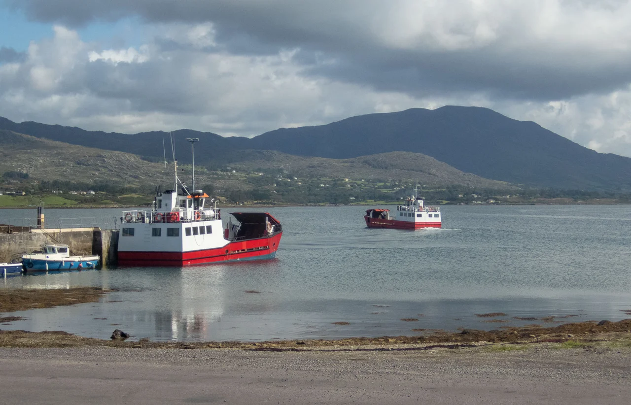
The 1851 census, taken after the worst of the Great Famine, found 1,454 people on Bere Island. By 2022 the population had fallen to 218. The decline tracks the broader emptying of rural Ireland - emigration, particularly to North America, took generation after generation. Unlike many islands off the Irish coast, Bere's inhabitants in the early twentieth century spoke both English and Irish; an 1911 census sample shows a community moving steadily toward English as its first tongue. Today the island is served by two ferries from Castletownbere, both able to carry light vehicles. Mains electricity arrived via submarine cable in April 1958, sixty years after most of mainland Ireland. A local radio station broadcasts on 100.1 MHz for a few hours each Sunday from a transmitter on the island. The French author Michel Houellebecq, drawn perhaps by the same isolation that thinned the population, made it his writing refuge. The island has reinvented its purpose more than once. The Atlantic, the granite, the wind, and the long view of Bantry Bay have not.
From the Air
Coordinates 51.633°N, 9.883°W, in Bantry Bay off the Beara Peninsula in County Cork. The island lies east-west, roughly 10 km long and 3 km wide, with the highest point Knockanallig prominent in the eastern third. Cruise at 2,000-4,000 ft for a clear view of the deep natural anchorage of Berehaven between the island and Castletownbere on the mainland. The four Martello towers and signal tower are still visible from the air on the hills. To the west, Ardnakinna lighthouse marks the western channel entrance. Nearest airports: Kerry (EIKY) about 30 nm northeast, Cork (EICK) about 50 nm east. Bantry Bay can hold cloud below the surrounding hills when the open ocean is clear.
Nearby Stories
- Iveragh Peninsula 4.6 km away
- Ballydehob 5 km away
- Battle of Callann 5.2 km away
- HMHS Llandovery Castle 8.9 km away
- Inishvickillane 21 km away
- SM U-68 41 km away
- RMS Lusitania 66 km away
- Sao Miguel 1909 km away