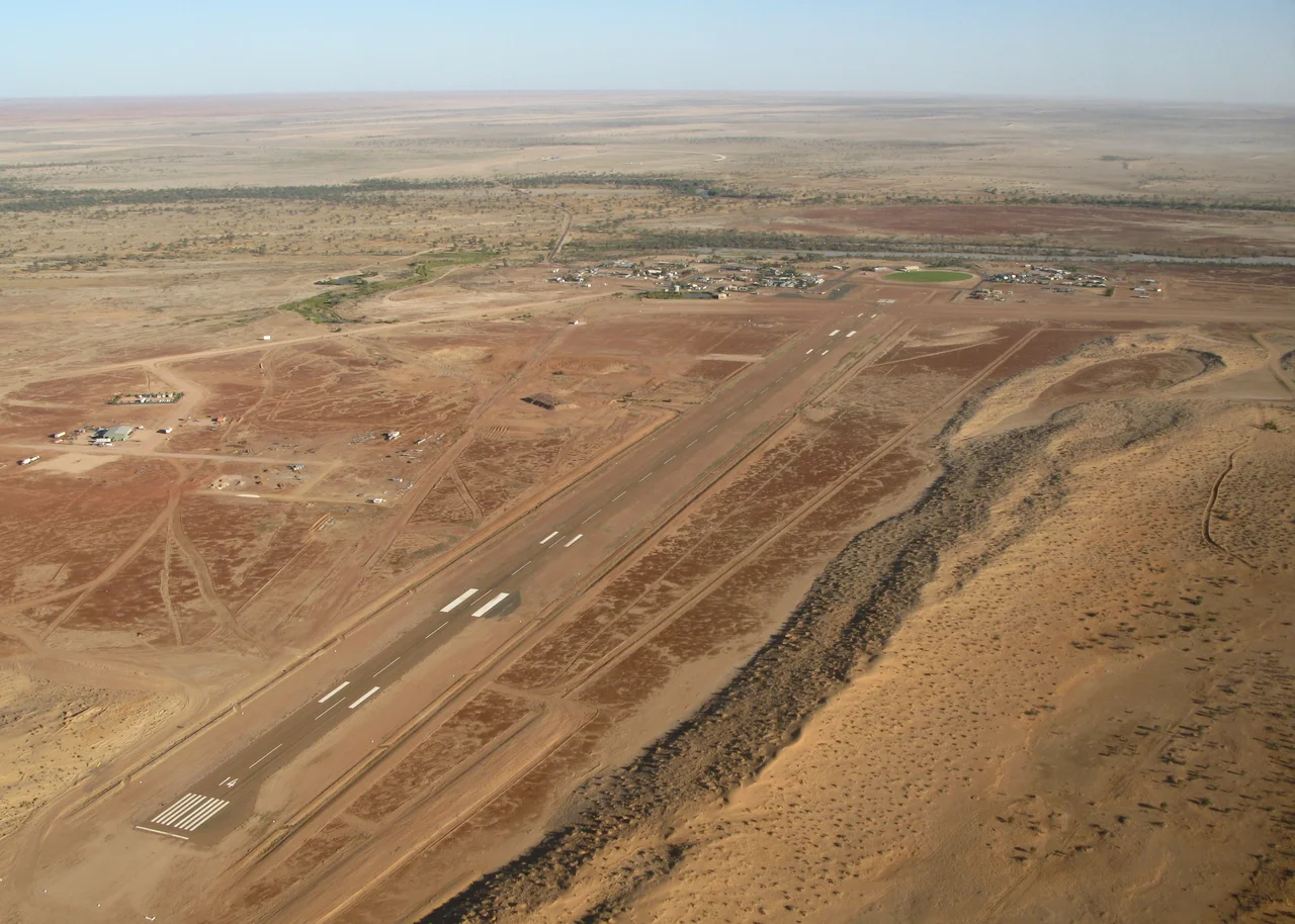

Birdsville Airport
For most of the year the radio is quiet and the windsock hangs limp over an airfield that serves a town of about a hundred people. Then comes the first weekend of September. Out of a clear sky the aircraft arrive in a steady stream - Cessnas, Pipers, Bonanzas, the occasional turboprop - until as many as 200 light planes stand parked across the apron and the surrounding flat, their pilots permitted to roll out swags and sleep under the wings. For two days, Birdsville Airport becomes one of the busiest aerodromes in outback Australia, and then, just as suddenly, the desert silence returns.
The Strip in the Gibber
Birdsville Airport (YBDV to pilots, BVI on a luggage tag) is exactly the kind of airfield that makes the outback feel close and the cities feel far. It sits at about 159 feet above sea level on the gibber plain just west of town, with one sealed runway, 14/32, running roughly 5,680 feet. There is nothing forgiving about the surroundings: red dunes to the west marking the Simpson Desert, stony plain in every other direction, and summer temperatures that routinely climb past 45 degrees. A 1.5-million-dollar upgrade finished in 2011 - funded by the Diamantina Shire Council and the Queensland Government - added a terminal, resealed the surface, and fitted runway edge lights, all to handle the swelling tide of fly-in tourists drawn to the town's outsized reputation.
The World's Longest Mail Run
Long before tourism, the aircraft here did humbler, vital work, and some still do. The Channel Country Mail Run is reckoned the longest mail route in the world, threading more than a thousand kilometres between Port Augusta in South Australia and Birdsville. The plane drops onto remote station strips along the way, swapping letters, parcels, newspapers and groceries for the families running cattle on properties like Glengyle and Durrie - places measured not in suburbs but in thousands of square kilometres. For stations this isolated, the mail flight is a lifeline to the rest of the country, and a rare scheduled visitor. West Wing Aviation has flown the route in recent years; Central Eagle Aviation runs scenic flights out over Lake Eyre when the floodwaters arrive and the salt pan briefly becomes an inland sea.
Wings Over an Inland Sea
There is a second reason pilots point their aircraft at Birdsville, and it depends entirely on rain falling somewhere else. When monsoon floodwaters drain down the Channel Country, they can eventually reach Lake Eyre - or Kati Thanda, to use the name of the country's traditional owners - and the great salt pan, normally bone dry, fills into a vast and temporary inland sea alive with pelicans and other waterbirds. It is a spectacle best seen from above, and operators such as Central Eagle Aviation have run scenic flights out of the region to show travellers a desert briefly turned to water. The rhythm is unmistakably outback: the airfield's busiest seasons are dictated not by timetables but by weather hundreds of kilometres away, and by a town that has learned to make the most of whatever the sky delivers.
When the Sky Fills Up
The races are the reason the airport punches so far above its weight. Because Birdsville lies a long, dusty drive from anywhere, flying in is not a luxury here so much as the obvious choice, and the pilot community treats the September meeting as a pilgrimage. The scene on race weekend is unlike any ordinary aerodrome: tents pitched beside parked aircraft, eskies in the shade of the wings, and a constant choreography of arrivals and departures managed largely by courtesy and common sense. It is general aviation at its most Australian - self-reliant, sociable, and entirely at home in a landscape that would intimidate most travellers. Then Monday comes, the planes lift off in ones and twos, and the strip exhales back into its usual enormous quiet.
From the Air
Birdsville Airport, ICAO YBDV (IATA BVI), sits at roughly 25.898°S, 139.348°E, immediately west of the township, with a published elevation near 159 ft. The single sealed runway is 14/32, about 5,680 ft long and lit. Nearest alternates are sparse: Windorah (YWDH) lies east, Boulia (YBOU) north, Bedourie (YBIE) to the north-west, and Marree across the South Australian border to the south. Expect a remote, non-towered environment - pilots self-announce on CTAF, and during the September races traffic density is extreme, so monitor and broadcast early. Hazards include heat-driven density altitude, blowing dust, kangaroos and birds on the strip, and very long distances to fuel and services. Landmarks: the red Simpson Desert dunes to the west (Big Red lies about 35 km out), the Diamantina River channels, and the tight knot of corrugated-iron heritage buildings that is the town itself.
Nearby Stories
- Annandale Station 3.4 km away
- Eromanga Sea 11 km away
- Carcory Homestead Ruin 50 km away
- Koonchera Point Massacre 56 km away
- Munga-Thirri National Park 86 km away
- Cordillo Downs 90 km away
- Munga-Thirri–Simpson Desert National Park 99 km away
- Currawilla 154 km away