
Bleikvasslia
Water made Bleikvasslia and water finished it, and the two events happened about forty years apart within a few kilometres of each other. At the village's edge, a controlled fall of 135 metres out of Norway's second-largest lake drives three Francis turbines that push roughly 900 gigawatt-hours onto the grid every year. Underground, a short way off, water did the opposite: it seeped into the shafts of the Bleikvassli mine until pumping it out cost more than the zinc and lead coming up were worth. The mine closed in 1998. Same substance, two verdicts, one village of a few hundred people sitting at 314 metres in the upper Rossaga valley.
An Arestue From the 1750s
People lived here long before either the turbines or the ore. Settlement in Bleikvasslia goes back to the 1700s, and an arestue from the 1750s still stands - a hearth-house, the old Norwegian form where the fire burns in an open central hearth and the smoke leaves through a hole in the roof. It is the kind of building that survives in places nobody had a strong reason to modernise.
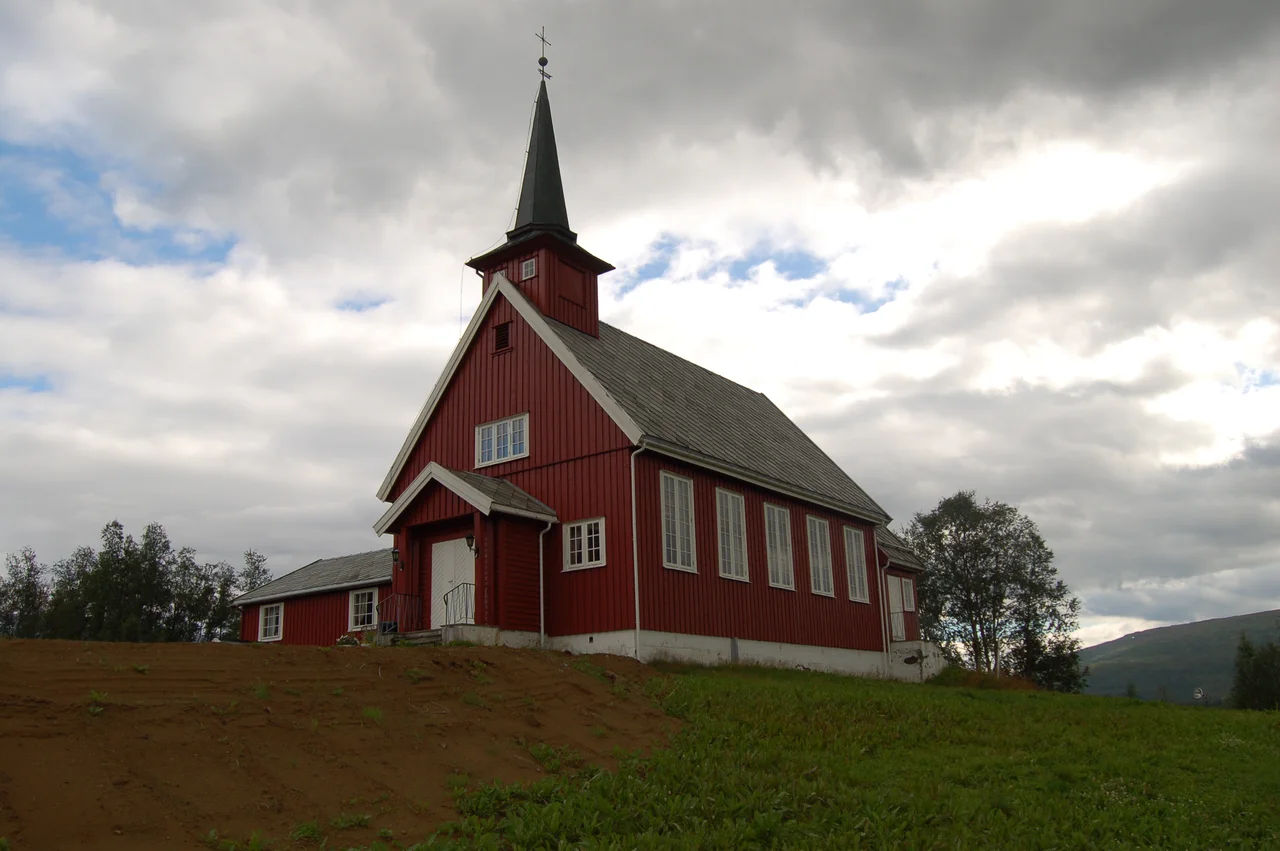
Then the 1950s arrived and gave the valley several reasons at once. The mine opened, the population climbed, and in 1955 Bleikvassli Church was consecrated: a red timber long church designed by Torgeir Alvsaker, seating around 190. A boarding school building from 1920 passed into the hands of the local heritage society. By 2020, counting the valley above Stormyrbassenget and the Kongsdalen side valley, a little over 400 people lived here.
What the Rock Held
Bleikvassli Gruber A/S went after a mixed body of ore - svovelkis, zinc and lead, with small showings of other metals. Pyrite, in English, though the money was in the zinc and lead. The mine opened in the 1950s and ran for roughly four decades, which in the arc of Norwegian metal mining is a respectable innings and not a long one.
Groundwater ended it. Hard-rock mines in wet country are always a negotiation with the water table, and the negotiation is only worth having while the metal price holds. In 1998 the shafts were left to flood. What is unusual is what happened next: rather than dissolving, the company reinvented itself, moving into contracting and IT work. The ore body is under water. The payroll, in reduced form, is not.
The Top of the Water Chain
Bleikvasslia sits between two very different bodies of water. Northeast of the houses is Bleikvatnet, the small lake the village is named for. South, along the municipal boundary, is Rossvatnet - dammed in 1957, raised about ten metres at the cost of shoreline farmland, and at 218 square kilometres now the second-largest lake in Norway. That flooding is the lake's own story. Bleikvasslia's part is what happens to the water afterwards.
The Ovre Rossaga power station stands here, taking up to 160 cubic metres a second from the reservoir - which is held between 375 and 384 metres above sea level - and dropping it 135 metres into Stormyrbassenget below. Three Francis turbines, 175 megawatts, about 900 gigawatt-hours a year. Production started in 1961, construction wrapped in 1962, and a 2020 upgrade added another 15 megawatts and roughly 100 gigawatt-hours. Everything downstream of here, including the far larger plant at Korgen, runs on water this village lets go.
Karihaugen
During the German occupation a labour camp stood at Karihaugen, above the village. Northern Norway was dotted with such camps, built to supply forced labour for roads, rail and installations, and the men held in them worked through winters they were neither clothed nor fed for. The barracks at Karihaugen are gone, demolished long ago.
The site was not abandoned, though. A modern building stands there now, used for youth camps and confirmation retreats - ground that once held prisoners now given over to teenagers on summer weeks. In a valley with very little flat, accessible land, reuse is not sentimentality; it is arithmetic. But it is hard to walk that ground without the arithmetic feeling like something more.
Cabins, a Shop, and County Road 806
Today the village runs on quieter things. One filling station and one shop serve the road. County Road 806 runs the roughly twenty kilometres north to Korgen, and it carries a steady weekend traffic in the other direction: cabins are scattered thickly through the country around Bleikvasslia, and a good share of them belong to families from Korgen who come south to sit by water they do not have to generate anything with.
It is a familiar Norwegian pattern, and here it has a particular edge. The industry left, the power station stayed, the reservoir keeps its level, and the village persists on agriculture, contracting and other people's holidays. The turbines under the fall are still turning. They were always the part of this economy that could not be relocated.
From the Air
Bleikvasslia sits at 65.9083 N, 13.8072 E, at an elevation of 314 m. The village lies just southwest of the lake Bleikvatnet, with the far larger Rossvatnet - 218 sq km, the second-largest lake in Norway - immediately to the south along the municipal boundary; this pair makes the position unmistakable from the air. County Road 806 runs north from the village to Korgen and is the only significant road feature nearby. The glaciated Okstindan massif lies to the east and includes Oksskolten at 1,916 m, the highest peak in North Norway; plan terrain clearance accordingly. Nearest airports are Mosjoen Airport, Kjaerstad (ENMS), roughly 30 km to the southwest, and Mo i Rana Airport, Rossvoll (ENRA), roughly 55 km to the north. Recommended viewing altitude is 6,000-8,000 ft. Expect strong terrain-driven winds funnelling along the Rossaga valley and rapid deterioration in visibility when moist air arrives from the coast.
Nearby Stories
- Vefsn Municipality 6 km away
- 2024 Finneidfjord Train Derailment 9.3 km away
- Hattfjelldal Municipality 12 km away
- Joesjö 15 km away
- Dunderland Valley Bus Crash 42 km away
- Stekenjokk 53 km away
- Wideroe Flight 710 62 km away
- Træna Lighthouse 73 km away